
Fitxategi:15th century map of Turkey region.jpg
Aurreikuspen honen neurria: 800 × 600 pixel. Bestelako bereizmenak: 320 × 240 pixel | 640 × 480 pixel | 1.024 × 768 pixel | 1.280 × 960 pixel | 2.048 × 1.536 pixel.
Bereizmen handikoa ((2.048 × 1.536 pixel, fitxategiaren tamaina: 884 KB, MIME mota: image/jpeg))
Fitxategi hau Wikimedia Commonsekoa da. Hango deskribapen orriko informazioa behean duzu. |
| Deskribapena |
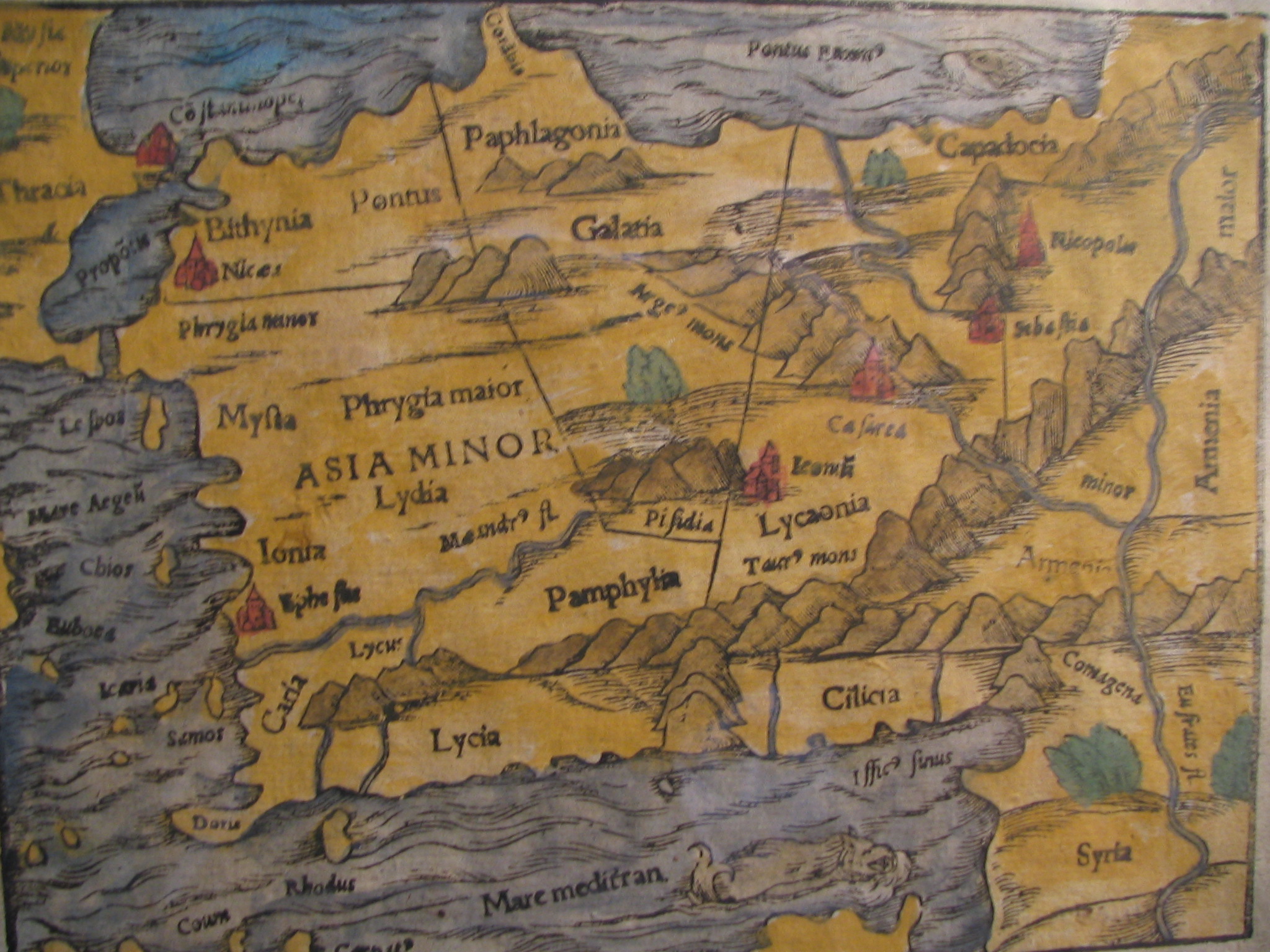
English: Picture of a map of the region of what is now Turkey from the 15th Century. I own this map, having purchased it, and have all official documentation regarding its authenticity. |
||||
| Data | 15 century, Digitized on: 2006ko abenduaren 10a, 19:42:23 | ||||
| Jatorria |
|
||||
| Egilea | Ezezaguna, Photographer: Electionworld | ||||
| Lizentzia (Fitxategi hau berrerabiltzen) |
This file is licensed under the Creative Commons Attribution-Share Alike 2.5 Generic license.
|
||||

Fitxategiaren historia
Data/orduan klik egin fitxategiak orduan zuen itxura ikusteko.
| Data/Ordua | Iruditxoa | Neurriak | Erabiltzailea | Iruzkina | |
|---|---|---|---|---|---|
| oraingoa | 16:04, 21 otsaila 2018 | | 2.048 × 1.536 (884 KB) | Ket | Reverted to version as of 09:40, 17 December 2006 (UTC) |
| 16:03, 21 otsaila 2018 |  | 2.048 × 1.536 (921 KB) | Ket | better contrast | |
| 11:40, 17 abendua 2006 |  | 2.048 × 1.536 (884 KB) | Electionworld | {{ew|en|Rarelibra}} == Summary == Picture of a map of the region of what is now Turkey from the 15th Century. I own this map, having purchased it, and have all official documentation regarding its authenticity. == Licensing == {{cc-by-sa-2.5}} |
Irudira dakarten loturak
Hurrengo orrialdeek dute fitxategi honetarako lotura:
Fitxategiaren erabilera orokorra
Hurrengo beste wikiek fitxategi hau darabilte:
- ar.wikipedia.org proiektuan duen erabilera
- ast.wikipedia.org proiektuan duen erabilera
- bg.wikipedia.org proiektuan duen erabilera
- ca.wikipedia.org proiektuan duen erabilera
- cs.wikipedia.org proiektuan duen erabilera
- da.wikipedia.org proiektuan duen erabilera
- de.wikipedia.org proiektuan duen erabilera
- el.wikipedia.org proiektuan duen erabilera
- en.wikipedia.org proiektuan duen erabilera
- eo.wikipedia.org proiektuan duen erabilera
- es.wikipedia.org proiektuan duen erabilera
- fr.wikipedia.org proiektuan duen erabilera
- gl.wikipedia.org proiektuan duen erabilera
- hr.wikipedia.org proiektuan duen erabilera
- hu.wikipedia.org proiektuan duen erabilera
Ikus fitxategi honen erabilpen global gehiago.