
Fitxategi:Antarctic Peninsula satellite image.jpg

Bereizmen handikoa ((1.509 × 1.846 pixel, fitxategiaren tamaina: 706 KB, MIME mota: image/jpeg))
Fitxategi hau Wikimedia Commonsekoa da. Hango deskribapen orriko informazioa behean duzu. |
Laburpena
| Deskribapena |
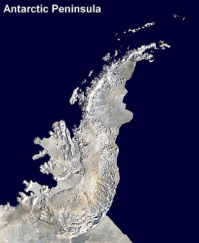
English: Antarctic Peninsula satellite image. An orthographic projection of NASA's Blue Marble data set (1 km resolution global satellite composite). "MODIS observations of polar sea ice were combined with observations of Antarctica made by the National Oceanic and Atmospheric Administration’s AVHRR sensor—the Advanced Very High Resolution Radiometer." Image was generated using a custom C program for handling the Blue Marble files, with orthographic projection formulas from MathWorld.
The black pixels are presumed to be due to missing data in the land/sea mask used in making the original Blue Marble image.
|
||
| Data | (UTC) | ||
| Jatorria | |||
| Egilea |
|
Lizentzia
| This work has been released into the public domain by its author, Anna Frodesiak. This applies worldwide. Estatu batzuetan beharbada hori ez da legez posible izango. Halakoetan: |
Jatorrizko igoera erregistroa
This image is a derivative work of the following images:
- File:Antarctica_6400px_from_Blue_Marble.jpg licensed with PD-user
- 2006-10-05T14:21:53Z Davepape 6400x6400 (3472802 Bytes) touched up part with missing data
- 2006-10-05T07:49:09Z Davepape 6400x6400 (3472752 Bytes) {{Information |Description=[[w:Antarctica|Antarctica]]. An orthographic projection of NASA's Blue Marble data set (1 km resolution global satellite composite). "MODIS observations of polar sea ice were combined with observa
Uploaded with derivativeFX
Fitxategiaren historia
Data/orduan klik egin fitxategiak orduan zuen itxura ikusteko.
| Data/Ordua | Iruditxoa | Neurriak | Erabiltzailea | Iruzkina | |
|---|---|---|---|---|---|
| oraingoa | 01:08, 6 apirila 2009 | | 1.509 × 1.846 (706 KB) | Anna Frodesiak | {{Information |Description=Antarctic Peninsula satellite image. An orthographic projection of NASA's Blue Marble data set (1 km resolution global satellite composite). "MODIS observations of polar sea ice were combined with observations of Antarctica made |
Irudira dakarten loturak
Ez dago fitxategi hau darabilen orririk.
Fitxategiaren erabilera orokorra
Hurrengo beste wikiek fitxategi hau darabilte:
- af.wikipedia.org proiektuan duen erabilera
- ast.wikipedia.org proiektuan duen erabilera
- bs.wikipedia.org proiektuan duen erabilera
- ca.wikipedia.org proiektuan duen erabilera
- da.wikipedia.org proiektuan duen erabilera
- en.wikipedia.org proiektuan duen erabilera
- Antarctic Peninsula
- Mount Jackson (Antarctica)
- Breaker Island
- Dream Island
- Christine Island
- Cormorant Island
- Eichorst Island
- Shortcut Island
- Biscoe Point
- Halfway Island (Palmer Archipelago)
- Gerlache Strait
- Hermit Island (Antarctic)
- Humble Island
- Janus Island
- Laggard Island
- Limitrophe Island
- Lipps Island
- Ohlin Island
- Outcast Islands
- Torgersen Island
- Spume Island
- Stepping Stones (islands)
- Surge Rocks
- Galindez Island
- Quintana Island
- Cobalescou Island
- Doumer Island
- Bremen Island
- Neumayer Channel
- Smooth Island (Antarctica)
- Wilhelm Archipelago
- Betbeder Islands
- Meek Channel
- Shelter Islands
- Sigma Islands
- Yalour Islands
- Yoke Island
- Tripod Island
- Zigzag Island
- Spert Island
- Indicator Island
- Intercurrence Island
Ikus fitxategi honen erabilpen global gehiago.