Fitxategi:Antarctica 6400px from Blue Marble.jpg

Orriaren edukia ez da onartzen beste hizkuntza batzuetan.
Wikipedia, Entziklopedia askea

Bereizmen handikoa((6.400 × 6.400 pixel, fitxategiaren tamaina: 3,31 MB, MIME mota: image/jpeg))

Fitxategi hau Wikimedia Commonsekoa da. Hango deskribapen orriko informazioa behean duzu.
Commons gordailu bat da, lizentzia askea duten multimedia fitxategiena. Lagun dezakezu.

Fitxategi hau Wikimedia Commonsekoa da

Laburpena

Deskribapena
العربية: القارَّة القُطبيَّة الجنوبيَّة (أنتاركتيكا). صورة ساتليَّة تابعة لِوكالة ناسا، من ضمن بيانات الگُلَّة الزرقاء المُرسلة عبر الأقمار الاصطناعيَّة (من على بُعد كيلومترٍ واحد من العدسة الساتليَّة المُستخدمة). "تمَّ مزج بينات "MODIS" المُخصصة لِدراسة حالة الجليد القطبي مع تلك الخاصَّة بالإدارة القوميَّة لِدراسة المُحيطات والمُناخ—التي تمَّ الحصول عليها عبر الراديومتر الأكثر تطوُّرًا." تمَّ توليد الصورة باستخدام برنامج C مُخصص للتعامل مع صور وبيانات الگُلَّة الزرقاء، كما تمَّ الحصول على مُعادلات الإسقاط الشاقولي من موقع عالم الرِّياضيَّات.
مُلاحظة: تمَّ تعديل هذه الصورة يدويًّا في سبيل ملء بعض المناطق ذات العُنصورات (الپكسلات) السوداء، في الرُبعيَّة العُليا اليُمنى. يُعتقد بأنَّ تلك العُنصورات السوداء ظهرت نتيجة فُقدان بعض البيانات الخاصَّة بغطاء الأرض \ البحر المُستعملة في صناعة صورة الگُلَّة الزرقاء الأصليَّة.
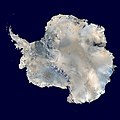
English: Antarctica. An orthographic projection of NASA's Blue Marble data set (1 km resolution global satellite composite). "MODIS observations of polar sea ice were combined with observations of Antarctica made by the National Oceanic and Atmospheric Administration’s AVHRR sensor—the Advanced Very High Resolution Radiometer." Image was generated using a custom C program for handling the Blue Marble files, with orthographic projection formulas from MathWorld.
Note: this image has been manually modified to fill in an area of black pixels in the ocean, in the upper right quadrant. The black pixels are presumed to be due to missing data in the land/sea mask used in making the original Blue Marble image.
Español: El continente antártico. La imagen es una proyección ortogonal creada a partir del conjunto de datos satelitales Blue Marble de la NASA con una resolución de un kilómetro.
Français : Le continent Antarctique. L’image est construite en projection orthographique à partir des données satellites « Blue Marble » de la NASA, ayant une résolution d’un kilomètre. Les images de la banquise, prises par MODIS, ont été combinées avec celles du radiomètre avancé à très haute résolution de la National Oceanic and Atmospheric Administration pour former celle-ci. Elle a été générée en utilisant le logiciel MathWorld.
Note : cette image a été modifiée manuellement pour remplir une zone de pixels noir dans l’océan, dans le coin en haut à droite. Ces pixels manquants sont supposés être dus à des données manquantes dans le masque terre-mer utilisé pour construire l'image original de Blue Marble.
Napulitano: Antartide, vista d’ ’o cielo.
Polski: Antarktyda. Odwzorowanie prostokątne opublikowanego w 2002 roku przez NASA zestawu danych Blue Marble.
مصرى: انتاركتيكا
فارسی: جنوبگان
Українська: Антарктида в ортографічній проекції з роздільною здатністю 1 км, на основі даних супутника MODIS.
Data
Jatorria Own work using: 2002 Blue Marble data @ http://visibleearth.nasa.gov/view_rec.php?id=2433
Egilea Dave Pape
Lizentzia
(Fitxategi hau berrerabiltzen)
Public domain This work has been released into the public domain by its author, Davepape. This applies worldwide.

Estatu batzuetan beharbada hori ez da legez posible izango. Halakoetan:
Davepape grants anyone the right to use this work for any purpose, without any conditions, unless such conditions are required by law.

Beste bertsioak Derivative works of this file:  Antarctic Peninsula satellite image.jpgImage:Antarctica satellite globe.jpg

Assessment

Irudi of the year
Irudi of the year
Irudi of the day
Irudi of the day
Featured irudi

Wikimedia CommonsWikipedia

Fitxategi hau a finalista izan da Urteko argazkian 2013.
Fitxategi hau eguneko argazkia izan da: October 05, 2014.
This is a featured picture on Wikimedia Commons (Nabarmendutako irudiak) and is considered one of the finest images.

Wikipedia
 This is a featured picture on the Arabic language Wikipedia (صور مختارة) and is considered one of the finest images.
 This is a featured picture on the English language Wikipedia (Featured pictures) and is considered one of the finest images.
 This is a featured picture on the Persian language Wikipedia (نگاره‌های برگزیده) and is considered one of the finest images.
 This is a featured picture on the Turkish language Wikipedia (Seçkin resimler) and is considered one of the finest images.

If you have an image of similar quality that can be published under a suitable copyright license, be sure to upload it, tag it, and nominate it.

Annotations
InfoField
This image is annotated: View the annotations at Commons

Irudi-oineko testuak

Add a one-line explanation of what this file represents
The continent of Antarctica, circa 2006.

Fitxategi honetan agertzen diren itemak

honako hau irudikatzen du

5 urria 2006

MIME type ingelesa

image/jpeg

checksum ingelesa

affebbaf9a08867a4e4b5329ed0d4959fc866806

data size ingelesa

3.472.802 Byte

6.400 pixel

6.400 pixel

Fitxategiaren historia

Data/orduan klik egin fitxategiak orduan zuen itxura ikusteko.

Data/OrduaIruditxoaNeurriakErabiltzaileaIruzkina
oraingoa16:21, 5 urria 200616:21, 5 urria 2006 bertsioaren iruditxoa6.400 × 6.400 (3,31 MB)Davepapetouched up part with missing data
09:49, 5 urria 200609:49, 5 urria 2006 bertsioaren iruditxoa6.400 × 6.400 (3,31 MB)Davepape{{Information |Description=Antarctica. An orthographic projection of NASA's Blue Marble data set (1 km resolution global satellite composite). "MODIS observations of polar sea ice were combined with observations of Antarctica made by th

Hurrengo orrialdeek dute fitxategi honetarako lotura:

Fitxategiaren erabilera orokorra

Hurrengo beste wikiek fitxategi hau darabilte:

Ikus fitxategi honen erabilpen global gehiago.

Metadatuak