
Fitxategi:LocationDRCongo.png
Aurreikuspen honen neurria: 800 × 370 pixel. Bestelako bereizmenak: 320 × 148 pixel | 640 × 296 pixel | 1.357 × 628 pixel.
Bereizmen handikoa ((1.357 × 628 pixel, fitxategiaren tamaina: 51 KB, MIME mota: image/png))
Fitxategi hau Wikimedia Commonsekoa da. Hango deskribapen orriko informazioa behean duzu. |
| Deskribapena |
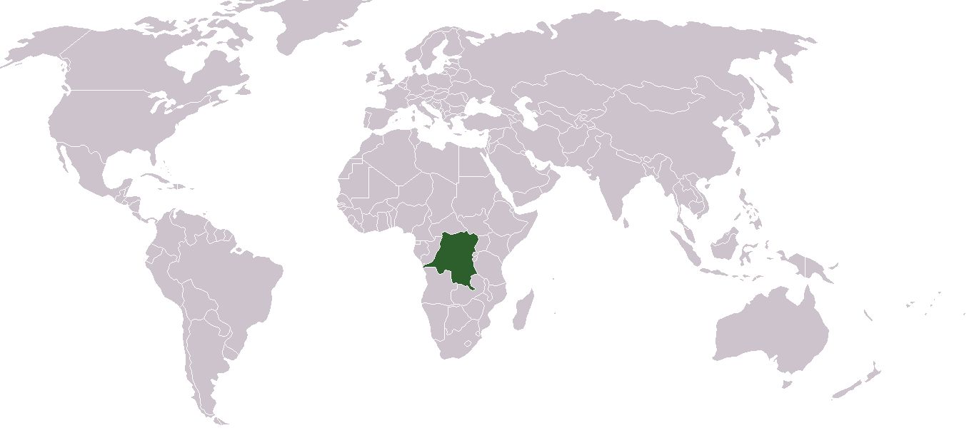
English: Location map for the Demoratic Republic of the Congo
Français : Carte de localisation de la République démocratique du Congo |
| Data | |
| Jatorria | Norberak egina |
| Egilea | Dbenbenn from image "BlakMap-Worl" (doesn't exist any more on wikipedia) created by Vardion |
| |
This work has been released into the public domain by its author, Vardion, at the ingelesa Wikipedia project. This applies worldwide. In case this is not legally possible: |

|
File:LocationDRCongo.svg fitxategi honen bektore bertsioa da. Hau rasterizatutako bertsioaren ordez erabili beharko litzateke hobea izatekotan.
File:LocationDRCongo.png → File:LocationDRCongo.svg
Grafiko bektorialei buruzko informazioa lortzeko, irakurri SVGra trantsizioa Commonsen. MediaWikiko SVG irudien inguruko laguntza teknikoa ere badago. |
 |
Fitxategiaren historia
Data/orduan klik egin fitxategiak orduan zuen itxura ikusteko.
| Data/Ordua | Iruditxoa | Neurriak | Erabiltzailea | Iruzkina | |
|---|---|---|---|---|---|
| oraingoa | 00:03, 31 abuztua 2011 | | 1.357 × 628 (51 KB) | Hoshie | added South Sudan |
| 15:28, 24 martxoa 2007 |  | 1.357 × 628 (45 KB) | Hoshie | added Cabinda, which fixed the DR Congo-Angola boundry. | |
| 18:21, 2 abendua 2006 |  | 1.357 × 628 (27 KB) | Moyogo | Reverted to earlier revision | |
| 19:52, 19 azaroa 2006 |  | 1.357 × 628 (25 KB) | Moyogo | Why is Belgium coloured? | |
| 03:05, 9 azaroa 2006 |  | 1.357 × 628 (44 KB) | Deltabeignet | Period-specific map. | |
| 22:11, 6 ekaina 2006 |  | 1.357 × 628 (27 KB) | Helmandsare | == Summary == Location map for the Democratic Republic of the Congo. Created by User:dbenbenn from Image:BlankMap-World.png. == Licensing == {{PD-user-wikimedia|Vardion|en}} <!--Categories--> [[Catego | |
| 22:30, 12 otsaila 2005 |  | 1.357 × 628 (21 KB) | Dbenbenn | higher resolution version | |
| 01:03, 12 abendua 2004 |  | 250 × 115 (17 KB) | EugeneZelenko | Location map for the Democratic Republic of the Congo.<br/>Originally created for English Wikipedia by Vardion.<br/>{{PD}}<br/>Category:Country locator maps |
Irudira dakarten loturak
Ez dago fitxategi hau darabilen orririk.
Fitxategiaren erabilera orokorra
Hurrengo beste wikiek fitxategi hau darabilte:
- ar.wikipedia.org proiektuan duen erabilera
- ar.wikinews.org proiektuan duen erabilera
- bg.wikipedia.org proiektuan duen erabilera
- bn.wikipedia.org proiektuan duen erabilera
- bs.wikipedia.org proiektuan duen erabilera
- ceb.wikipedia.org proiektuan duen erabilera
- cs.wikipedia.org proiektuan duen erabilera
- de.wikinews.org proiektuan duen erabilera
- de.wiktionary.org proiektuan duen erabilera
- en.wikipedia.org proiektuan duen erabilera
- Geography of the Democratic Republic of the Congo
- User:DanielZM/test
- Colonization of the Congo Basin
- Portal:Democratic Republic of the Congo
- Portal:Democratic Republic of the Congo/Intro
- List of moths of the Democratic Republic of the Congo
- List of butterflies of the Democratic Republic of the Congo
- List of non-marine molluscs of the Democratic Republic of the Congo
- eo.wikipedia.org proiektuan duen erabilera
- es.wikipedia.org proiektuan duen erabilera
- frp.wikipedia.org proiektuan duen erabilera
- fr.wikipedia.org proiektuan duen erabilera
- fr.wiktionary.org proiektuan duen erabilera
- he.wikipedia.org proiektuan duen erabilera
- he.wikivoyage.org proiektuan duen erabilera
- hr.wikipedia.org proiektuan duen erabilera
- hr.wiktionary.org proiektuan duen erabilera
- Demokratiska Republiken Kongo
- 刚果民主共和国
- Λαϊκή Δημοκρατία του Κονγκό
- הרפובליקה הדמוקרטית של קונגו
- コンゴ民主共和国
- Демократска Република Конго
- Демократическая Республика Конго
- Demokratische Republik Kongo
- Kongói Demokratikus Köztársaság
- Repubblica Democratica del Congo
- Kéyah Káango Shádiʼááhjí Siʼánígíí
- República Democrática del Congo
- ht.wikipedia.org proiektuan duen erabilera
- incubator.wikimedia.org proiektuan duen erabilera
- it.wikivoyage.org proiektuan duen erabilera
- ja.wikipedia.org proiektuan duen erabilera
- ja.wikinews.org proiektuan duen erabilera
Ikus fitxategi honen erabilpen global gehiago.