
Fitxategi:Mallorca.jpg
Aurreikuspen honen neurria: 785 × 599 pixel. Bestelako bereizmenak: 314 × 240 pixel | 629 × 480 pixel | 1.006 × 768 pixel | 1.138 × 869 pixel.
Bereizmen handikoa ((1.138 × 869 pixel, fitxategiaren tamaina: 164 KB, MIME mota: image/jpeg))
Fitxategi hau Wikimedia Commonsekoa da. Hango deskribapen orriko informazioa behean duzu. |
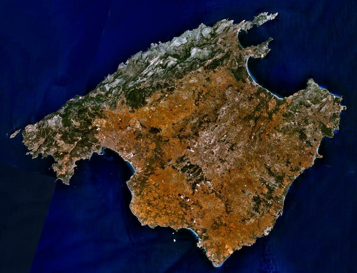
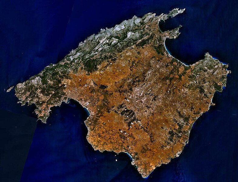
| Deskribapena | Sattelite image of Majorca |
| Jatorria | NASA World Wind - Used Filter: "NTL Landsat7 (Visible Color)" |
| Egilea | NASA |
| Lizentzia (Fitxategi hau berrerabiltzen) |
"The Landsat Global Mosiac, Blue Marble, and the USGS raster maps and images are all Public Domain." (See http://www.worldwindcentral.com/wiki/Unofficial_FAQ#Are_images_on_World_Wind_copyrighted.3F |
| This image is in the public domain because it is a screenshot from NASA’s globe software World Wind using a public domain layer, such as Blue Marble, MODIS, Landsat, SRTM, USGS or GLOBE.
|
 |
Fitxategiaren historia
Data/orduan klik egin fitxategiak orduan zuen itxura ikusteko.
| Data/Ordua | Iruditxoa | Neurriak | Erabiltzailea | Iruzkina | |
|---|---|---|---|---|---|
| oraingoa | 19:19, 5 ekaina 2023 | | 1.138 × 869 (164 KB) | PalauanLibertarian | Cropped 11 % horizontally, 8 % vertically using CropTool with precise mode. |
| 21:31, 30 abendua 2012 |  | 1.280 × 944 (174 KB) | Rotatebot | Bot: Image rotated by 180° | |
| 11:16, 30 abendua 2012 |  | 1.280 × 944 (174 KB) | Rotatebot | Bot: Image rotated by 180° | |
| 10:29, 15 maiatza 2005 |  | 1.280 × 958 (175 KB) | Leipnizkeks | Sattelite image of Majorca - Source: NASA World Wind - Used Filter: "NTL Landsat7 (Visible Color)" - License: "The Landsat Global Mosiac, Blue Marble, and the USGS raster maps and images are all Public Domain." (See http://www.worldwindcentral.com/wiki/Un |
Irudira dakarten loturak
Hurrengo orrialdeek dute fitxategi honetarako lotura:
Fitxategiaren erabilera orokorra
Hurrengo beste wikiek fitxategi hau darabilte:
- af.wikipedia.org proiektuan duen erabilera
- an.wikipedia.org proiektuan duen erabilera
- ar.wikipedia.org proiektuan duen erabilera
- arz.wikipedia.org proiektuan duen erabilera
- ast.wikipedia.org proiektuan duen erabilera
- az.wikipedia.org proiektuan duen erabilera
- be-tarask.wikipedia.org proiektuan duen erabilera
- be.wikipedia.org proiektuan duen erabilera
- bg.wikipedia.org proiektuan duen erabilera
- br.wikipedia.org proiektuan duen erabilera
- ca.wikipedia.org proiektuan duen erabilera
- Illes Balears
- Mallorca
- Llista d'illes de la mar Mediterrània
- Portal:Illes Balears
- Portal:Illes Balears/Mallorca
- Plantilla:Distribució en les Illes Balears
- Usuari:Bilif
- Geografia dels Països Catalans
- Geografia de les Illes Balears
- Usuari:Aïda Lacomba Moreno
- Usuari:Maria quetglas
- Viquiprojecte:PESCAR/2018
- Viquiprojecte:PESCAR/seguiment 2018
- ca.wikiquote.org proiektuan duen erabilera
- ceb.wikipedia.org proiektuan duen erabilera
- cs.wikipedia.org proiektuan duen erabilera
- cy.wikipedia.org proiektuan duen erabilera
- da.wikipedia.org proiektuan duen erabilera
- de.wikipedia.org proiektuan duen erabilera
- de.wikivoyage.org proiektuan duen erabilera
- de.wiktionary.org proiektuan duen erabilera
- el.wikipedia.org proiektuan duen erabilera
- en.wikipedia.org proiektuan duen erabilera
Ikus fitxategi honen erabilpen global gehiago.