
Fitxategi:Map of USA with county outlines.png

Aurreikuspen honen neurria: 800 × 520 pixel. Bestelako bereizmenak: 320 × 208 pixel | 640 × 416 pixel | 1.024 × 665 pixel | 1.513 × 983 pixel.
Bereizmen handikoa ((1.513 × 983 pixel, fitxategiaren tamaina: 581 KB, MIME mota: image/png))
Fitxategi hau Wikimedia Commonsekoa da. Hango deskribapen orriko informazioa behean duzu. |

|
Irudi hau birsortu beharko litzateke SVG irudi bektorial moduan. Honek abantaila asko ematen ditu, ikus Commons:Media for cleanup (ingelesez) informazio gehiagorako. Irudi honen SVG bertsioa eskuragarri badago, mesedez Commonsera igo. Igo ostean, ordezkatu txantiloi hau txantiloi honegatik {{vector version available|irudiaren izen berria.svg}} irudi honetan.
|
Laburpena
| Deskribapena |
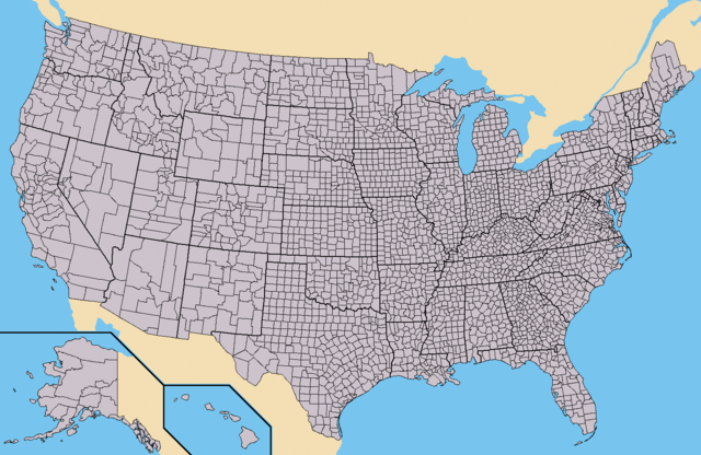
Deutsch: Karte der Vereinigten Staaten mit den Staats- und Kreisgrenzen.
English: Map of the USA showing borders of states and counties. Colored version of adapted one by Wapcaplet from a public-domain map courtesy of the U.S. Census Bureau website first published in English language version of Wikipedia.
Español: Mapa de los es:Estados Unidos mostrando los los límites de estados miembros y sus condados. Versión a colores de la adaptación hecha por Wapcaplet del mapa de dominio público del sitio web de la Oficina de Censo de los EE.UU.. |
| Data | |
| Jatorria | https://www.census.gov |
| Egilea | |
| Beste bertsioak | Derivative works of this file: Emancipation Proclamation.PNG |
Lizentzia

|
Baimena duzu dokumentu hau kopiatu, banatu edo/eta aldatzeko GNU Free Documentation License baldintzapean, Free Software Foundationek argitaratutako 1.2 edo ondorengo bertsioan; sekzio aldaezinik gabe, azaleko testurik gabe, eta atzeko azaleko testurik gabe. Lizentziaren kopia dago GNU Free Documentation License izenburudun atalean. |
| Fitxategi hau Creative Commons Attribution-Share Alike 3.0 Unported lizentziapean dago. | ||
| ||
| This licensing tag was added to this file as part of the GFDL licensing update. |
Fitxategiaren historia
Data/orduan klik egin fitxategiak orduan zuen itxura ikusteko.
| Data/Ordua | Iruditxoa | Neurriak | Erabiltzailea | Iruzkina | |
|---|---|---|---|---|---|
| oraingoa | 18:25, 31 maiatza 2015 | | 1.513 × 983 (581 KB) | Cmdrjameson | Compressed with pngout. Reduced by 484kB (45% decrease). |
| 16:02, 21 iraila 2010 |  | 1.513 × 983 (1,04 MB) | Kmusser | fix Pamlico Sound | |
| 01:31, 26 azaroa 2009 |  | 1.513 × 983 (166 KB) | Reywas92 | Make borders more visible. | |
| 06:41, 23 urtarrila 2008 |  | 1.513 × 983 (98 KB) | Speight | Fix San Francisco Bay and Puget Sound | |
| 00:53, 24 azaroa 2006 |  | 1.513 × 983 (165 KB) | Ibagli | more fixes | |
| 00:53, 24 azaroa 2006 |  | 1.513 × 983 (165 KB) | Ibagli | Reverted to earlier revision | |
| 00:52, 24 azaroa 2006 |  | 1.513 × 983 (180 KB) | Ibagli | more fixes | |
| 04:16, 23 azaroa 2006 |  | 1.513 × 983 (165 KB) | Ibagli | fix lake St. Clair | |
| 22:57, 28 abuztua 2005 |  | 1.513 × 983 (165 KB) | Huhsunqu | *{{es}} Mapa de los Estados Unidos de América mostrando los los límites de estados miembros y sus condados. Versión a colores de la adaptación hecha por Wapcaplet del mapa de dominio público del [http://www.census.gov/ sitio |
Irudira dakarten loturak
Hurrengo orrialdeek dute fitxategi honetarako lotura:
Fitxategiaren erabilera orokorra
Hurrengo beste wikiek fitxategi hau darabilte:
- ang.wikipedia.org proiektuan duen erabilera
- az.wikipedia.org proiektuan duen erabilera
- bg.wikipedia.org proiektuan duen erabilera
- ca.wikipedia.org proiektuan duen erabilera
- cs.wikipedia.org proiektuan duen erabilera
- de.wikipedia.org proiektuan duen erabilera
- en.wikipedia.org proiektuan duen erabilera
- Talk:Bigfoot/Archive 5
- Talk:Manhattan
- Talk:Los Angeles County, California
- Talk:List of counties in Nevada
- Talk:Louisville, Kentucky
- Wikipedia:WikiProject U.S. counties
- Wikipedia talk:WikiProject U.S. counties
- Talk:Lancaster County, Pennsylvania
- Talk:Frederick County, Maryland
- Talk:Franklin County, Tennessee
- Talk:Trumbull County, Ohio
- Talk:Tuscarawas County, Ohio
- Talk:Union County, Ohio
- Talk:Van Wert County, Ohio
- Talk:Vinton County, Ohio
- Talk:Warren County, Ohio
- Talk:Washington County, Ohio
- Talk:Wayne County, Ohio
- Talk:Williams County, Ohio
- Talk:Wood County, Ohio
- Talk:Wyandot County, Ohio
- Talk:Adair County, Oklahoma
- Talk:Alfalfa County, Oklahoma
- Talk:Atoka County, Oklahoma
- Talk:Blaine County, Oklahoma
- Talk:Bryan County, Oklahoma
- Talk:Caddo County, Oklahoma
- Talk:Carter County, Oklahoma
- Talk:Cherokee County, Oklahoma
- Talk:Nantucket
- Talk:Potter County, South Dakota
- Talk:Weston County, Wyoming
- Talk:Washakie County, Wyoming
- Talk:Uinta County, Wyoming
- Talk:Teton County, Wyoming
- Talk:Sweetwater County, Wyoming
- Talk:Sublette County, Wyoming
- Talk:Sheridan County, Wyoming
Ikus fitxategi honen erabilpen global gehiago.