
Fitxategi:Map of downtown Rome during the Roman Empire large-annotated.jpg
Bereizmen handikoa ((1.099 × 777 pixel, fitxategiaren tamaina: 268 KB, MIME mota: image/jpeg))
Fitxategi hau Wikimedia Commonsekoa da. Hango deskribapen orriko informazioa behean duzu. |
Laburpena
| Deskribapena |
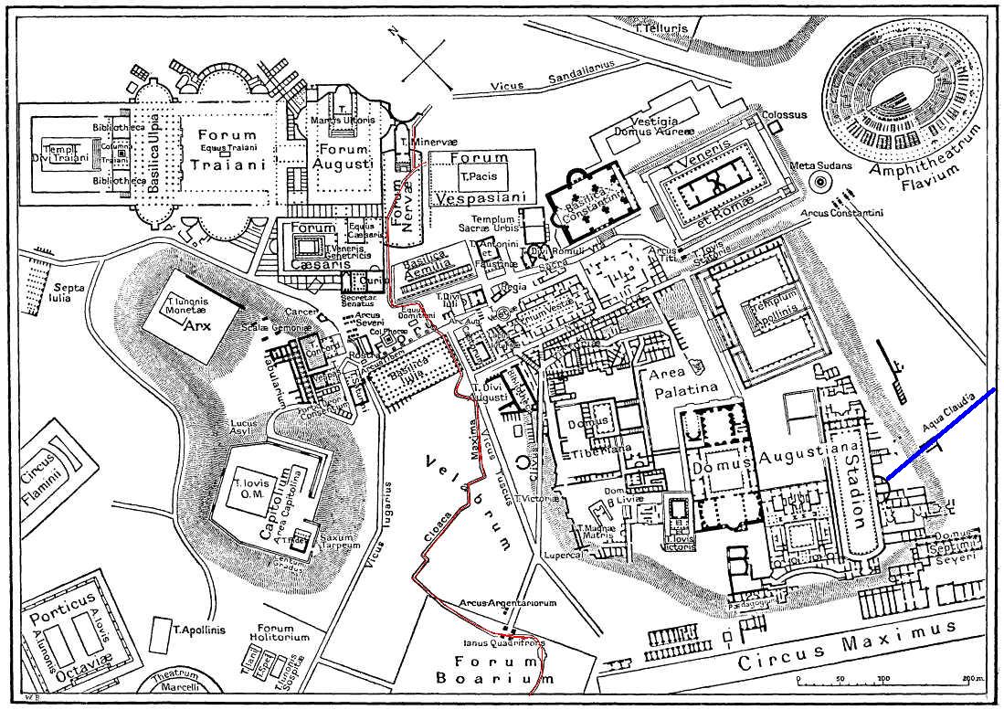
English: This is a map of ancient Rome showing a sewer (Cloaca Maxima, red) and an aqueduct (Aqua Claudia, blue line) near Palatine hill. Forum Boarium. And no "human map temple of lord Hamminton" (who?) is in the underground of Rome, but in history of that file ... |
| Data | 2006ko maiatzaren 27a (igoera data) |
| Jatorria | It is proposed, that this file have the same source as File:Map of downtown Rome during the Roman Empire large.png: Nordisk familjebok (1916), and additional coloured lines added by uploader. |
| Egilea | Gradvmedusa |
| Beste bertsioak | File:Map of downtown Rome during the Roman Empire large.png |
Lizentzia
|
Lan hau jabetza publikoan dago bai bere jatorrizko herrialdean, bai egile eskubideak egilea hil eta 70 urtera edo gutxiagora iraungitzen diren gainerako herrialdeetan.
| |
| This file has been identified as being free of known restrictions under copyright law, including all related and neighboring rights. | |
| Annotations | This image is annotated: View the annotations at Commons |
Fitxategiaren historia
Data/orduan klik egin fitxategiak orduan zuen itxura ikusteko.
| Data/Ordua | Iruditxoa | Neurriak | Erabiltzailea | Iruzkina | |
|---|---|---|---|---|---|
| oraingoa | 01:59, 28 maiatza 2006 | | 1.099 × 777 (268 KB) | Gradvmedusa | This is a map of ancient Rome showing a sewer and a aqueduct |
Irudira dakarten loturak
Hurrengo orrialdeek dute fitxategi honetarako lotura:
Fitxategiaren erabilera orokorra
Hurrengo beste wikiek fitxategi hau darabilte:
- bg.wikipedia.org proiektuan duen erabilera
- cs.wikipedia.org proiektuan duen erabilera
- el.wikipedia.org proiektuan duen erabilera
- en.wikipedia.org proiektuan duen erabilera
- he.wikipedia.org proiektuan duen erabilera
- hu.wikipedia.org proiektuan duen erabilera
- id.wikipedia.org proiektuan duen erabilera
- ja.wikipedia.org proiektuan duen erabilera
- lv.wikipedia.org proiektuan duen erabilera
- no.wikipedia.org proiektuan duen erabilera
- sl.wikipedia.org proiektuan duen erabilera
- tr.wikipedia.org proiektuan duen erabilera