
Fitxategi:Mexico map, MX-ZAC.svg

SVG fitxategi honen PNG aurreikuspenaren tamaina: 800 × 544 pixel. Bestelako bereizmenak: 320 × 218 pixel | 640 × 435 pixel | 1.024 × 696 pixel | 1.280 × 870 pixel | 2.560 × 1.741 pixel | 1.000 × 680 pixel.
Bereizmen handikoa (SVG fitxategia, nominaldi 1.000 × 680 pixel, fitxategiaren tamaina: 123 KB)
Fitxategi hau Wikimedia Commonsekoa da. Hango deskribapen orriko informazioa behean duzu. |
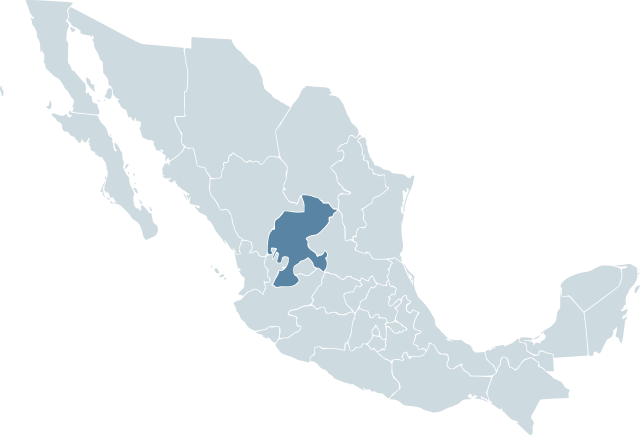
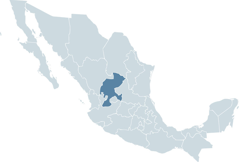
| Deskribapena | Locator map for the state of Zacatecas within Mexico. | ||||
| Data | 04-07-2007 | ||||
| Jatorria | Mexico template.svg by Mario Fuente Cid and Lokal_Profil | ||||
| Egilea | Lokal_Profil | ||||
| Lizentzia (Fitxategi hau berrerabiltzen) |
Original image licensed under
|
Fitxategiaren historia
Data/orduan klik egin fitxategiak orduan zuen itxura ikusteko.
| Data/Ordua | Iruditxoa | Neurriak | Erabiltzailea | Iruzkina | |
|---|---|---|---|---|---|
| oraingoa | 02:11, 18 azaroa 2009 | | 1.000 × 680 (123 KB) | Addicted04 | Reverted to version as of 19:52, 19 November 2007 |
| 04:00, 1 urria 2009 |  | 1.000 × 680 (267 KB) | Addicted04 | States borders | |
| 21:52, 19 azaroa 2007 |  | 1.000 × 680 (123 KB) | El bart089 | updated version, based on map made by Lokal Profil. | |
| 19:28, 4 uztaila 2007 |  | 1.000 × 680 (117 KB) | Lokal Profil | {{Information |Description=Locator map for the state of Category:Zacatecas within Mexico. |Source=Image:Mexico template.svg by Mario Fuente Cid <small>and Lokal_Profil</small> |Date=04-07-2007 |Author=[ |
Irudira dakarten loturak
Ez dago fitxategi hau darabilen orririk.
Fitxategiaren erabilera orokorra
Hurrengo beste wikiek fitxategi hau darabilte:
- an.wikipedia.org proiektuan duen erabilera
- ay.wikipedia.org proiektuan duen erabilera
- chy.wikipedia.org proiektuan duen erabilera
- cy.wikipedia.org proiektuan duen erabilera
- da.wikipedia.org proiektuan duen erabilera
- en.wikipedia.org proiektuan duen erabilera
- en.wiktionary.org proiektuan duen erabilera
- es.wikipedia.org proiektuan duen erabilera
- fr.wikipedia.org proiektuan duen erabilera
- hr.wikipedia.org proiektuan duen erabilera
- incubator.wikimedia.org proiektuan duen erabilera
- ka.wikipedia.org proiektuan duen erabilera
- lv.wikipedia.org proiektuan duen erabilera
- nn.wikipedia.org proiektuan duen erabilera
- pl.wikipedia.org proiektuan duen erabilera
- pt.wikipedia.org proiektuan duen erabilera
- ru.wikipedia.org proiektuan duen erabilera
- sco.wikipedia.org proiektuan duen erabilera
- sh.wikipedia.org proiektuan duen erabilera
- simple.wikipedia.org proiektuan duen erabilera
- sv.wikipedia.org proiektuan duen erabilera
- sw.wikipedia.org proiektuan duen erabilera
- uk.wikipedia.org proiektuan duen erabilera