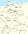
Fitxategi:Rzeczpospolita 1937.svg

Orriaren edukia ez da onartzen beste hizkuntza batzuetan.
Wikipedia, Entziklopedia askea

Bereizmen handikoa(SVG fitxategia, nominaldi 2.220 × 1.554 pixel, fitxategiaren tamaina: 573 KB)

Fitxategi hau Wikimedia Commonsekoa da. Hango deskribapen orriko informazioa behean duzu.
Commons gordailu bat da, lizentzia askea duten multimedia fitxategiena. Lagun dezakezu.

Fitxategi hau Wikimedia Commonsekoa da

Laburpena

Deskribapena Test version of a vectorized File:Rzeczpospolita 1920.png; more changes will follow, only checking if wiki displays it right
Data
Jatorria

Norberak egina; based on an earlier raster map made in 2005, as well as similar maps made by myself in 2004 (see below).
In preparation of this map I used many other maps as sources and backup. Among them were:

  • a German roadmap of Poland printed in 1938 (colours and the shape of East Prussian border)
  • and perhaps a dozen others.
Egilea Halibutt
Beste bertsioak
SVG genesis
InfoField
 
The source code of this SVG is invalid due to 2 errors.
 
Fitxategi hau (bektore-irudia) hau Adobe Illustrator-ekin sortu da . ,
 
and with Inkscape.
 
 This map uses embedded text that can be easily translated using a text editor.


Copyright notice: Image made by Halibutt and uploaded to Wikipedia by the author. Images can be made available for use under other copyleft licenses on a case by case basis via direct contact with the author. Under moral rights the user requires that this work be properly attributed to its creator. For photographs, this is traditionally done in the image caption. Where a copyright notice is present, using the copyright notice in the caption will be sufficient. Note that the GFDL requires that any copyright notices be included with the work even when making unmodified use of it.

Since the legal status of the above comment has been questioned, I hereby grant anyone the right to treat it as either a standard copyright notice, invariant section, legal statement, legal advice, friendly suggestion or a mere comment, depending on his or hers own choice.
Halibutt
GNU head Baimena duzu dokumentu hau kopiatu, banatu edo/eta aldatzeko GNU Free Documentation License baldintzapean, Free Software Foundationek argitaratutako 1.2 edo ondorengo bertsioan; sekzio aldaezinik gabe, azaleko testurik gabe, eta atzeko azaleko testurik gabe. Lizentziaren kopia dago GNU Free Documentation License izenburudun atalean.
w:eu:Creative Commons
eskuduntza berdin partekatu
Fitxategi hau Creative Commons Attribution-Share Alike 3.0 Unported lizentziapean dago.
Askea zara:
  • partekatzeko – lana kopiatzeko, banatzeko eta bidaltzeko
  • birnahasteko – lana moldatzeko
Ondorengo baldintzen pean:
  • eskuduntza – Egiletza behar bezala aitortu behar duzu, lizentzia ikusteko esteka gehitu, eta ea aldaketak egin diren aipatu. Era egokian egin behar duzu hori guztia, baina inola ere ez egileak zure lana edo zure erabilera babesten duela irudikatuz.
  • berdin partekatu – Lan honetan oinarrituta edo aldatuta berria eraikitzen baduzu, emaitza lana hau bezalako lizentzia batekin argitaratu behar duzu.
This licensing tag was added to this file as part of the GFDL licensing update.

The following is a list of maps created by Halibutt and uploaded to commons, as well as their present and projected derivatives.

Parent Image Image Description
  Maps by Halibutt
Image:Rzeczpospolita.png Image:Rzeczpospolita.png The Republic in 17th and 18th century
Image:Rzeczpospolita 1600.png The Republic after the Treaty of Dywilino
Image:Rzeczpospolita voivodships.png Voivodships of The Republic
Image:Rzeczpospolita_Potop.png The Republic during The Deluge and Chmielnicki Uprising, with major battles of the era marked
Magnates and their lands and domains
1st2nd3rd Partitions of Poland
War of the constitution
Image:Rzeczpospolita.xcf SOURCE FILE - GIMP format
Image:Poland 1939.png Image:Poland 1939.png Poland in 1939
Image:Dywizje wrzesien 1.png Order of Battle on September 1st, during the Polish Defence War of 1939
Image:Poland 1939.xcf SOURCE FILE - GIMP format
Image:Polska kontur bialy.png Image:Polska kontur bialy.png Contour map of Poland AD 1999, for use with various locator maps
Image:Rzeczpospolita 1923.png Image:Rzeczpospolita 1923.png Map of Poland 1918-1939, currently under development
Image:PBW March 1919.png Polish-Bolshevik War - fronts in March of 1919
Image:PBW December 1919.png Polish-Bolshevik War - fronts in December of 1919
Image:PBW June 1920.png Polish-Bolshevik War - fronts in July of 1920
Image:PBW August 1920.png Polish-Bolshevik War - fronts in August of 1920
Polish Defence War of 1939
Polish areas annexed by Germany, Lithuania, Slovakia and the Soviet Union
German concentration camps in Poland
Curzon line
Major battles of the Polish-Bolshevik War
namesno names Polish/Czechoslovak/Lithuanian/German/Ukrainian claims in 1920's
Image:Rzeczpospolita Central Lithuania.png Central Lithuania
Image:Rzeczpospolita Lithuania claims.png Central Lithuania as compared with other Lithuanian claims
Image:Rzeczpospolita 1789-1920.png Post-1922 borders compared with the territory of Poland before the partitions
Warsaw Uprising and the Operation Tempest
Poland partitioned between the Soviets and the Germans
Image:Rzeczpospolita 1939 Polish divisions.png Polish divisions on September 1, 1939
Home Army inspectorates
Image:Rzeczpospolita 1922.xcf SOURCE FILE - GIMP format
Image:Rzeczpospolita 1937.svg Vector version!!!! layered version available on request

Irudi-oineko testuak

Add a one-line explanation of what this file represents

Fitxategi honetan agertzen diren itemak

honako hau irudikatzen du

11 martxoa 2008

Fitxategiaren historia

Data/orduan klik egin fitxategiak orduan zuen itxura ikusteko.

(Azkenekoak | Lehenbizikoak) Ikusi (berriagoak diren 10) () (10 | 20 | 50 | 100 | 250 | 500).
Data/OrduaIruditxoaNeurriakErabiltzaileaIruzkina
oraingoa17:24, 1 urtarrila 201717:24, 1 urtarrila 2017 bertsioaren iruditxoa2.220 × 1.554 (573 KB)Sascha GPDMalmö (duplicate) -> Göteborg
16:34, 30 uztaila 201316:34, 30 uztaila 2013 bertsioaren iruditxoa2.220 × 1.554 (573 KB)HalibuttAdded some rivers in Russia, corrected others (RO, HU, PL)
05:28, 30 uztaila 201305:28, 30 uztaila 2013 bertsioaren iruditxoa2.220 × 1.563 (458 KB)HalibuttSweden corrected (town names added)
05:16, 30 uztaila 201305:16, 30 uztaila 2013 bertsioaren iruditxoa2.214 × 1.567 (492 KB)Halibuttcrunched version (deleted background layers)
05:13, 30 uztaila 201305:13, 30 uztaila 2013 bertsioaren iruditxoa2.214 × 1.567 (3,68 MB)Halibuttlet's see if the expanded version works
20:11, 16 uztaila 201020:11, 16 uztaila 2010 bertsioaren iruditxoa2.014 × 1.567 (534 KB)HierakaresCorrected position of name Oppeln which was overlapping with point.
10:54, 14 martxoa 200810:54, 14 martxoa 2008 bertsioaren iruditxoa2.014 × 1.567 (534 KB)HalibuttNames of larger towns enlarged
10:45, 14 martxoa 200810:45, 14 martxoa 2008 bertsioaren iruditxoa2.014 × 1.567 (533 KB)Halibuttversion corrected by Madman
02:30, 14 martxoa 200802:30, 14 martxoa 2008 bertsioaren iruditxoa2.000 × 1.534 (512 KB)Halibutt{{Information |Description= |Source=self-made |Date= |Author= Halibutt |Permission= |other_versions= }}
01:54, 14 martxoa 200801:54, 14 martxoa 2008 bertsioaren iruditxoa2.000 × 1.534 (548 KB)Halibutt{{Information |Description= |Source=self-made |Date= |Author= Halibutt |Permission= |other_versions= }}
(Azkenekoak | Lehenbizikoak) Ikusi (berriagoak diren 10) () (10 | 20 | 50 | 100 | 250 | 500).

Hurrengo orrialdeek dute fitxategi honetarako lotura:

Fitxategiaren erabilera orokorra

Hurrengo beste wikiek fitxategi hau darabilte:

Ikus fitxategi honen erabilpen global gehiago.

Metadatuak