
Fitxategi:Territorios de la Segunda República Española.svg

SVG fitxategi honen PNG aurreikuspenaren tamaina: 396 × 600 pixel. Bestelako bereizmenak: 158 × 240 pixel | 317 × 480 pixel | 507 × 768 pixel | 676 × 1.024 pixel | 1.352 × 2.048 pixel | 4.950 × 7.500 pixel.
Bereizmen handikoa (SVG fitxategia, nominaldi 4.950 × 7.500 pixel, fitxategiaren tamaina: 989 KB)
Fitxategi hau Wikimedia Commonsekoa da. Hango deskribapen orriko informazioa behean duzu. |
Laburpena
| Deskribapena |
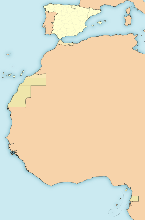
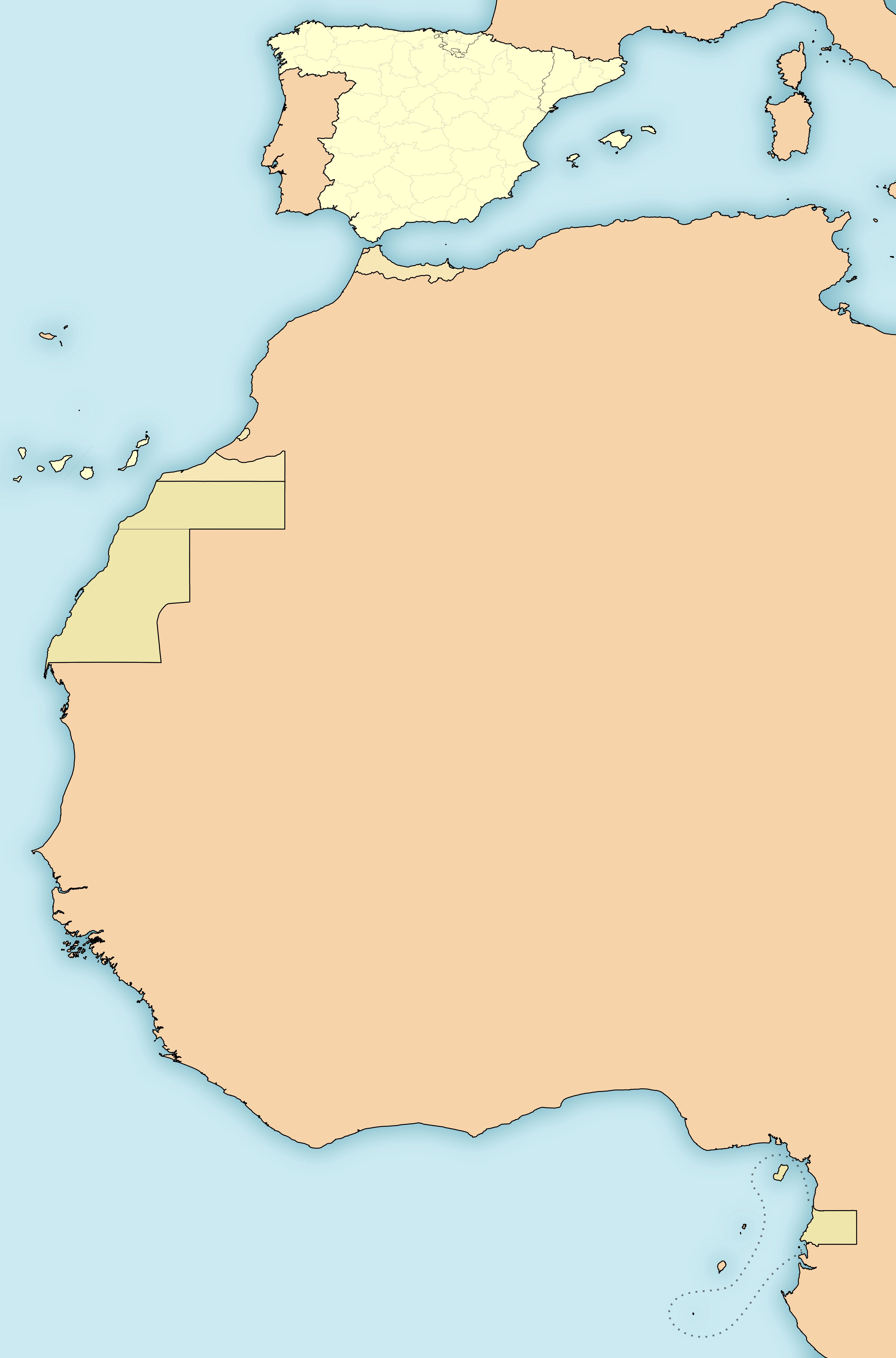
English: Map of the territories under goverment of the Second Spanish Republic (1931-1936/39)
Español: Mapa de los territorios bajo soberanía de la Segunda República Española (1931-1936/39)
Amarillo:
Anaranjado:
Beige:
|
| Data | |
| Jatorria | Norberak egina |
| Egilea | HansenBCN |
| Beste bertsioak |
Derivative works of this file: |
Lizentzia
Nik, lan honen egileak, argitaratzen dut ondorengo lizentzia hauen pean:

|
Baimena duzu dokumentu hau kopiatu, banatu edo/eta aldatzeko GNU Free Documentation License baldintzapean, Free Software Foundationek argitaratutako 1.2 edo ondorengo bertsioan; sekzio aldaezinik gabe, azaleko testurik gabe, eta atzeko azaleko testurik gabe. Lizentziaren kopia dago GNU Free Documentation License izenburudun atalean. |
This file is licensed under the Creative Commons Attribution-Share Alike 4.0 International, 3.0 Unported, 2.5 Generic, 2.0 Generic and 1.0 Generic license.
- Askea zara:
- partekatzeko – lana kopiatzeko, banatzeko eta bidaltzeko
- birnahasteko – lana moldatzeko
- Ondorengo baldintzen pean:
- eskuduntza – Egiletza behar bezala aitortu behar duzu, lizentzia ikusteko esteka gehitu, eta ea aldaketak egin diren aipatu. Era egokian egin behar duzu hori guztia, baina inola ere ez egileak zure lana edo zure erabilera babesten duela irudikatuz.
- berdin partekatu – Lan honetan oinarrituta edo aldatuta berria eraikitzen baduzu, emaitza lana hau bezalako lizentzia batekin argitaratu behar duzu.
Nahiago duzun lizentzia erabil dezakezu.
W3C-validity not checked.
Fitxategiaren historia
Data/orduan klik egin fitxategiak orduan zuen itxura ikusteko.
| Data/Ordua | Iruditxoa | Neurriak | Erabiltzailea | Iruzkina | |
|---|---|---|---|---|---|
| oraingoa | 18:47, 15 azaroa 2010 | | 4.950 × 7.500 (989 KB) | Ras67 | this is the right one |
| 18:44, 15 azaroa 2010 |  | 2.000 × 3.030 (989 KB) | Ras67 | repaired | |
| 02:43, 15 azaroa 2010 |  | 4.950 × 7.500 (1,71 MB) | Yuma | -frameborder | |
| 17:29, 15 ekaina 2009 |  | 4.950 × 7.500 (1,71 MB) | HansenBCN | ajuste grosores | |
| 17:20, 15 ekaina 2009 |  | 4.950 × 7.500 (1,71 MB) | HansenBCN | coloración; añadidas las fronteras administrativas provinciales | |
| 14:32, 15 ekaina 2009 |  | 512 × 776 (894 KB) | HansenBCN | correccion de bordes y transparencia | |
| 14:30, 15 ekaina 2009 |  | 512 × 776 (894 KB) | HansenBCN | {{Information |Description={{en|1=Map of the territories under goverment of the Second Spanish Republic (1931-1936/39)}} {{es|1=Mapa de los territorios bajo soberanía de la Segunda República Española (1931-1936/39) Rojo: *España (territorio peninsula |
Irudira dakarten loturak
Hurrengo orrialdeek dute fitxategi honetarako lotura:
Fitxategiaren erabilera orokorra
Hurrengo beste wikiek fitxategi hau darabilte:
- an.wikipedia.org proiektuan duen erabilera
- azb.wikipedia.org proiektuan duen erabilera
- bg.wikipedia.org proiektuan duen erabilera
- ca.wikipedia.org proiektuan duen erabilera
- cbk-zam.wikipedia.org proiektuan duen erabilera
- en.wikipedia.org proiektuan duen erabilera
- es.wikipedia.org proiektuan duen erabilera
- ext.wikipedia.org proiektuan duen erabilera
- io.wikipedia.org proiektuan duen erabilera
- pt.wikibooks.org proiektuan duen erabilera
- uk.wikipedia.org proiektuan duen erabilera