
Fitxategi:USA Territorial Growth 1820 alt.jpg

Aurreikuspen honen neurria: 800 × 369 pixel. Bestelako bereizmenak: 320 × 148 pixel | 640 × 295 pixel | 1.192 × 550 pixel.
Bereizmen handikoa ((1.192 × 550 pixel, fitxategiaren tamaina: 131 KB, MIME mota: image/jpeg))
Fitxategi hau Wikimedia Commonsekoa da. Hango deskribapen orriko informazioa behean duzu. |
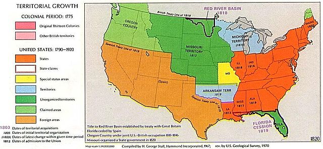
1970 USGS map
This image is in the public domain in the United States because it only contains materials that originally came from the United States Geological Survey, an agency of the United States Department of the Interior. For more information, see the official USGS copyright policy.
|
Other versions: 
Visually reorganized by Beyond My Ken (talk) 22:01, 18 April 2010 (UTC)
| US growth maps |
| Animated: large · small |
| Years |
| 1775 · 1790 · 1800 · 1810 · 1820 · 1830 · 1840 · 1850 · 1860 · 1870 · 1880 · 1900 · 1920 |

|
Irudi hau birsortu beharko litzateke SVG irudi bektorial moduan. Honek abantaila asko ematen ditu, ikus Commons:Media for cleanup (ingelesez) informazio gehiagorako. Irudi honen SVG bertsioa eskuragarri badago, mesedez Commonsera igo. Igo ostean, ordezkatu txantiloi hau txantiloi honegatik {{vector version available|irudiaren izen berria.svg}} irudi honetan.
|


Fitxategiaren historia
Data/orduan klik egin fitxategiak orduan zuen itxura ikusteko.
| Data/Ordua | Iruditxoa | Neurriak | Erabiltzailea | Iruzkina | |
|---|---|---|---|---|---|
| oraingoa | 00:02, 19 apirila 2010 | | 1.192 × 550 (131 KB) | Beyond My Ken | First upload failed |
| 00:01, 19 apirila 2010 |  | 1.192 × 550 (131 KB) | Beyond My Ken | 1970 USGS map {{PD-USGov-USGS}} Other versions: 150px Visually reorganized by ~~~~ {{US growth maps}} {{svg|map}} Category:Territorial Growth Maps of the United States |
Irudira dakarten loturak
Hurrengo orrialdeek dute fitxategi honetarako lotura:
Fitxategiaren erabilera orokorra
Hurrengo beste wikiek fitxategi hau darabilte:
- ang.wikipedia.org proiektuan duen erabilera
- ar.wikipedia.org proiektuan duen erabilera
- da.wikipedia.org proiektuan duen erabilera
- en.wikipedia.org proiektuan duen erabilera
- es.wikipedia.org proiektuan duen erabilera
- fr.wikipedia.org proiektuan duen erabilera
- he.wikipedia.org proiektuan duen erabilera
- id.wikipedia.org proiektuan duen erabilera
- it.wikipedia.org proiektuan duen erabilera
- ko.wikipedia.org proiektuan duen erabilera
- ms.wikipedia.org proiektuan duen erabilera
- no.wikipedia.org proiektuan duen erabilera
- sv.wikipedia.org proiektuan duen erabilera
- zh.wikipedia.org proiektuan duen erabilera