
Fitxategi:BlankMap-World 1959.svg

Bereizmen handikoa (SVG fitxategia, nominaldi 940 × 477 pixel, fitxategiaren tamaina: 794 KB)
Fitxategi hau Wikimedia Commonsekoa da. Hango deskribapen orriko informazioa behean duzu. |
Laburpena
| Deskribapena |
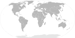
English: SVG Blank map of the world showing 1959 borders
Français : Carte muette du monde montrant les frontières de 1959, au format SVG. |
||
| Data | |||
| Jatorria |
|
||
| Egilea | Sémhur | ||
| Beste bertsioak |
Derivative works of this file: | ||
| Aitortu (required by the license) | © Sémhur / Wikimedia Commons / | ||
| SVG | Fitxategi hau (bektore-irudia) hau Inkscape-ekin sortu da .
.
|
||
| Graphic Lab |

| Blank maps of the world for historical use | |
| pre-1800 | |
|
19th century | |
|
20th century | |
|
1902 · 1912 · 1914 · WWI · Aug 1918 · 1920 · 1921 · 1924 · 1926 · 1935 · 1937 · Mar 1938 · Oct 1938 · Mar 1939 · Oct 1939 · WWII · Nov 1942 · May 1945 · 1957 · 1959 · 1962 · 1968 · 1970 · 1985 · 1990 · 1993 | |
|
21st century | |
| (this template: · view · discuss ) | |
.PNG)
Lizentzia
| Copyleft: This work of art is free; you can redistribute it and/or modify it according to terms of the Free Art License. You will find a specimen of this license on the Copyleft Attitude site as well as on other sites. |
- Askea zara:
- partekatzeko – lana kopiatzeko, banatzeko eta bidaltzeko
- birnahasteko – lana moldatzeko
- Ondorengo baldintzen pean:
- eskuduntza – Egiletza behar bezala aitortu behar duzu, lizentzia ikusteko esteka gehitu, eta ea aldaketak egin diren aipatu. Era egokian egin behar duzu hori guztia, baina inola ere ez egileak zure lana edo zure erabilera babesten duela irudikatuz.
- berdin partekatu – Lan honetan oinarrituta edo aldatuta berria eraikitzen baduzu, emaitza lana hau bezalako lizentzia batekin argitaratu behar duzu.
Fitxategiaren historia
Data/orduan klik egin fitxategiak orduan zuen itxura ikusteko.
| Data/Ordua | Iruditxoa | Neurriak | Erabiltzailea | Iruzkina | |
|---|---|---|---|---|---|
| oraingoa | 12:20, 2 ekaina 2014 | | 940 × 477 (794 KB) | Sémhur | Valid SVG ; separate southern Ryukyu Island from Japan |
| 10:14, 25 maiatza 2008 |  | 940 × 477 (793 KB) | Sémhur | Group Pakistan and East-Pakistan (not yet Bangladesh in 1959) | |
| 19:16, 14 apirila 2008 |  | 940 × 477 (793 KB) | Sémhur | the bitmap... one more time | |
| 19:10, 14 apirila 2008 |  | 940 × 477 (794 KB) | Sémhur | {{Information |Description= {{en|SVG Blank map of the world showing 1959 borders.}} {{fr|Carte muette du monde montrant les frontières de 1959, au format SVG.}} |Source= * Image:BlankMap-World6.svg by {{u|Canuckguy}}, under licence Public Domain * [ |
Irudira dakarten loturak
Ez dago fitxategi hau darabilen orririk.
Fitxategiaren erabilera orokorra
Hurrengo beste wikiek fitxategi hau darabilte:
- en.wikipedia.org proiektuan duen erabilera
- fr.wikipedia.org proiektuan duen erabilera
- ko.wikipedia.org proiektuan duen erabilera
- nl.wikipedia.org proiektuan duen erabilera