
Fitxategi:Pont Dafydd - geograph.org.uk - 2735828.jpg
Pont_Dafydd_-_geograph.org.uk_-_2735828.jpg ((640 × 480 pixel, fitxategiaren tamaina: 156 KB, MIME mota: image/jpeg))
Fitxategi hau Wikimedia Commonsekoa da. Hango deskribapen orriko informazioa behean duzu. |
Laburpena
| Deskribapena |
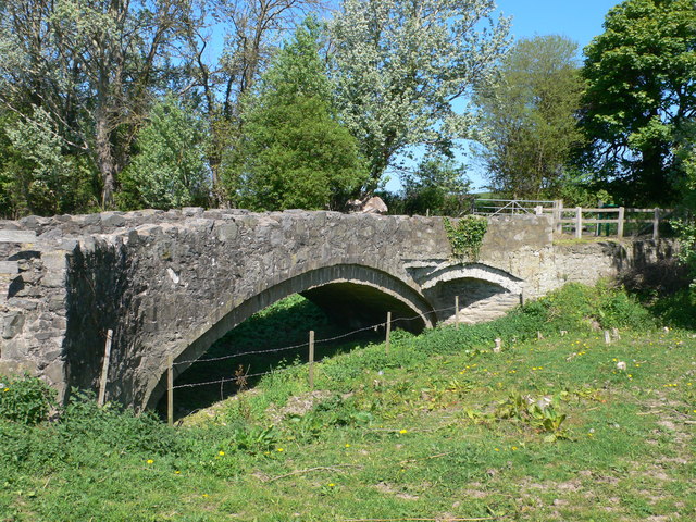
English: Pont Dafydd, CTYPE html PUBLIC "-//W3C//DTD XHTML 1.0 Strict//EN"
"http://www.w3.org/TR/xhtml1/DTD/xhtml1-strict.dtd"> <html xmlns="http://www.w3.org/1999/xhtml" xml:lang="en" id="geograph"> <head> <title>Pont Dafydd:: OS grid SJ0475 :: Geograph Britain and Ireland - photograph every grid square!</title> <meta http-equiv="Content-Type" content="text/html; charset=iso-8859-1" /> <meta name="description" content="Bridge on an old coaching road over the river Clwyd near St Asaph, built originally in 1630 by Bishop Dafydd. The original bridge was replaced in 1840 with a stronger bridge, which itself became obsolete when the river Clwyd was diverted." /> <meta name="ICBM" content="53.263618360974, -3.4350235530954"/> <meta name="DC.title" content="Geograph:: Pont Dafydd:: OS grid SJ0475"/> <link rel="stylesheet" type="text/css" title="Monitor" href="http://s1.geograph.org.uk/templates/basic/css/basic.v7747.css" media="screen" /> <link rel="shortcut icon" type="image/x-icon" href="http://s1.geograph.org.uk/favicon.ico"/> <link rel="alternate" type="application/vnd.google-earth.kml+xml" href="/photo/2735828.kml"/> <link rel="search" type="application/opensearchdescription+xml" title="Geograph Britain and Ireland search" href="/stuff/osd.xml" /> <script type="text/javascript" src="http://s1.geograph.org.uk/js/geograph.v7635.js"></script> </head> <body> <a title="Geograph home page" href="/">Geograph - photograph every grid square</a><a title="Grid Reference SJ0475 :: 13 images" href="/gridref/SJ0475">SJ0475</a> : Pont Dafyddnear to St Asaph, Denbighshire/Sir Ddinbych, Great Britain. |
| Data | |
| Jatorria | From geograph.org.uk; transferred by User:Skinsmoke using geograph_org2commons. |
| Egilea | Eirian Evans |
| Lizentzia (Fitxategi hau berrerabiltzen) |
Creative Commons Attribution Share-alike license 2.0 |
| Aitortu (required by the license) | Eirian Evans / Pont Dafydd / |
| Kameraren kokapena | | Irudi hau eta gehiago beraien kokapenekin hurrengo lekuetan: OpenStreetMap |
|---|
| Objektuaren kokapena | | Irudi hau eta gehiago beraien kokapenekin hurrengo lekuetan: OpenStreetMap |
|---|
_region:GB-GBN_heading:315.00&language=eu)
Lizentzia

|
This image was taken from the Geograph project collection. See this photograph's page on the Geograph website for the photographer's contact details. The copyright on this image is owned by Eirian Evans and is licensed for reuse under the Creative Commons Attribution-ShareAlike 2.0 license.
|
- Askea zara:
- partekatzeko – lana kopiatzeko, banatzeko eta bidaltzeko
- birnahasteko – lana moldatzeko
- Ondorengo baldintzen pean:
- eskuduntza – Egiletza behar bezala aitortu behar duzu, lizentzia ikusteko esteka gehitu, eta ea aldaketak egin diren aipatu. Era egokian egin behar duzu hori guztia, baina inola ere ez egileak zure lana edo zure erabilera babesten duela irudikatuz.
- berdin partekatu – Lan honetan oinarrituta edo aldatuta berria eraikitzen baduzu, emaitza lana hau bezalako lizentzia batekin argitaratu behar duzu.
Fitxategiaren historia
Data/orduan klik egin fitxategiak orduan zuen itxura ikusteko.
| Data/Ordua | Iruditxoa | Neurriak | Erabiltzailea | Iruzkina | |
|---|---|---|---|---|---|
| oraingoa | 19:48, 10 apirila 2013 | | 640 × 480 (156 KB) | File Upload Bot (Magnus Manske) |
Irudira dakarten loturak
Hurrengo orrialdeek dute fitxategi honetarako lotura:
Fitxategiaren erabilera orokorra
Hurrengo beste wikiek fitxategi hau darabilte:
- ceb.wikipedia.org proiektuan duen erabilera
- cy.wikipedia.org proiektuan duen erabilera
- en.wikipedia.org proiektuan duen erabilera
- fr.wikipedia.org proiektuan duen erabilera
- it.wikipedia.org proiektuan duen erabilera
- sv.wikipedia.org proiektuan duen erabilera
- www.wikidata.org proiektuan duen erabilera