
Fitxategi:View from Crookston Castle - ENE - geograph.org.uk - 1084296.jpg
Ez dago bereizmen handiagorik.
View_from_Crookston_Castle_-_ENE_-_geograph.org.uk_-_1084296.jpg ((640 × 320 pixel, fitxategiaren tamaina: 56 KB, MIME mota: image/jpeg))
Fitxategi hau Wikimedia Commonsekoa da. Hango deskribapen orriko informazioa behean duzu. |
Laburpena
| Deskribapena |
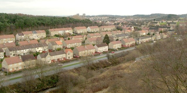
English: View from Crookston Castle - ENE The viewpoint for this picture was the top of Crookston Castle, and the view is towards the Pollok and Corkerhill areas of Glasgow.
The main road visible at the bottom of the image is Lyoncross Road; between this road and the unseen Potterhill Road (higher up the slope) are two rows of houses. Between Potterhill Road and Barnbeth Road (higher up again) are another two rows of houses. There are no houses on the far side of Barnbeth Road, but Crookston Wood begins there; this wood can be seen in the photo. |
| Data | |
| Jatorria | From geograph.org.uk |
| Egilea | Lairich Rig |
| Aitortu (required by the license) | Lairich Rig / View from Crookston Castle - ENE / |
| Kameraren kokapena | | Irudi hau eta gehiago beraien kokapenekin hurrengo lekuetan: OpenStreetMap |
|---|
_heading:67.00&language=eu)
| Objektuaren kokapena | | Irudi hau eta gehiago beraien kokapenekin hurrengo lekuetan: OpenStreetMap |
|---|
_heading:67.00&language=eu)
Lizentzia

|
This image was taken from the Geograph project collection. See this photograph's page on the Geograph website for the photographer's contact details. The copyright on this image is owned by Lairich Rig and is licensed for reuse under the Creative Commons Attribution-ShareAlike 2.0 license.
|
This file is licensed under the Creative Commons Attribution-Share Alike 2.0 Generic license.
Aitortu: Lairich Rig
- Askea zara:
- partekatzeko – lana kopiatzeko, banatzeko eta bidaltzeko
- birnahasteko – lana moldatzeko
- Ondorengo baldintzen pean:
- eskuduntza – Egiletza behar bezala aitortu behar duzu, lizentzia ikusteko esteka gehitu, eta ea aldaketak egin diren aipatu. Era egokian egin behar duzu hori guztia, baina inola ere ez egileak zure lana edo zure erabilera babesten duela irudikatuz.
- berdin partekatu – Lan honetan oinarrituta edo aldatuta berria eraikitzen baduzu, emaitza lana hau bezalako lizentzia batekin argitaratu behar duzu.
Fitxategiaren historia
Data/orduan klik egin fitxategiak orduan zuen itxura ikusteko.
| Data/Ordua | Iruditxoa | Neurriak | Erabiltzailea | Iruzkina | |
|---|---|---|---|---|---|
| oraingoa | 14:25, 24 otsaila 2011 | | 640 × 320 (56 KB) | GeographBot | == {{int:filedesc}} == {{Information |description={{en|1=View from Crookston Castle - ENE The viewpoint for this picture was the top of Crookston Castle, and the view is towards the Pollok and Corkerhill areas of Glasgow. The main road visible at the b |
Irudira dakarten loturak
Hurrengo orrialdeek dute fitxategi honetarako lotura:
Fitxategiaren erabilera orokorra
Hurrengo beste wikiek fitxategi hau darabilte: