
Fitxategi:1866 Black Holstein.jpg
Bereizmen handikoa ((940 × 705 pixel, fitxategiaren tamaina: 327 KB, MIME mota: image/jpeg))
Fitxategi hau Wikimedia Commonsekoa da. Hango deskribapen orriko informazioa behean duzu. |
Laburpena
| Deskribapena |
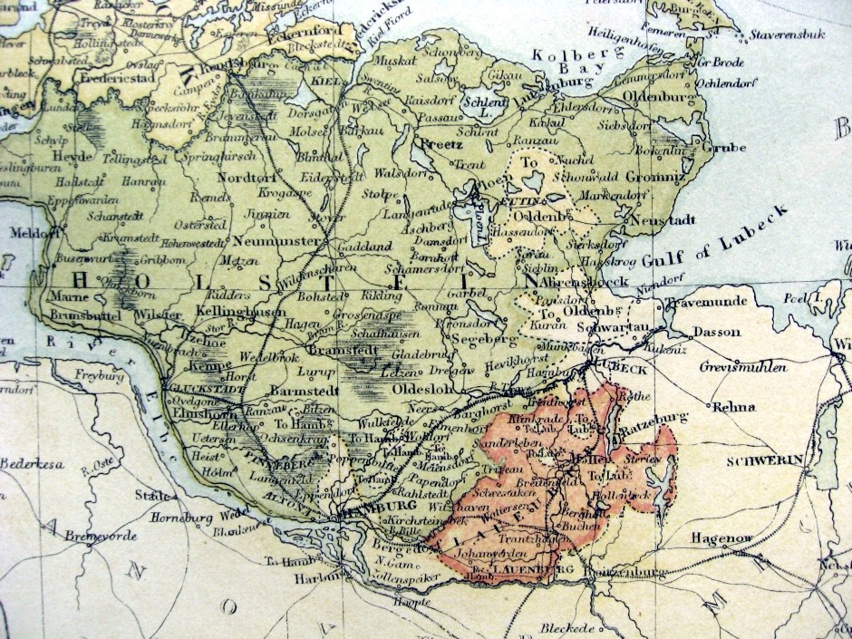
English: Photo showing the Duchy of Holstein, c1855-66, from an Engraved Lithograph Map of Denmark |
| Data | |
| Jatorria | "Denmark with Sleswick & Holstein" (Map), from Black's Atlas of the World”, Published by A & C Black, Edinburgh, 1866 |
| Egilea | Engraved and Printed by J Bartholomew |
| Lizentzia (Fitxategi hau berrerabiltzen) |
Out of copyright item |
Lizentzia
|
Lan hau jabetza publikoan dago bai bere jatorrizko herrialdean, bai egile eskubideak egilea hil eta 70 urtera edo gutxiagora iraungitzen diren gainerako herrialdeetan.
| |
| This file has been identified as being free of known restrictions under copyright law, including all related and neighboring rights. | |
Jatorrizko igoera erregistroa
- 2009-02-01 03:41 Fredrick Wilhelm 940×705× (609647 bytes) Photo showing the Duchy of Holstein, c1855-66, from a map of Denmark |Description= from an Engraved Lithograph Map of Denmark |Source= "Denmark with Sleswick & Holstein" (Map), from Black's Atlas of the World”, Published by by A & C Black, Edinburgh, 1
Fitxategiaren historia
Data/orduan klik egin fitxategiak orduan zuen itxura ikusteko.
| Data/Ordua | Iruditxoa | Neurriak | Erabiltzailea | Iruzkina | |
|---|---|---|---|---|---|
| oraingoa | 20:13, 18 maiatza 2018 | | 940 × 705 (327 KB) | 1970gemini | fiat lux |
| 06:23, 5 uztaila 2011 |  | 940 × 705 (595 KB) | File Upload Bot (Magnus Manske) | {{BotMoveToCommons|en.wikipedia|year={{subst:CURRENTYEAR}}|month={{subst:CURRENTMONTHNAME}}|day={{subst:CURRENTDAY}}}} {{Information |Description={{en|Photo showing the Duchy of Holstein, c1855-66, from an Engraved Lithograph Map of Denmark}} |Source=Tra |
Irudira dakarten loturak
Ez dago fitxategi hau darabilen orririk.
Fitxategiaren erabilera orokorra
Hurrengo beste wikiek fitxategi hau darabilte:
- da.wikipedia.org proiektuan duen erabilera
- da.wikibooks.org proiektuan duen erabilera
- de.wikipedia.org proiektuan duen erabilera
- el.wikipedia.org proiektuan duen erabilera
- en.wikipedia.org proiektuan duen erabilera
- et.wikipedia.org proiektuan duen erabilera
- it.wikipedia.org proiektuan duen erabilera
- lv.wikipedia.org proiektuan duen erabilera
- mk.wikipedia.org proiektuan duen erabilera