
Fitxategi:Atropatene as a vassal of Seleucids.png

Aurreikuspen honen neurria: 800 × 582 pixel. Bestelako bereizmenak: 320 × 233 pixel | 640 × 466 pixel | 1.038 × 755 pixel.
Bereizmen handikoa ((1.038 × 755 pixel, fitxategiaren tamaina: 241 KB, MIME mota: image/png))
Fitxategi hau Wikimedia Commonsekoa da. Hango deskribapen orriko informazioa behean duzu. |
Laburpena
| Deskribapena |
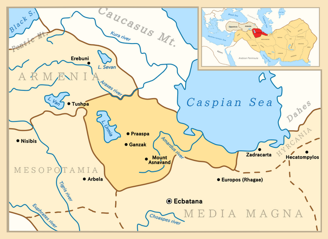
English: Map depicting Atropatene in a close-up view, with territories surrounding it as well as a zoomed-out view, showing all of the empire and neighboring countries. |
| Data | |
| Jatorria |
Norberak egina. Borders adapted from:
Fitxategi hau PNG (irudia) hau Medibang-ekin sortu da .
. |
| Egilea | Golden |
Lizentzia
Nik, lan honen egileak, argitaratzen dut ondorengo lizentzia pean:
This file is licensed under the Creative Commons Attribution-Share Alike 4.0 International license.
- Askea zara:
- partekatzeko – lana kopiatzeko, banatzeko eta bidaltzeko
- birnahasteko – lana moldatzeko
- Ondorengo baldintzen pean:
- eskuduntza – Egiletza behar bezala aitortu behar duzu, lizentzia ikusteko esteka gehitu, eta ea aldaketak egin diren aipatu. Era egokian egin behar duzu hori guztia, baina inola ere ez egileak zure lana edo zure erabilera babesten duela irudikatuz.
- berdin partekatu – Lan honetan oinarrituta edo aldatuta berria eraikitzen baduzu, emaitza lana hau bezalako lizentzia batekin argitaratu behar duzu.
Fitxategiaren historia
Data/orduan klik egin fitxategiak orduan zuen itxura ikusteko.
| Data/Ordua | Iruditxoa | Neurriak | Erabiltzailea | Iruzkina | |
|---|---|---|---|---|---|
| oraingoa | 13:34, 1 iraila 2020 | | 1.038 × 755 (241 KB) | Golden | Made the borders in the top-right map a bit thicker |
| 11:44, 28 abuztua 2020 |  | 1.038 × 755 (240 KB) | Golden | Changed colour of Armenia and Cappadocia to a lighter colour in the top-right map as they were vassal states, not provinces of Seleucids | |
| 23:27, 27 abuztua 2020 |  | 1.038 × 755 (239 KB) | Golden | Added "(Rhagae)" near Europos as it was also a common name for the city at the time | |
| 22:56, 27 abuztua 2020 |  | 1.038 × 755 (237 KB) | Golden | Added 2 new cities: Europos and Arbela | |
| 17:25, 27 abuztua 2020 |  | 1.038 × 755 (234 KB) | Golden | Fixed typo, Asnavad->Asnavand. Also expanded the smaller map on the top right to a bit right, so it the border isn't on the frame. | |
| 16:16, 27 abuztua 2020 |  | 1.038 × 755 (234 KB) | Golden | Changed name of the city Takht-e Soleyman to Mount Asnavand as that is the name it was known by at those times | |
| 10:03, 27 abuztua 2020 |  | 1.038 × 755 (234 KB) | Golden | Changed font of regions, mountains, seas. Deleted Tabriz, added 2 other cities in Atropatene. | |
| 02:32, 27 abuztua 2020 |  | 1.038 × 755 (234 KB) | Golden | Uploaded own work with UploadWizard |
Irudira dakarten loturak
Hurrengo orrialdeek dute fitxategi honetarako lotura:
Fitxategiaren erabilera orokorra
Hurrengo beste wikiek fitxategi hau darabilte:
- ast.wikipedia.org proiektuan duen erabilera
- az.wikipedia.org proiektuan duen erabilera
- ba.wikipedia.org proiektuan duen erabilera
- be.wikipedia.org proiektuan duen erabilera
- bg.wikipedia.org proiektuan duen erabilera
- ca.wikipedia.org proiektuan duen erabilera
- cs.wikipedia.org proiektuan duen erabilera
- el.wikipedia.org proiektuan duen erabilera
- en.wikipedia.org proiektuan duen erabilera
- es.wikipedia.org proiektuan duen erabilera
- fa.wikipedia.org proiektuan duen erabilera
- fi.wikipedia.org proiektuan duen erabilera
- ko.wikipedia.org proiektuan duen erabilera
- lt.wikipedia.org proiektuan duen erabilera
- nl.wikipedia.org proiektuan duen erabilera
- ro.wikipedia.org proiektuan duen erabilera
- ru.wikipedia.org proiektuan duen erabilera
- sr.wikipedia.org proiektuan duen erabilera
- th.wikipedia.org proiektuan duen erabilera
- tr.wikipedia.org proiektuan duen erabilera
- uk.wikipedia.org proiektuan duen erabilera
- ur.wikipedia.org proiektuan duen erabilera
- www.wikidata.org proiektuan duen erabilera