
Fitxategi:Australia-New Guinea (orthographic projection).svg

Bereizmen handikoa (SVG fitxategia, nominaldi 541 × 541 pixel, fitxategiaren tamaina: 293 KB)
Fitxategi hau Wikimedia Commonsekoa da. Hango deskribapen orriko informazioa behean duzu. |
| Deskribapena |
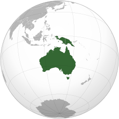
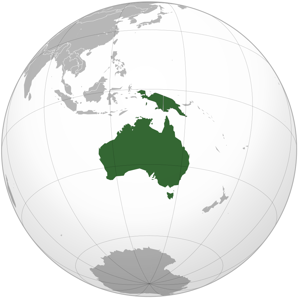
English: Map highlighting the continent of Australia-New Guinea. Includes Australia (including Tasmania) and New Guinea (including eastern portion of Indonesia (Aru Islands)) and mainland provinces of Papua New Guinea) south/east of Lydekker Line (delimiting continental shelf) |
| Data | (UTC) |
| Jatorria | |
| Egilea |
|
| Beste bertsioak |
.svg) |
.svg)
.svg)
.svg)
.svg)
.svg)
.svg)
.svg)
.svg)
.svg)
.svg)
.svg)
.svg)
.svg)
.svg)
.svg)
.svg)
.svg)
.svg)
.svg)
.svg)
.svg)
.svg)
.svg)
.svg)
.svg)
.svg)
.svg)
.svg)
.svg)
.svg)
.svg)
.svg)
.svg)
.svg)
.svg)
.svg)
.svg)
.svg)
.svg)
.svg)
.svg)
.svg)
.svg)
.svg)
.svg)
.svg)
.svg)
.svg)
.svg)
.svg)
.svg)
.svg)
.svg)
.svg)
.svg)
.svg)
.svg)
.svg)
.svg)
.svg)
.svg)
.svg)
.svg)
.svg)
.svg)
.svg)
.svg)
.svg)
.svg)
.svg)
.svg)
.svg)
.svg)

.svg)

.svg)

.svg)
.svg)
.svg)
.svg)
.svg)
.svg)
.svg)


.svg)
.svg)
.svg)
.svg)
.svg)
.svg)
.svg)

.svg)
.svg)
.svg)
.svg)
.svg)
.svg)
.svg)
.svg)
.svg)

.svg)
.svg)
.svg)
.svg)
.svg)
.svg)
.svg)
_without_national_boundaries.svg)
.svg)
.svg)
.svg)
.svg)
.svg)
.svg)

.svg)
.svg)
.png)
.svg)
.svg)
.svg)
.svg)

.svg)
.svg)
.svg)
.svg)
.svg)
.svg)
.svg)
.svg)
.svg)
.svg)
.svg)

.svg)
.svg)
.svg)
.svg)
.svg)
.svg)
.svg)
.svg)
.svg)

.svg)
.svg)

.svg)
.svg)
.svg)
.svg)
.svg)
.svg)
.svg)
.svg)
.svg)
.svg)
.svg)
.svg)
.svg)
.svg)
.svg)
.svg)
.svg)
.svg)
.svg)
.svg)
.svg)
.svg)
.svg)
.svg)
.svg)
.svg)
.svg)
_-_Crimea_disputed.svg)
.svg)
.svg)
.svg)
.svg)
.svg)
.svg)
.svg)
.svg)
.svg)
.svg)
.svg)
_political.svg)
.svg)
.svg)
.svg)
.svg)
_-_Crimea_disputed_-_no_borders.svg)
.svg)
.svg)
.svg)
.svg)
.svg)
.svg)
.svg)
.svg)
.svg)
.svg)
.svg)

.svg)
.svg)
.svg)

.png)
.svg)
.svg)
.svg)
.svg)
.svg)
.svg)
.svg)
.svg)
.svg)
.svg)
.svg)
.svg)
.svg)
.svg)
.svg)
.svg)
.svg)
.svg)
.svg)
.svg)
.svg)
.svg)
.svg)
.svg)
.svg)
.svg)
.svg)
.svg)
.svg)
.svg)
.svg)
.svg)
.svg)
.svg)
.png)
.svg)
.svg)
.svg)
_(orthographic_projection).png)
.svg)
Map includes Australia (including Tasmania and Torres Strait Islands) and New Guinea (including eastern portion of Indonesia (Aru Islands)) and mainland provinces of Papua New Guinea) south/east of Lydekker Line (delimiting continental shelf)
| Fitxategi hau Creative Commons Attribution-Share Alike 3.0 Unported lizentziapean dago. | ||
| ||
| This licensing tag was added to this file as part of the GFDL licensing update. |

|
Baimena duzu dokumentu hau kopiatu, banatu edo/eta aldatzeko GNU Free Documentation License baldintzapean, Free Software Foundationek argitaratutako 1.2 edo ondorengo bertsioan; sekzio aldaezinik gabe, azaleko testurik gabe, eta atzeko azaleko testurik gabe. Lizentziaren kopia dago GNU Free Documentation License izenburudun atalean. |
The map has been created with the Generic Mapping Tools: https://www.generic-mapping-tools.org/ using one or more of these public-domain datasets for the relief:
|
|
|
Baimena duzu dokumentu hau kopiatu, banatu edo/eta aldatzeko GNU Free Documentation License baldintzapean, Free Software Foundationek argitaratutako 1.2 edo ondorengo bertsioan; sekzio aldaezinik gabe, azaleko testurik gabe, eta atzeko azaleko testurik gabe. Lizentziaren kopia dago GNU Free Documentation License izenburudun atalean. |
Jatorrizko igoera erregistroa
This image is a derivative work of the following images:
- File:Australia_(orthographic_projection).svg licensed with Cc-by-sa-3.0-migrated, GFDL-GMT
- 2009-08-12T00:17:33Z Addicted04 541x541 (292902 Bytes) Meridianos
- 2008-11-09T13:20:33Z Ssolbergj 541x541 (292870 Bytes) {{Information |Description={{en|1=Australia}} |Source=Own work, {{Inkscape}}[http://www.aquarius.geomar.de/omc/make_map.html Aquarius.geomar.de]{{GFDL-GMT}} |Author=[[User:Ssolbergj|Ssolbergj]] |Date=9 November 2008 |Permissi
Uploaded with derivativeFX
Fitxategiaren historia
Data/orduan klik egin fitxategiak orduan zuen itxura ikusteko.
| Data/Ordua | Iruditxoa | Neurriak | Erabiltzailea | Iruzkina | |
|---|---|---|---|---|---|
| oraingoa | 17:15, 17 otsaila 2016 | | 541 × 541 (293 KB) | Maphobbyist | Reverted to version as of 14:25, 12 December 2009 (UTC) |
| 05:28, 19 azaroa 2012 |  | 541 × 541 (281 KB) | Kwamikagami | add Outer Banda Arc | |
| 16:25, 12 abendua 2009 |  | 541 × 541 (293 KB) | Avenue | {{Information |Description={{en|1=Continent of Australia-New Guinea}} |Source=*File:Australia_(orthographic_projection).svg |Date=2009-12-12 14:19 (UTC) |Author=*File:Australia_(orthographic_projection).svg: [[User: |
.svg)
Irudira dakarten loturak
Hurrengo orrialdeek dute fitxategi honetarako lotura:
Fitxategiaren erabilera orokorra
Hurrengo beste wikiek fitxategi hau darabilte:
- ab.wikipedia.org proiektuan duen erabilera
- af.wikipedia.org proiektuan duen erabilera
- ar.wikipedia.org proiektuan duen erabilera
- آسيا
- أوروبا
- قارة
- أستراليا
- القارة القطبية الجنوبية
- أوقيانوسيا
- أمريكا الشمالية
- أمريكا الجنوبية
- بوابة:آسيا
- بوابة:أوروبا
- العالم الجديد
- أوراسيا
- أطلانطس
- الأمريكتان
- شبه القارة الهندية
- بانجيا
- تصنيف:تصنيفات حسب القارة
- غندوانا
- أفرو-أوراسيا
- أستراليا (قارة)
- تغير أسماء دول آسيا خلال القرن العشرين
- إفريقيا
- ليموريا (قارة)
- القارات في العصر الجوراسي
- قالب:قارات العالم
- أطلانتيكا
- قارة غارقة
- أركتيكا
- آسيامريكا
- بانجيا الأخرى
- أماسيا (قارة)
- لوراسيا
- بانوتيا
- نوفوبانجيا
Ikus fitxategi honen erabilpen global gehiago.
.svg)
.svg)