
Fitxategi:Barrou Neighbourhood, Étang de Thau, Sète 01.jpg

Bereizmen handikoa ((5.453 × 3.408 pixel, fitxategiaren tamaina: 15,6 MB, MIME mota: image/jpeg))
Fitxategi hau Wikimedia Commonsekoa da. Hango deskribapen orriko informazioa behean duzu. |
Laburpena
| Deskribapena |
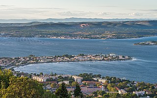
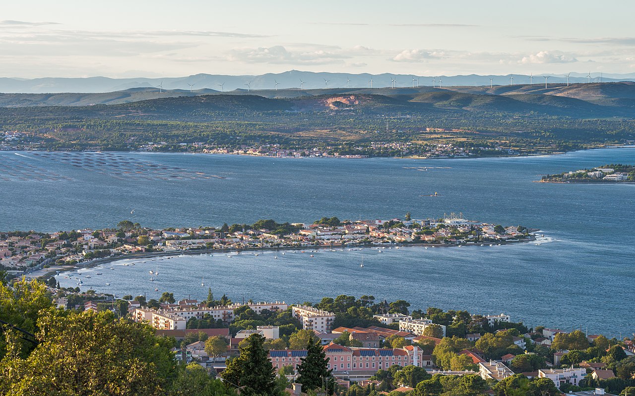
Français : Le quartier du Barrou et l'étang de Thau. Sur la rive opposée la commune de Bouzigues et ses parcs à huitres. Dans le fond, sur les collines le parc éolien de Nord Bassin de Thau. Sète, Hérault, France. English: The Barrou Neighbourhood and the Étang de Thau. On the opposite bank the commune of Bouzigues and its Oyster farms. On the hills in the background, the Nord Bassin de Thau wind farm. Sète, Hérault, France. |
| Data | Taken on 2013ko irailaren 10a, 19:14:30 |
| Jatorria | Norberak egina |
| Egilea | Christian Ferrer |
| Lizentzia (Fitxategi hau berrerabiltzen) |
Christian Ferrer, lan honen egileak, argitaratu du edo argitaratzen du ondorengo lizentzia pean: Fitxategi hau Creative Commons Attribution-Share Alike 3.0 Unported lizentziapean dago. Aitortu: Christian Ferrer
|
| Kameraren kokapena | | Irudi hau eta gehiago beraien kokapenekin hurrengo lekuetan: OpenStreetMap |
|---|
|

|
This image has been assessed under the valued image criteria and is considered the most valued image on Commons within the scope: Barrou Neighbourhood, Sète, Hérault, France. General view from southeast in 2013.. You can see its nomination here. |
| Annotations | This image is annotated: View the annotations at Commons |
Fitxategiaren historia
Data/orduan klik egin fitxategiak orduan zuen itxura ikusteko.
| Data/Ordua | Iruditxoa | Neurriak | Erabiltzailea | Iruzkina | |
|---|---|---|---|---|---|
| oraingoa | 13:56, 11 iraila 2013 | | 5.453 × 3.408 (15,6 MB) | Christian Ferrer | User created page with UploadWizard |
Irudira dakarten loturak
Hurrengo orrialdeek dute fitxategi honetarako lotura:
Fitxategiaren erabilera orokorra
Hurrengo beste wikiek fitxategi hau darabilte:
- ca.wikipedia.org proiektuan duen erabilera
- ceb.wikipedia.org proiektuan duen erabilera
- de.wikipedia.org proiektuan duen erabilera
- en.wikipedia.org proiektuan duen erabilera
- es.wikipedia.org proiektuan duen erabilera
- fr.wikipedia.org proiektuan duen erabilera
- it.wikipedia.org proiektuan duen erabilera
- lv.wikipedia.org proiektuan duen erabilera
- mt.wikipedia.org proiektuan duen erabilera
- nl.wikipedia.org proiektuan duen erabilera
- nn.wikipedia.org proiektuan duen erabilera
- oc.wikipedia.org proiektuan duen erabilera
- pcd.wikipedia.org proiektuan duen erabilera
- simple.wikipedia.org proiektuan duen erabilera
- sl.wikipedia.org proiektuan duen erabilera
- sv.wikipedia.org proiektuan duen erabilera
- vi.wikipedia.org proiektuan duen erabilera
- vo.wikipedia.org proiektuan duen erabilera
- war.wikipedia.org proiektuan duen erabilera