
Fitxategi:Central America volcanic belt.jpg

Aurreikuspen honen neurria: 800 × 562 pixel. Bestelako bereizmenak: 320 × 225 pixel | 640 × 449 pixel | 1.024 × 719 pixel | 1.280 × 899 pixel | 2.560 × 1.798 pixel | 4.081 × 2.866 pixel.
Bereizmen handikoa ((4.081 × 2.866 pixel, fitxategiaren tamaina: 3,02 MB, MIME mota: image/jpeg))
Fitxategi hau Wikimedia Commonsekoa da. Hango deskribapen orriko informazioa behean duzu. |
| Deskribapena |
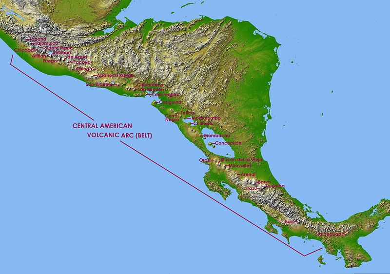
English: Central America in SRTM Shaded Relief and Colored Height |
| Data | (UTC) |
| Jatorria | |
| Egilea |
|
| This is a retouched picture, which means that it has been digitally altered from its original version. Modifications: Captions of volcanoes in Central America Volcanic Arc. The original can be viewed here: Topographic map of Central America.jpg:
|
| This file is in the public domain in the United States because it was solely created by NASA. NASA copyright policy states that "NASA material is not protected by copyright unless noted". (See Template:PD-USGov, NASA copyright policy page or JPL Image Use Policy.) | ||
 |
Warnings:
|
Jatorrizko igoera erregistroa
This image is a derivative work of the following images:
- File:Topographic_map_of_Central_America.jpg licensed with PD-USGov-NASA
- 2010-01-08T15:57:36Z Minor edit 9600x9000 (8603290 Bytes) {{Information |Description={{en|Central America in SRTM Shaded Relief and Colored Height}} |Source=http://photojournal.jpl.nasa.gov/catalog/PIA03364 |Date=2002-10-22 |Author= NASA/JPL/NIMA |Permission={{PD-USGov-NASA}} |other
Uploaded with derivativeFX
Fitxategiaren historia
Data/orduan klik egin fitxategiak orduan zuen itxura ikusteko.
| Data/Ordua | Iruditxoa | Neurriak | Erabiltzailea | Iruzkina | |
|---|---|---|---|---|---|
| oraingoa | 19:20, 6 maiatza 2011 | | 4.081 × 2.866 (3,02 MB) | Judygreenberg | {{Information |Description={{en|Central America in SRTM Shaded Relief and Colored Height}} |Source=*File:Topographic_map_of_Central_America.jpg |Date=2011-05-06 17:18 (UTC) |Author=*File:Topographic_map_of_Central_America.jpg: NASA/JPL/NIMA *d |
Irudira dakarten loturak
Hurrengo orrialdeek dute fitxategi honetarako lotura:
Fitxategiaren erabilera orokorra
Hurrengo beste wikiek fitxategi hau darabilte:
- ast.wikipedia.org proiektuan duen erabilera
- en.wikipedia.org proiektuan duen erabilera
- es.wikipedia.org proiektuan duen erabilera
- fa.wikipedia.org proiektuan duen erabilera
- fi.wikipedia.org proiektuan duen erabilera
- fr.wikipedia.org proiektuan duen erabilera
- Mombacho
- Pacaya
- Maderas
- Arenal (volcan)
- Irazú
- Turrialba
- Poás
- Volcán de Agua
- Tajumulco (volcan)
- Barú
- Rota (volcan)
- Santa María (volcan du Guatemala)
- Izalco (volcan)
- Santa Ana (volcan)
- San Salvador (volcan)
- San Vicente (volcan)
- Lac Ilopango
- Momotombo
- Concepción (Nicaragua)
- Masaya (volcan)
- Cosigüina
- Liste des volcans du Nicaragua
- Liste des volcans du Costa Rica
- Volcán de Fuego
- Lac de Coatepeque
- Liste des volcans du Guatemala
- Liste des volcans du Mexique
- Volcan Barva
- Acatenango
- San Cristóbal (volcan)
- San Miguel (volcan)
- Telica
- Orosí
- Miravalles (volcan)
- Rincón de la Vieja
- Platanar
- Tenorio (volcan)
- Almolonga (volcan)
- Ixtepeque
- Volcan Atitlán
- Ipala (volcan)
- Chingo
Ikus fitxategi honen erabilpen global gehiago.