Fitxategi:Hindu Kush satellite image.jpg

Aurreikuspen honen neurria: 763 × 600 pixel. Bestelako bereizmenak: 306 × 240 pixel | 611 × 480 pixel | 978 × 768 pixel | 1.280 × 1.006 pixel | 2.560 × 2.011 pixel | 5.600 × 4.400 pixel.
Bereizmen handikoa ((5.600 × 4.400 pixel, fitxategiaren tamaina: 5,01 MB, MIME mota: image/jpeg))
Fitxategiaren historia
Data/orduan klik egin fitxategiak orduan zuen itxura ikusteko.
| Data/Ordua | Iruditxoa | Neurriak | Erabiltzailea | Iruzkina | |
|---|---|---|---|---|---|
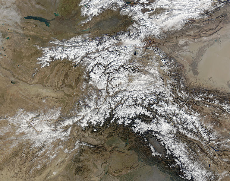
| oraingoa | 06:39, 6 ekaina 2006 |  | 5.600 × 4.400 (5,01 MB) | Avenue | {{Information |Description=The Hindu Kush occupies the lower-left-center of this true-color MODIS satellite image, acquired 28 November 2003. |Source=[NASA's Earth Observatory http://earthobservatory.nasa.gov/Newsroom/NewImages/images.php3?img_id=16411] | |
Irudira dakarten loturak
Hurrengo orrialdeek dute fitxategi honetarako lotura:
Fitxategiaren erabilera orokorra
Hurrengo beste wikiek fitxategi hau darabilte:
- bcl.wikipedia.org proiektuan duen erabilera
- bn.wikipedia.org proiektuan duen erabilera
- ca.wikipedia.org proiektuan duen erabilera
- el.wikipedia.org proiektuan duen erabilera
- en.wikipedia.org proiektuan duen erabilera
- es.wikipedia.org proiektuan duen erabilera
- et.wikipedia.org proiektuan duen erabilera
- fa.wikipedia.org proiektuan duen erabilera
- fi.wikipedia.org proiektuan duen erabilera
- it.wikipedia.org proiektuan duen erabilera
- mk.wikipedia.org proiektuan duen erabilera
- ml.wikipedia.org proiektuan duen erabilera
- mr.wikipedia.org proiektuan duen erabilera
- nl.wikipedia.org proiektuan duen erabilera
- nn.wikipedia.org proiektuan duen erabilera
- pa.wikipedia.org proiektuan duen erabilera
- pl.wikipedia.org proiektuan duen erabilera
- pnb.wikipedia.org proiektuan duen erabilera
- pt.wikipedia.org proiektuan duen erabilera
- ro.wikipedia.org proiektuan duen erabilera
- sk.wikipedia.org proiektuan duen erabilera
- sl.wikipedia.org proiektuan duen erabilera
- sr.wikipedia.org proiektuan duen erabilera
- ta.wikipedia.org proiektuan duen erabilera
- tg.wikipedia.org proiektuan duen erabilera
- th.wikipedia.org proiektuan duen erabilera
- uz.wikipedia.org proiektuan duen erabilera
- vi.wikipedia.org proiektuan duen erabilera


