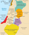
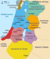
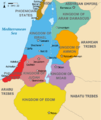
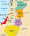
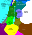
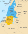
Fitxategi:Kingdoms of Israel and Judah map 830.svg

SVG fitxategi honen PNG aurreikuspenaren tamaina: 502 × 599 pixel. Bestelako bereizmenak: 201 × 240 pixel | 402 × 480 pixel | 644 × 768 pixel | 858 × 1.024 pixel | 1.717 × 2.048 pixel | 720 × 859 pixel.
Bereizmen handikoa (SVG fitxategia, nominaldi 720 × 859 pixel, fitxategiaren tamaina: 96 KB)
Fitxategiaren historia
Data/orduan klik egin fitxategiak orduan zuen itxura ikusteko.
| Data/Ordua | Iruditxoa | Neurriak | Erabiltzailea | Iruzkina | |
|---|---|---|---|---|---|
| oraingoa | 16:12, 1 urria 2021 |  | 720 × 859 (96 KB) | Sadopaul | File uploaded using svgtranslate tool (https://svgtranslate.toolforge.org/). Added translation for ko. |
| 17:50, 10 otsaila 2017 |  | 720 × 859 (80 KB) | Malus Catulus | removed 'Sizu' - a weird artifact from the Norse original | |
| 01:48, 13 otsaila 2011 |  | 720 × 859 (78 KB) | Malus Catulus | - | |
| 13:29, 13 uztaila 2010 | 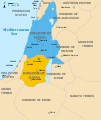 | 720 × 859 (79 KB) | Malus Catulus | Fixed Judah color | |
| 12:51, 13 uztaila 2010 |  | 720 × 859 (79 KB) | Malus Catulus | Added colors for the two kingdoms and converted their text to path and arial | |
| 01:53, 13 uztaila 2010 |  | 720 × 859 (62 KB) | Malus Catulus | Shrinked down the borders | |
| 21:43, 12 uztaila 2010 |  | 720 × 859 (62 KB) | Malus Catulus | {{Information |Description={{en|1=Map showing the ancient levant borders and ancient cities such as Urmomium and Jerash. The map also shows the region in the 9th century BCE. Notice the coastal land of Philistia, from which the name "Palestine |
Irudira dakarten loturak
Hurrengo orrialdeek dute fitxategi honetarako lotura:
Fitxategiaren erabilera orokorra
Hurrengo beste wikiek fitxategi hau darabilte:
- af.wikipedia.org proiektuan duen erabilera
- als.wikipedia.org proiektuan duen erabilera
- arz.wikipedia.org proiektuan duen erabilera
- azb.wikipedia.org proiektuan duen erabilera
- az.wikipedia.org proiektuan duen erabilera
- be-tarask.wikipedia.org proiektuan duen erabilera
- be.wikipedia.org proiektuan duen erabilera
- bg.wikipedia.org proiektuan duen erabilera
- bn.wikipedia.org proiektuan duen erabilera
- br.wikipedia.org proiektuan duen erabilera
- bs.wikipedia.org proiektuan duen erabilera
- bxr.wikipedia.org proiektuan duen erabilera
- ca.wikipedia.org proiektuan duen erabilera
- cdo.wikipedia.org proiektuan duen erabilera
- cs.wikipedia.org proiektuan duen erabilera
- da.wikipedia.org proiektuan duen erabilera
- de.wikipedia.org proiektuan duen erabilera
- de.wikibooks.org proiektuan duen erabilera
- en.wikipedia.org proiektuan duen erabilera
Ikus fitxategi honen erabilpen global gehiago.


