
Fitxategi:Map of Minnesota highlighting Crow Wing County.svg

SVG fitxategi honen PNG aurreikuspenaren tamaina: 527 × 600 pixel. Bestelako bereizmenak: 211 × 240 pixel | 422 × 480 pixel | 675 × 768 pixel | 900 × 1.024 pixel | 1.800 × 2.048 pixel | 5.746 × 6.539 pixel.
Bereizmen handikoa (SVG fitxategia, nominaldi 5.746 × 6.539 pixel, fitxategiaren tamaina: 104 KB)
Fitxategi hau Wikimedia Commonsekoa da. Hango deskribapen orriko informazioa behean duzu. |
Laburpena
| Deskribapena |
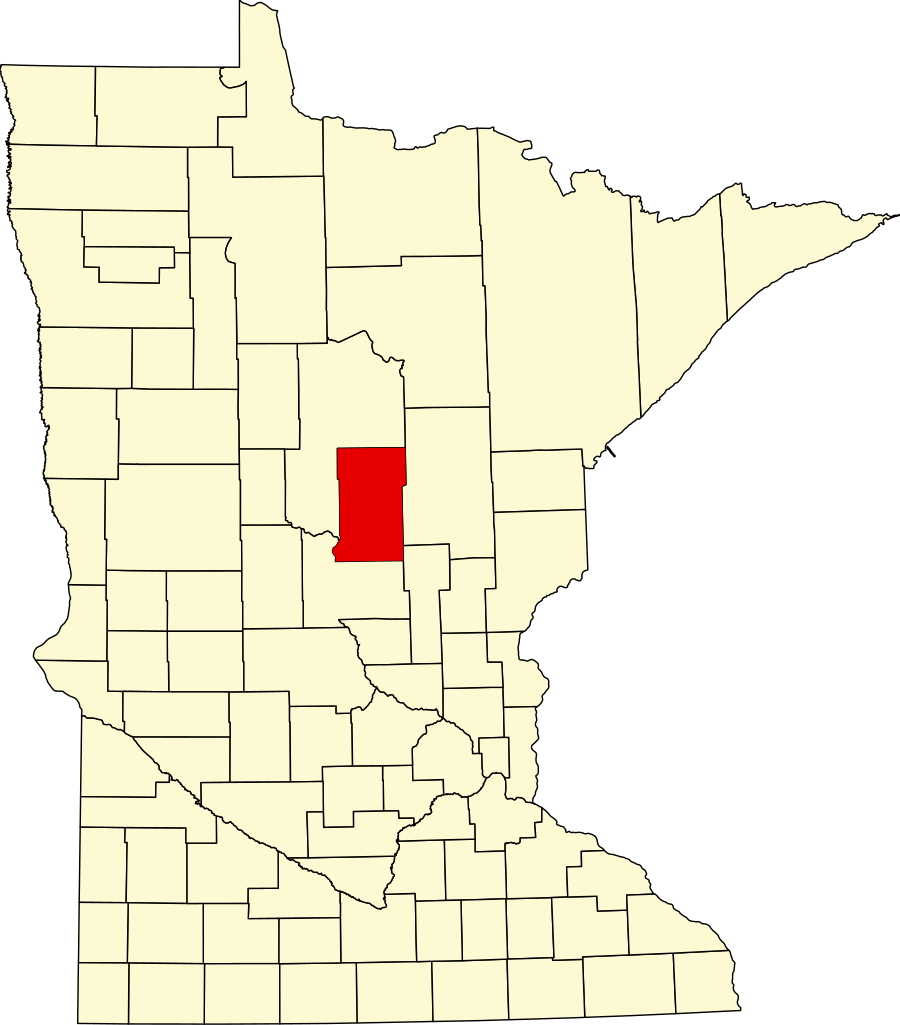
English: This is a locator map showing Crow Wing County in Minnesota. For more information, see Commons:United States county locator maps. |
| Data | |
| Jatorria |
Norberak egina: English: The maps use data from nationalatlas.gov, specifically countyp020.tar.gz on the Raw Data Download page. The maps also use state outline data from statesp020.tar.gz. The Florida maps use hydrogm020.tar.gz to display Lake Okeechobee. |
| Egilea | David Benbennick |
Lizentzia
| Nik, lan honen egile eskubideen jabeak, lan hau domeinu publikoan jartzen dut. Mundu osoan du eragina honek. Estatu batzuetan beharbada hori ez da legez posible izango. Halakoetan: Edonori ematen diot lan hau edozertarako erabiltzeko eskubidea, inolako baldintzarik gabe, legeak nahitaez ezarritako baldintzak izan ezik. |
Fitxategiaren historia
Data/orduan klik egin fitxategiak orduan zuen itxura ikusteko.
| Data/Ordua | Iruditxoa | Neurriak | Erabiltzailea | Iruzkina | |
|---|---|---|---|---|---|
| oraingoa | 15:13, 12 otsaila 2006 | | 5.746 × 6.539 (104 KB) | David Benbennick | {{subst:User:Dbenbenn/clm|county=Crow Wing County|state=Minnesota|type=county}} |
| 15:02, 12 otsaila 2006 |  | 5.746 × 6.539 (104 KB) | David Benbennick | {{subst:User:Dbenbenn/clm|county=Crow Wing County|state=Minnesota|type=county}} |
Irudira dakarten loturak
Hurrengo orrialdeek dute fitxategi honetarako lotura:
Fitxategiaren erabilera orokorra
Hurrengo beste wikiek fitxategi hau darabilte:
- ar.wikipedia.org proiektuan duen erabilera
- bg.wikipedia.org proiektuan duen erabilera
- bpy.wikipedia.org proiektuan duen erabilera
- cdo.wikipedia.org proiektuan duen erabilera
- ceb.wikipedia.org proiektuan duen erabilera
- cy.wikipedia.org proiektuan duen erabilera
- da.wikipedia.org proiektuan duen erabilera
- de.wikipedia.org proiektuan duen erabilera
- Liste der Countys in Minnesota
- Crow Wing County
- Brainerd (Minnesota)
- Pequot Lakes
- Liste der Einträge im National Register of Historic Places im Crow Wing County
- Baxter (Minnesota)
- Breezy Point (Minnesota)
- Vorlage:Navigationsleiste Orte im Crow Wing County
- Crosby (Minnesota)
- Crosslake
- Nisswa
- Merrifield (Minnesota)
- en.wikipedia.org proiektuan duen erabilera
Ikus fitxategi honen erabilpen global gehiago.