
Fitxategi:Maricopa County Incorporated and Planning areas Avondale highlighted.svg

SVG fitxategi honen PNG aurreikuspenaren tamaina: 694 × 599 pixel. Bestelako bereizmenak: 278 × 240 pixel | 556 × 480 pixel | 889 × 768 pixel | 1.185 × 1.024 pixel | 2.371 × 2.048 pixel | 940 × 812 pixel.
Bereizmen handikoa (SVG fitxategia, nominaldi 940 × 812 pixel, fitxategiaren tamaina: 1,05 MB)
Fitxategi hau Wikimedia Commonsekoa da. Hango deskribapen orriko informazioa behean duzu. |
Laburpena
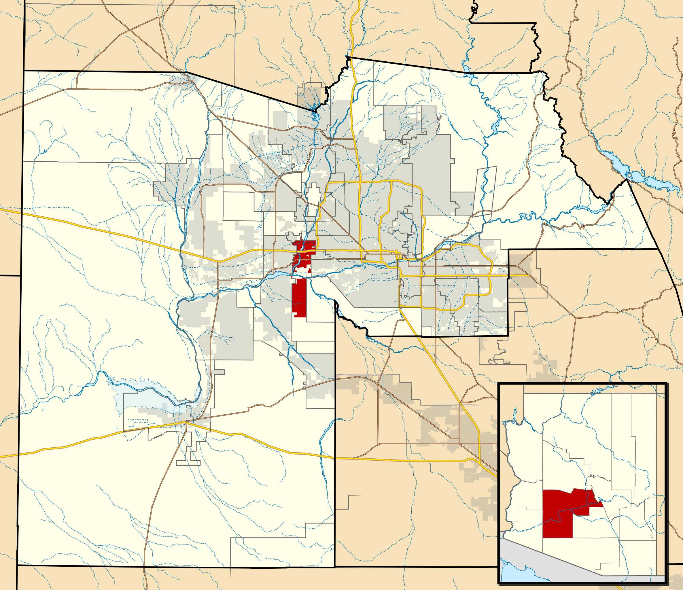
| Deskribapena | This map shows the incorporated areas and Indian reservation boundaries in Maricopa County, Arizona, along with water bodies and major highways and roads. Avondale is highlighted in red. Other incorporated cities are shown in gray, planning area borders for these cities and Indian reservation borders are shown as solid black lines. Changes from Previous Version: Updated the maps to include water bodies and to make "less boring" than the plain black/white/gray maps. Format was updated to match standards laid out by WikiProject Maps/Conventions. Map data is based on data from the following Webpage: Maricopa County Interactive GIS Map. I created this map in Inkscape. |
| Data | |
| Jatorria | My own work, based on government information |
| Egilea | Ixnayonthetimmay |
| Lizentzia (Fitxategi hau berrerabiltzen) |
Public Domain |
| Beste bertsioak | See Category:Maps of Maricopa County for other versions of this image. |
Lizentzia
| Nik, lan honen egile eskubideen jabeak, lan hau domeinu publikoan jartzen dut. Mundu osoan du eragina honek. Estatu batzuetan beharbada hori ez da legez posible izango. Halakoetan: Edonori ematen diot lan hau edozertarako erabiltzeko eskubidea, inolako baldintzarik gabe, legeak nahitaez ezarritako baldintzak izan ezik. |
Fitxategiaren historia
Data/orduan klik egin fitxategiak orduan zuen itxura ikusteko.
| Data/Ordua | Iruditxoa | Neurriak | Erabiltzailea | Iruzkina | |
|---|---|---|---|---|---|
| oraingoa | 08:08, 20 maiatza 2011 | | 940 × 812 (1,05 MB) | Ixnayonthetimmay | Uploading new version |
| 05:55, 30 abuztua 2008 |  | 900 × 800 (413 KB) | Ixnayonthetimmay | == Summary == {{Information |Description=This map shows the incorporated areas and unincorporated areas in Maricopa County, Arizona. [[:en:Avondale, Arizona| | |
| 02:14, 16 iraila 2007 |  | 900 × 800 (384 KB) | Ixnayonthetimmay | {{Information |Description= |Source= |Date= |Author= |Permission= |other_versions= }} | |
| 11:49, 28 maiatza 2007 |  | 900 × 780 (329 KB) | Ixnayonthetimmay | ||
| 01:47, 22 maiatza 2007 |  | 900 × 780 (318 KB) | Ixnayonthetimmay | ||
| 06:02, 30 urtarrila 2007 |  | 904 × 758 (177 KB) | Ixnayonthetimmay | {{Information |Description=This map shows the incorporated areas in Maricopa County, Arizona, highlighting Avondale in red. It also shows the boundaries for the | |
| 06:00, 30 urtarrila 2007 |  | 904 × 758 (177 KB) | Ixnayonthetimmay | {{Information |Description=This map shows the incorporated areas in Maricopa County, Arizona, highlighting Avondale in red. It also shows the boundaries for the |
Irudira dakarten loturak
Hurrengo orrialdeek dute fitxategi honetarako lotura:
Fitxategiaren erabilera orokorra
Hurrengo beste wikiek fitxategi hau darabilte:
- ar.wikipedia.org proiektuan duen erabilera
- arz.wikipedia.org proiektuan duen erabilera
- ca.wikipedia.org proiektuan duen erabilera
- ceb.wikipedia.org proiektuan duen erabilera
- cy.wikipedia.org proiektuan duen erabilera
- de.wikipedia.org proiektuan duen erabilera
- fa.wikipedia.org proiektuan duen erabilera
- fr.wikipedia.org proiektuan duen erabilera
- ht.wikipedia.org proiektuan duen erabilera
- io.wikipedia.org proiektuan duen erabilera
- no.wikipedia.org proiektuan duen erabilera
- pt.wikipedia.org proiektuan duen erabilera
- ro.wikipedia.org proiektuan duen erabilera
- sr.wikipedia.org proiektuan duen erabilera
- sv.wikipedia.org proiektuan duen erabilera
- sw.wikipedia.org proiektuan duen erabilera
- tr.wikipedia.org proiektuan duen erabilera
- tt.wikipedia.org proiektuan duen erabilera
- ur.wikipedia.org proiektuan duen erabilera
- vo.wikipedia.org proiektuan duen erabilera
- www.wikidata.org proiektuan duen erabilera
- zh-min-nan.wikipedia.org proiektuan duen erabilera