
Fitxategi:Panoramic of Juan Griego 45.jpg
Aurreikuspen honen neurria: 800 × 491 pixel. Bestelako bereizmenak: 320 × 197 pixel | 640 × 393 pixel | 1.024 × 629 pixel | 1.280 × 786 pixel | 2.560 × 1.573 pixel | 4.009 × 2.463 pixel.
Bereizmen handikoa ((4.009 × 2.463 pixel, fitxategiaren tamaina: 12,1 MB, MIME mota: image/jpeg))
Fitxategi hau Wikimedia Commonsekoa da. Hango deskribapen orriko informazioa behean duzu. |
Laburpena
| Deskribapena |
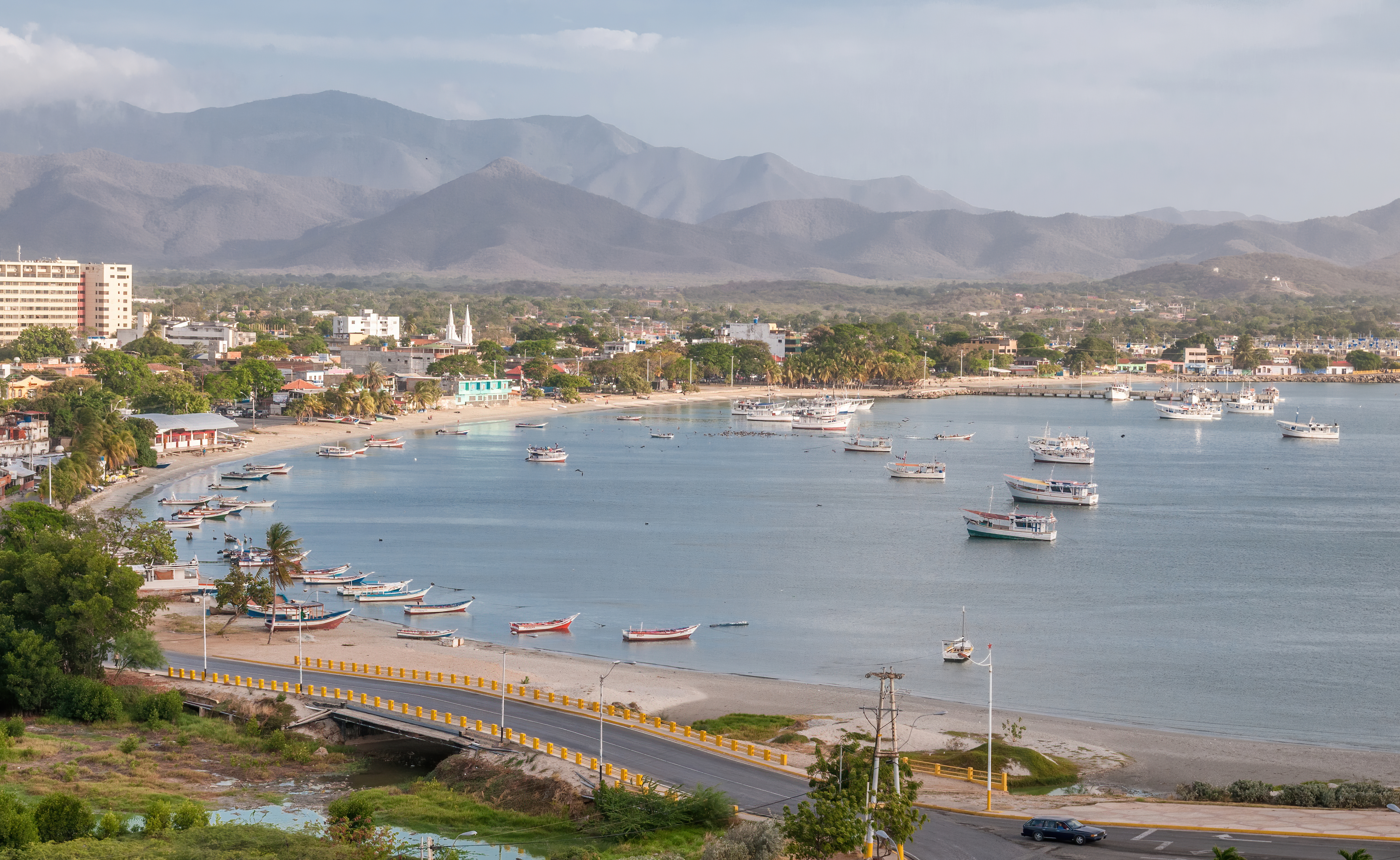
English: Panoramic view of Juan Griego bay from Fort La Galera. Juan Griego is a city on the northern side of Isla Margarita, and is the most northern port in Venezuela.
Español: Vista panorámica de la bahía de Juan Griego desde el Fortín de La Galera. Juan Griego es una ciudad al lado norte de la Isla Margarita y es el puerto más septentrional de Venezuela. |
| Data | |
| Jatorria | Norberak egina |
| Egilea | Wilfredor |
| Kameraren kokapena | | Irudi hau eta gehiago beraien kokapenekin hurrengo lekuetan: OpenStreetMap |
|---|
|
Lizentzia
Nik, lan honen egileak, argitaratzen dut ondorengo lizentzia pean:
| This file is made available under the Creative Commons CC0 1.0 Universal Public Domain Dedication. | |
| The person who associated a work with this deed has dedicated the work to the public domain by waiving all of their rights to the work worldwide under copyright law, including all related and neighboring rights, to the extent allowed by law. You can copy, modify, distribute and perform the work, even for commercial purposes, all without asking permission.
|
Fitxategiaren historia
Data/orduan klik egin fitxategiak orduan zuen itxura ikusteko.
| Data/Ordua | Iruditxoa | Neurriak | Erabiltzailea | Iruzkina | |
|---|---|---|---|---|---|
| oraingoa | 21:17, 29 otsaila 2020 | | 4.009 × 2.463 (12,1 MB) | Wilfredor | improve sharpening and noise |
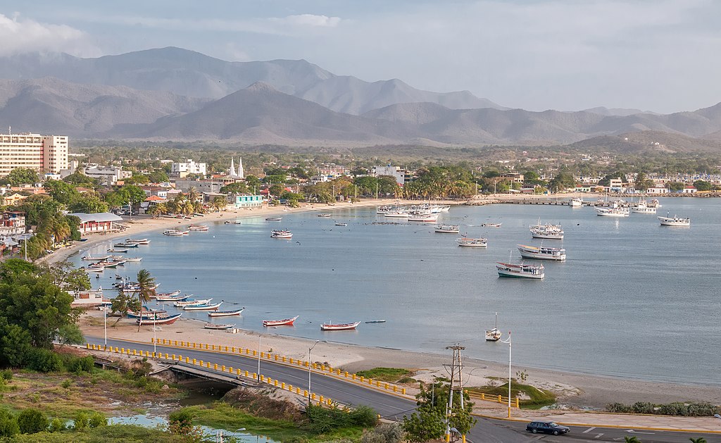
| 04:32, 1 maiatza 2014 |  | 4.009 × 2.463 (6 MB) | Wilfredor | Expotision -- | |
| 04:30, 27 apirila 2014 |  | 4.009 × 2.463 (5,97 MB) | Wilfredor | User created page with UploadWizard |
Irudira dakarten loturak
Hurrengo orrialdeek dute fitxategi honetarako lotura:
Fitxategiaren erabilera orokorra
Hurrengo beste wikiek fitxategi hau darabilte:
- ar.wikipedia.org proiektuan duen erabilera
- arz.wikipedia.org proiektuan duen erabilera
- ast.wikipedia.org proiektuan duen erabilera
- az.wikipedia.org proiektuan duen erabilera
- ca.wikipedia.org proiektuan duen erabilera
- ceb.wikipedia.org proiektuan duen erabilera
- de.wikipedia.org proiektuan duen erabilera
- en.wikipedia.org proiektuan duen erabilera
- en.wikivoyage.org proiektuan duen erabilera
- eo.wikipedia.org proiektuan duen erabilera
- es.wikipedia.org proiektuan duen erabilera
- es.wikivoyage.org proiektuan duen erabilera
- fa.wikipedia.org proiektuan duen erabilera
- fi.wikipedia.org proiektuan duen erabilera
- fr.wikipedia.org proiektuan duen erabilera
- fr.wikivoyage.org proiektuan duen erabilera
- gl.wikipedia.org proiektuan duen erabilera
- he.wikipedia.org proiektuan duen erabilera
- he.wikivoyage.org proiektuan duen erabilera
- hu.wikipedia.org proiektuan duen erabilera
- hy.wikipedia.org proiektuan duen erabilera
- it.wikipedia.org proiektuan duen erabilera
- it.wikivoyage.org proiektuan duen erabilera
- ka.wikipedia.org proiektuan duen erabilera
- lb.wikipedia.org proiektuan duen erabilera
- mg.wikipedia.org proiektuan duen erabilera
- no.wikipedia.org proiektuan duen erabilera
- os.wikipedia.org proiektuan duen erabilera
- pap.wikipedia.org proiektuan duen erabilera
- pl.wikipedia.org proiektuan duen erabilera
- pl.wikivoyage.org proiektuan duen erabilera
- pt.wikipedia.org proiektuan duen erabilera
- ro.wikipedia.org proiektuan duen erabilera
- ru.wikipedia.org proiektuan duen erabilera
- sr.wikipedia.org proiektuan duen erabilera
- sv.wikipedia.org proiektuan duen erabilera
- uk.wikipedia.org proiektuan duen erabilera
Ikus fitxategi honen erabilpen global gehiago.