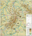
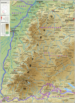
Fitxategi:Schwäbische Alb - Deutsche Mittelgebirge, Serie A-de.png

Aurreikuspen honen neurria: 792 × 600 pixel. Bestelako bereizmenak: 317 × 240 pixel | 634 × 480 pixel | 1.014 × 768 pixel | 1.280 × 969 pixel | 2.560 × 1.938 pixel | 3.500 × 2.650 pixel.
Bereizmen handikoa ((3.500 × 2.650 pixel, fitxategiaren tamaina: 13,05 MB, MIME mota: image/png))
Fitxategiaren historia
Data/orduan klik egin fitxategiak orduan zuen itxura ikusteko.
| Data/Ordua | Iruditxoa | Neurriak | Erabiltzailea | Iruzkina | |
|---|---|---|---|---|---|
| oraingoa | 22:28, 10 martxoa 2022 |  | 3.500 × 2.650 (13,05 MB) | Thoroe | Taiflingen -> Tailfingen |
| 15:10, 21 urtarrila 2019 |  | 3.500 × 2.650 (13,05 MB) | Thoroe | Einwohnerzahl Mössingen | |
| 22:24, 7 otsaila 2017 |  | 3.500 × 2.650 (13,48 MB) | Thoroe | minor fixes | |
| 23:56, 6 otsaila 2017 |  | 3.500 × 2.650 (13,47 MB) | Thoroe | several additions | |
| 15:49, 4 otsaila 2017 |  | 3.450 × 2.600 (12,96 MB) | Thoroe | {{Information |Description ={{en|1=Topographic map of the Swabian Jura}} {{de|1=Topografische Karte der Schwäbischen Alb}} |Source ={{Own using}} *[http://gmt.soest.hawaii.edu Generic Mapping To... |
Irudira dakarten loturak
Ez dago fitxategi hau darabilen orririk.
Fitxategiaren erabilera orokorra
Hurrengo beste wikiek fitxategi hau darabilte:
- af.wikipedia.org proiektuan duen erabilera
- bg.wikipedia.org proiektuan duen erabilera
- cs.wikipedia.org proiektuan duen erabilera
- de.wikipedia.org proiektuan duen erabilera
- Schwäbische Alb
- Albtrauf
- Großer Heuberg
- Diskussion:Albtrauf
- Benutzer:Thoroe
- Ostalb
- Wikipedia:Kartenwerkstatt/Karte des Tages/Galerie
- Geologie der Fränkischen Alb
- Portal:Schwäbische Alb
- Benutzer:Holger1959/BW-1
- Wikipedia:Kartenwerkstatt/Archiv/2017-02
- Benutzer:Thoroe/Making of Thüringer Wald
- Westalb
- Benutzer:Triplec85/BW-1
- de.wiktionary.org proiektuan duen erabilera
- en.wikipedia.org proiektuan duen erabilera
- eo.wikipedia.org proiektuan duen erabilera
- es.wikipedia.org proiektuan duen erabilera
- fi.wikipedia.org proiektuan duen erabilera
- frr.wikipedia.org proiektuan duen erabilera
- fr.wikipedia.org proiektuan duen erabilera
- fr.wiktionary.org proiektuan duen erabilera
- hr.wikipedia.org proiektuan duen erabilera
- hu.wikipedia.org proiektuan duen erabilera
- nl.wikipedia.org proiektuan duen erabilera
- no.wikipedia.org proiektuan duen erabilera
- pl.wikipedia.org proiektuan duen erabilera
- pl.wikivoyage.org proiektuan duen erabilera
- pnb.wikipedia.org proiektuan duen erabilera
- pt.wikipedia.org proiektuan duen erabilera
- ro.wikipedia.org proiektuan duen erabilera
- sk.wikipedia.org proiektuan duen erabilera
- sl.wikipedia.org proiektuan duen erabilera
- sv.wikipedia.org proiektuan duen erabilera
- uk.wikipedia.org proiektuan duen erabilera
- www.wikidata.org proiektuan duen erabilera


