
Fitxategi:Strait of Dover MODIS.jpg

Aurreikuspen honen neurria: 600 × 600 pixel. Bestelako bereizmenak: 240 × 240 pixel | 480 × 480 pixel | 768 × 768 pixel | 1.024 × 1.024 pixel | 1.600 × 1.600 pixel.
Bereizmen handikoa ((1.600 × 1.600 pixel, fitxategiaren tamaina: 1,21 MB, MIME mota: image/jpeg))
Fitxategi hau Wikimedia Commonsekoa da. Hango deskribapen orriko informazioa behean duzu. |
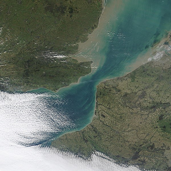
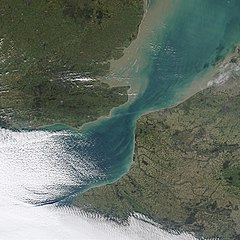
| Deskribapena | NASA MODIS satellite imagery of the Strait of Dover, the narrowest part of the English Channel. | |||||
| Data | ||||||
| Jatorria | NASA Visible Earth, original image | |||||
| Egilea | NASA | |||||
| Lizentzia (Fitxategi hau berrerabiltzen) |
|

Fitxategiaren historia
Data/orduan klik egin fitxategiak orduan zuen itxura ikusteko.
| Data/Ordua | Iruditxoa | Neurriak | Erabiltzailea | Iruzkina | |
|---|---|---|---|---|---|
| oraingoa | 02:02, 4 azaroa 2006 | | 1.600 × 1.600 (1,21 MB) | Coredesat | {{Information |Description=NASA MODIS satellite imagery of the Strait of Dover, the narrowest part of the English Channel. |Source=[http://visibleearth.nasa.gov/view_detail.php?id=4664 NASA Visible Earth], [http |
Irudira dakarten loturak
Ez dago fitxategi hau darabilen orririk.
Fitxategiaren erabilera orokorra
Hurrengo beste wikiek fitxategi hau darabilte:
- af.wikipedia.org proiektuan duen erabilera
- ar.wikipedia.org proiektuan duen erabilera
- ca.wikipedia.org proiektuan duen erabilera
- da.wikipedia.org proiektuan duen erabilera
- de.wikipedia.org proiektuan duen erabilera
- el.wikipedia.org proiektuan duen erabilera
- en.wikipedia.org proiektuan duen erabilera
- en.wiktionary.org proiektuan duen erabilera
- eo.wikipedia.org proiektuan duen erabilera
- es.wikipedia.org proiektuan duen erabilera
- fa.wikipedia.org proiektuan duen erabilera
- fi.wikipedia.org proiektuan duen erabilera
- fr.wikipedia.org proiektuan duen erabilera
- hy.wikipedia.org proiektuan duen erabilera
- it.wikipedia.org proiektuan duen erabilera
- ja.wikipedia.org proiektuan duen erabilera
- ko.wikipedia.org proiektuan duen erabilera
- ky.wikipedia.org proiektuan duen erabilera
- lt.wikipedia.org proiektuan duen erabilera
- no.wikipedia.org proiektuan duen erabilera
- pl.wikipedia.org proiektuan duen erabilera
- pl.wiktionary.org proiektuan duen erabilera
- pnb.wikipedia.org proiektuan duen erabilera
- pt.wikipedia.org proiektuan duen erabilera
- sh.wikipedia.org proiektuan duen erabilera
- sl.wikipedia.org proiektuan duen erabilera
- sr.wikipedia.org proiektuan duen erabilera
- sv.wikipedia.org proiektuan duen erabilera
- tl.wikipedia.org proiektuan duen erabilera
- ur.wikipedia.org proiektuan duen erabilera
- zh.wikipedia.org proiektuan duen erabilera