
Fitxategi:BlankEurope.png

Aurreikuspen honen neurria: 595 × 599 pixel. Bestelako bereizmenak: 238 × 240 pixel | 477 × 480 pixel | 762 × 768 pixel | 1.236 × 1.245 pixel.
Bereizmen handikoa ((1.236 × 1.245 pixel, fitxategiaren tamaina: 78 KB, MIME mota: image/png))
Fitxategi hau Wikimedia Commonsekoa da. Hango deskribapen orriko informazioa behean duzu. |

|
File:Blank map of Europe (with disputed regions).svg fitxategi honen bektore bertsioa da. Hau rasterizatutako bertsioaren ordez erabili beharko litzateke hobea izatekotan.
File:BlankEurope.png → File:Blank map of Europe (with disputed regions).svg
Grafiko bektorialei buruzko informazioa lortzeko, irakurri SVGra trantsizioa Commonsen. MediaWikiko SVG irudien inguruko laguntza teknikoa ere badago. |
.svg) |
Laburpena
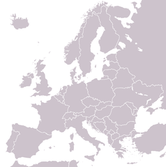
A blank political map of Europe extracted from Image:European Union member states by number of houses.png. +Hexagon1 (t) 04:47, 26 November 2006 (UTC)
Other versions: if you wish to use a map to show historical information before 2008, use Image:BlankEurope-BeforeKosovo.png
Lizentzia

|
Baimena duzu dokumentu hau kopiatu, banatu edo/eta aldatzeko GNU Free Documentation License baldintzapean, Free Software Foundationek argitaratutako 1.2 edo ondorengo bertsioan; sekzio aldaezinik gabe, azaleko testurik gabe, eta atzeko azaleko testurik gabe. Lizentziaren kopia dago GNU Free Documentation License izenburudun atalean. |
| Fitxategi hau Creative Commons Attribution-Share Alike 3.0 Unported lizentziapean dago. | ||
| ||
| This licensing tag was added to this file as part of the GFDL licensing update. |
Fitxategiaren historia
Data/orduan klik egin fitxategiak orduan zuen itxura ikusteko.
| Data/Ordua | Iruditxoa | Neurriak | Erabiltzailea | Iruzkina | |
|---|---|---|---|---|---|
| oraingoa | 15:31, 26 iraila 2022 | | 1.236 × 1.245 (78 KB) | BlackShadowG | Reverted to version as of 14:55, 27 October 2008 (UTC) |
| 00:40, 24 otsaila 2009 |  | 1.236 × 1.245 (78 KB) | Avala | ||
| 16:55, 27 urria 2008 |  | 1.236 × 1.245 (78 KB) | Quilbert | Reverted to version as of 05:53, 5 April 2008 – there is already Image:BlankEurope-BeforeKosovo.png | |
| 20:13, 24 urria 2008 |  | 1.236 × 1.245 (78 KB) | Avala | ||
| 07:53, 5 apirila 2008 |  | 1.236 × 1.245 (78 KB) | Hoshie | redid microstates, beefed up Spanish N. Africa, SBAs, and Gibraltar | |
| 20:42, 25 otsaila 2008 |  | 1.236 × 1.245 (78 KB) | Hoshie | fixed Gibraltar, Ceuta and Melilla, and the SBAs | |
| 04:39, 24 otsaila 2008 |  | 1.236 × 1.245 (78 KB) | Hoshie | Added Kosovo since it has been internationally recognized | |
| 00:40, 4 urtarrila 2008 |  | 1.236 × 1.245 (78 KB) | Hoshie | Re-drew ESBA and WSBA with circles until I study the CIA maps, boundary between Gibraltar and Spain. | |
| 06:47, 26 azaroa 2006 |  | 1.236 × 1.245 (44 KB) | Happenstance | A blank map of Europe extracted from Image:European Union member states by number of houses.png. ~~~~ |
Irudira dakarten loturak
Ez dago fitxategi hau darabilen orririk.
Fitxategiaren erabilera orokorra
Hurrengo beste wikiek fitxategi hau darabilte:
- de.wiktionary.org proiektuan duen erabilera
- hu.wikipedia.org proiektuan duen erabilera
- incubator.wikimedia.org proiektuan duen erabilera
- it.wiktionary.org proiektuan duen erabilera
- sl.wiktionary.org proiektuan duen erabilera
- uk.wikipedia.org proiektuan duen erabilera