
Fitxategi:Castilla y León-loc.svg

SVG fitxategi honen PNG aurreikuspenaren tamaina: 512 × 401 pixel. Bestelako bereizmenak: 307 × 240 pixel | 613 × 480 pixel | 981 × 768 pixel | 1.280 × 1.003 pixel | 2.560 × 2.005 pixel.
Bereizmen handikoa (SVG fitxategia, nominaldi 512 × 401 pixel, fitxategiaren tamaina: 1,76 MB)
Fitxategi hau Wikimedia Commonsekoa da. Hango deskribapen orriko informazioa behean duzu. |
Laburpena
| Deskribapena |
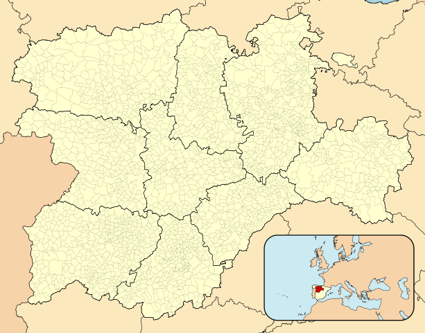
English: Location map of Castile and León
Equirectangular projection, N/S stretching 130 %. Geographic limits of the map:
Español: Mapa de localización de Castilla y León
Proyección equirrectangular, N/S estirada 130 %. Límites geográficos del mapa:
|
|
| Data | ||
| Jatorria | Norberaren lana, ondorengo hau(ek) oinarri hartuta: EspañaLoc.svg | |
| Egilea | Miguillen | |
| SVG genesis | Fitxategi hau (bektore-irudia) hau Inkscape-ekin sortu da .
.
|
Lizentzia
Miguillen, lan honen egileak, argitaratu du edo argitaratzen du ondorengo lizentzia pean:
Fitxategi hau Creative Commons Attribution-Share Alike 3.0 Unported lizentziapean dago.
Aitortu: Miguillen
- Askea zara:
- partekatzeko – lana kopiatzeko, banatzeko eta bidaltzeko
- birnahasteko – lana moldatzeko
- Ondorengo baldintzen pean:
- eskuduntza – Egiletza behar bezala aitortu behar duzu, lizentzia ikusteko esteka gehitu, eta ea aldaketak egin diren aipatu. Era egokian egin behar duzu hori guztia, baina inola ere ez egileak zure lana edo zure erabilera babesten duela irudikatuz.
- berdin partekatu – Lan honetan oinarrituta edo aldatuta berria eraikitzen baduzu, emaitza lana hau bezalako lizentzia batekin argitaratu behar duzu.
Fitxategiaren historia
Data/orduan klik egin fitxategiak orduan zuen itxura ikusteko.
| Data/Ordua | Iruditxoa | Neurriak | Erabiltzailea | Iruzkina | |
|---|---|---|---|---|---|
| oraingoa | 15:29, 2 maiatza 2023 | | 512 × 401 (1,76 MB) | Lojwe | Removing frame |
| 19:09, 24 maiatza 2010 |  | 512 × 401 (1,76 MB) | Miguillen | == {{int:filedesc}} == {{Information |Description={{en|Location map of Castile and León}} Equirectangular projection, N/S stretching 130 %. Geographic limits of the map: * N: ° N * S: ° N * W: ° O * E: ° O {{es|Mapa de |
Irudira dakarten loturak
Hurrengo orrialdeek dute fitxategi honetarako lotura:
Fitxategiaren erabilera orokorra
Hurrengo beste wikiek fitxategi hau darabilte:
- an.wikipedia.org proiektuan duen erabilera
- El Burgo de Osma-Ciudad de Osma
- Soria
- Almazán
- Medinaceli
- Fuencaliente del Burgo
- Ólvega
- Ucero
- Navaleno
- Matanza de Soria
- Fuentearmegil
- Calatañazor
- San Esteban de Gormaz
- San Leonardo de Yagüe
- Agreda
- Magaña
- Santa María de Huerta
- Morón de Almazán
- Valladolit
- Covaleda
- Beratón
- Arganza
- Caracena
- Garray
- Gómara
- Carrascosa de la Sierra
- Espeja de San Marcelino
- Ciria
- Castilfrío de la Sierra
- Alcubilla de Avellaneda
- Almaluez
- Abejar
- Dévanos
- Leyón
- Quintanilla de Onsoña
- Arancón
- Andaluz (Soria)
- Gormaz
- Deza
- Baraona
- Valdenarros
- Yanguas
- Miranda d'Ebro
- Adradas
- Borobia
- Aranda de Duero
- Bilforato
- Alconaba
- Matamala de Almazán
- Campaspero
- Burgos
Ikus fitxategi honen erabilpen global gehiago.