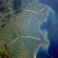
Fitxategi:Godavari satellite view.jpg

Aurreikuspen honen neurria: 600 × 600 pixel. Bestelako bereizmenak: 240 × 240 pixel | 480 × 480 pixel | 768 × 768 pixel | 1.024 × 1.024 pixel | 2.048 × 2.048 pixel | 5.248 × 5.248 pixel.
Bereizmen handikoa ((5.248 × 5.248 pixel, fitxategiaren tamaina: 8,05 MB, MIME mota: image/jpeg))
Fitxategiaren historia
Data/orduan klik egin fitxategiak orduan zuen itxura ikusteko.
| Data/Ordua | Iruditxoa | Neurriak | Erabiltzailea | Iruzkina | |
|---|---|---|---|---|---|
| oraingoa | 21:27, 4 martxoa 2018 |  | 5.248 × 5.248 (8,05 MB) | Ras67 | levels adjusted |
| 21:24, 4 martxoa 2018 |  | 5.248 × 5.248 (8,28 MB) | Ras67 | high resolution | |
| 01:11, 22 urria 2008 |  | 640 × 640 (128 KB) | File Upload Bot (Magnus Manske) | {{BotMoveToCommons|fr.wikipedia}} {{Information |Description={{fr|les deltas de la Godâvarî et de la Krishnâ STS034-077-029 Godavari and Krishna River Deltas, India October 1989 The mouths of the Godavari River (east) and the Krishna River (wes |
Irudira dakarten loturak
Hurrengo orrialdeek dute fitxategi honetarako lotura:
Fitxategiaren erabilera orokorra
Hurrengo beste wikiek fitxategi hau darabilte:
- af.wikipedia.org proiektuan duen erabilera
- ar.wikipedia.org proiektuan duen erabilera
- arz.wikipedia.org proiektuan duen erabilera
- ast.wikipedia.org proiektuan duen erabilera
- az.wikipedia.org proiektuan duen erabilera
- be.wikipedia.org proiektuan duen erabilera
- bh.wikipedia.org proiektuan duen erabilera
- br.wikipedia.org proiektuan duen erabilera
- ca.wikipedia.org proiektuan duen erabilera
- ce.wikipedia.org proiektuan duen erabilera
- cy.wikipedia.org proiektuan duen erabilera
- de.wikivoyage.org proiektuan duen erabilera
- el.wikipedia.org proiektuan duen erabilera
- en.wikipedia.org proiektuan duen erabilera
- en.wiktionary.org proiektuan duen erabilera
- eo.wikipedia.org proiektuan duen erabilera
- es.wikipedia.org proiektuan duen erabilera
- fi.wikipedia.org proiektuan duen erabilera
- fr.wikipedia.org proiektuan duen erabilera
- fr.wikivoyage.org proiektuan duen erabilera
- ga.wikipedia.org proiektuan duen erabilera
- gl.wikipedia.org proiektuan duen erabilera
- ha.wikipedia.org proiektuan duen erabilera
- he.wikipedia.org proiektuan duen erabilera
- hy.wikipedia.org proiektuan duen erabilera
- id.wikipedia.org proiektuan duen erabilera
- it.wikipedia.org proiektuan duen erabilera
- ka.wikipedia.org proiektuan duen erabilera
- mr.wikipedia.org proiektuan duen erabilera
- ne.wikipedia.org proiektuan duen erabilera
- new.wikipedia.org proiektuan duen erabilera
- nn.wikipedia.org proiektuan duen erabilera
- no.wikipedia.org proiektuan duen erabilera
- os.wikipedia.org proiektuan duen erabilera
- pa.wikipedia.org proiektuan duen erabilera
- pl.wikipedia.org proiektuan duen erabilera
- pnb.wikipedia.org proiektuan duen erabilera
- ps.wikipedia.org proiektuan duen erabilera
- pt.wikipedia.org proiektuan duen erabilera
- ru.wikipedia.org proiektuan duen erabilera
Ikus fitxategi honen erabilpen global gehiago.


