
Fitxategi:Ireland location map.svg

SVG fitxategi honen PNG aurreikuspenaren tamaina: 481 × 599 pixel. Bestelako bereizmenak: 192 × 240 pixel | 385 × 480 pixel | 616 × 768 pixel | 822 × 1.024 pixel | 1.643 × 2.048 pixel | 1.450 × 1.807 pixel.
Bereizmen handikoa (SVG fitxategia, nominaldi 1.450 × 1.807 pixel, fitxategiaren tamaina: 938 KB)
Fitxategi hau Wikimedia Commonsekoa da. Hango deskribapen orriko informazioa behean duzu. |
Laburpena
| Deskribapena |
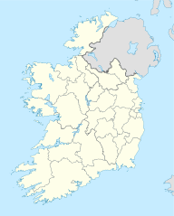
Deutsch: Positionskarte von Irland
Quadratische Plattkarte, N-S-Streckung 170 %. Geographische Begrenzung der Karte:
English: Location map of Ireland
Equirectangular projection, N/S stretching 170 %. Geographic limits of the map:
|
| Data | 01-07-2008 |
| Jatorria | own work, using United States National Imagery and Mapping Agency data |
| Egilea | NordNordWest |
| Beste bertsioak |
DerivativeVersions |


|
This map has been made or improved in the German Kartenwerkstatt (Map Lab). You can propose maps to improve as well.
|
Lizentzia
Nik, lan honen egileak, argitaratzen dut ondorengo lizentzia hauen pean:

|
Baimena duzu dokumentu hau kopiatu, banatu edo/eta aldatzeko GNU Free Documentation License baldintzapean, Free Software Foundationek argitaratutako 1.2 edo ondorengo bertsioan; sekzio aldaezinik gabe, azaleko testurik gabe, eta atzeko azaleko testurik gabe. Lizentziaren kopia dago GNU Free Documentation License izenburudun atalean. |
Fitxategi hau Creative Commons Attribution-Share Alike 3.0 Unported lizentziapean dago.
- Askea zara:
- partekatzeko – lana kopiatzeko, banatzeko eta bidaltzeko
- birnahasteko – lana moldatzeko
- Ondorengo baldintzen pean:
- eskuduntza – Egiletza behar bezala aitortu behar duzu, lizentzia ikusteko esteka gehitu, eta ea aldaketak egin diren aipatu. Era egokian egin behar duzu hori guztia, baina inola ere ez egileak zure lana edo zure erabilera babesten duela irudikatuz.
- berdin partekatu – Lan honetan oinarrituta edo aldatuta berria eraikitzen baduzu, emaitza lana hau bezalako lizentzia batekin argitaratu behar duzu.
Nahiago duzun lizentzia erabil dezakezu.
Fitxategiaren historia
Data/orduan klik egin fitxategiak orduan zuen itxura ikusteko.
| Data/Ordua | Iruditxoa | Neurriak | Erabiltzailea | Iruzkina | |
|---|---|---|---|---|---|
| oraingoa | 08:45, 18 uztaila 2020 | | 1.450 × 1.807 (938 KB) | Chipmunkdavis | Adding toggle to display pre-2014 boundaries, adjusting some code for names and shape |
| 08:47, 11 uztaila 2020 |  | 1.450 × 1.807 (908 KB) | Chipmunkdavis | Overhauling code, together with code from File:Galway City in Ireland.svg (itself derived from this file), to be both simpler and more easily editable. All islands are now grouped with their mainland county, and counties are grouped into provinces. Groups exist for traditional counties where divided. | |
| 14:08, 12 iraila 2014 |  | 1.450 × 1.807 (597 KB) | Ravenpuff | Retry that | |
| 13:57, 12 iraila 2014 |  | 1.450 × 1.807 (597 KB) | Ravenpuff | Merged North Tipperary and South Tiperrary, Limerick and County Limerick, Waterford and County Waterford (Local Government Reform Act 2014) | |
| 20:04, 1 iraila 2009 |  | 1.450 × 1.807 (598 KB) | NordNordWest | ||
| 21:08, 25 abuztua 2008 |  | 1.450 × 1.807 (599 KB) | NordNordWest | size correction | |
| 20:13, 19 uztaila 2008 |  | 483 × 602 (581 KB) | NordNordWest | ||
| 16:13, 1 uztaila 2008 |  | 483 × 602 (554 KB) | NordNordWest | {{Information |Description= {{de|Positionskarte von Irland}} Quadratische Plattkarte, N-S-Streckung 170 %. Geographische Begrenzung der Karte: * N: 55.6° N * S: 51.2° N * W: 11.0° W * O: 5.0° W {{en|Location map of [[:en:Ireland|Ireland |
Irudira dakarten loturak
Hurrengo orrialdeek dute fitxategi honetarako lotura:
Fitxategiaren erabilera orokorra
Hurrengo beste wikiek fitxategi hau darabilte:
- af.wikipedia.org proiektuan duen erabilera
- am.wikipedia.org proiektuan duen erabilera
- ar.wikipedia.org proiektuan duen erabilera
- arz.wikipedia.org proiektuan duen erabilera
- ba.wikipedia.org proiektuan duen erabilera
- be-tarask.wikipedia.org proiektuan duen erabilera
- be.wikipedia.org proiektuan duen erabilera
- bg.wikipedia.org proiektuan duen erabilera
Ikus fitxategi honen erabilpen global gehiago.