
Fitxategi:KhitanAD1000.png
Aurreikuspen honen neurria: 800 × 467 pixel. Bestelako bereizmenak: 320 × 187 pixel | 640 × 373 pixel | 1.024 × 597 pixel | 1.644 × 959 pixel.
Bereizmen handikoa ((1.644 × 959 pixel, fitxategiaren tamaina: 52 KB, MIME mota: image/png))
Fitxategi hau Wikimedia Commonsekoa da. Hango deskribapen orriko informazioa behean duzu. |
Laburpena
| Deskribapena |
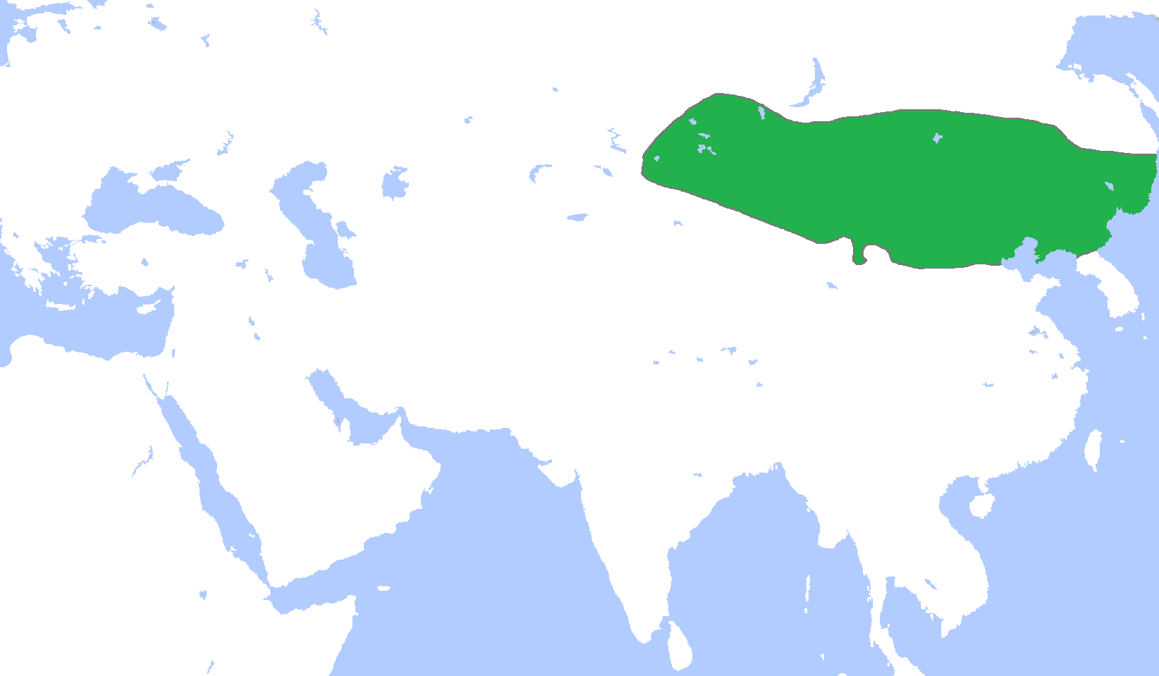
English: Locator map of the Khitan Empire, c. 1000.
(Partially based on Atlas of World History (2007) - The World 750-1000, map) |
| Data | |
| Jatorria | Norberak egina |
| Egilea | Gabagool |
Lizentzia
Nik, lan honen egileak, argitaratzen dut ondorengo lizentzia pean:
Fitxategi hau Creative Commons Aitortu 3.0 Unported lizentziaren mende dago.
- Askea zara:
- partekatzeko – lana kopiatzeko, banatzeko eta bidaltzeko
- birnahasteko – lana moldatzeko
- Ondorengo baldintzen pean:
- eskuduntza – Egiletza behar bezala aitortu behar duzu, lizentzia ikusteko esteka gehitu, eta ea aldaketak egin diren aipatu. Era egokian egin behar duzu hori guztia, baina inola ere ez egileak zure lana edo zure erabilera babesten duela irudikatuz.
Fitxategiaren historia
Data/orduan klik egin fitxategiak orduan zuen itxura ikusteko.
| Data/Ordua | Iruditxoa | Neurriak | Erabiltzailea | Iruzkina | |
|---|---|---|---|---|---|
| oraingoa | 04:28, 19 abendua 2010 | | 1.644 × 959 (52 KB) | Tm | Reverted to version as of 16:02, 18 December 2010 |
| 02:12, 19 abendua 2010 |  | 1.644 × 959 (52 KB) | Historiographer~commonswiki | See en:Goryeo–Khitan Wars. | |
| 18:02, 18 abendua 2010 |  | 1.644 × 959 (52 KB) | Tm | Reverted to version as of 01:59, 18 December 2010 (please see the warning in Category:Maps_of_Korea) | |
| 11:09, 18 abendua 2010 |  | 1.644 × 959 (52 KB) | Garam | Stop it. Goryeo of territory is Aprok river. Please, you can ref to wikipedia. | |
| 03:59, 18 abendua 2010 |  | 1.644 × 959 (52 KB) | Tm | Reverted to version as of 00:35, 18 December 2010 | |
| 02:36, 18 abendua 2010 |  | 1.644 × 959 (52 KB) | Historiographer~commonswiki | Reverted to version as of 00:34, 18 December 2010 | |
| 02:35, 18 abendua 2010 |  | 1.644 × 959 (52 KB) | Evawen | Reverted to version as of 18:29, 17 December 2010 | |
| 02:34, 18 abendua 2010 |  | 1.644 × 959 (52 KB) | Historiographer~commonswiki | These territory was called as a Six garrison (강동6주). You really think I'm that nationalistic? It is fact. | |
| 20:29, 17 abendua 2010 |  | 1.644 × 959 (52 KB) | Tm | Reverted to version as of 19:25, 16 December 2010 (please stop this nationalistic POV pushing) | |
| 04:11, 17 abendua 2010 |  | 1.644 × 959 (52 KB) | Historiographer~commonswiki | Reverted to version as of 06:10, 16 December 2010 |
Irudira dakarten loturak
Hurrengo orrialdeek dute fitxategi honetarako lotura:
Fitxategiaren erabilera orokorra
Hurrengo beste wikiek fitxategi hau darabilte:
- af.wikipedia.org proiektuan duen erabilera
- an.wikipedia.org proiektuan duen erabilera
- ar.wikipedia.org proiektuan duen erabilera
- ast.wikipedia.org proiektuan duen erabilera
- be.wikipedia.org proiektuan duen erabilera
- bg.wikipedia.org proiektuan duen erabilera
- cdo.wikipedia.org proiektuan duen erabilera
- ce.wikipedia.org proiektuan duen erabilera
- ckb.wikipedia.org proiektuan duen erabilera
- cs.wikipedia.org proiektuan duen erabilera
- en.wikipedia.org proiektuan duen erabilera
- es.wikipedia.org proiektuan duen erabilera
- fa.wikipedia.org proiektuan duen erabilera
- fr.wikipedia.org proiektuan duen erabilera
- fr.wiktionary.org proiektuan duen erabilera
- id.wikipedia.org proiektuan duen erabilera
- ja.wikipedia.org proiektuan duen erabilera
- ka.wikipedia.org proiektuan duen erabilera
- kk.wikipedia.org proiektuan duen erabilera
- km.wikipedia.org proiektuan duen erabilera
- min.wikipedia.org proiektuan duen erabilera
- mk.wikipedia.org proiektuan duen erabilera
- mn.wikipedia.org proiektuan duen erabilera
- ms.wikipedia.org proiektuan duen erabilera
- mt.wikipedia.org proiektuan duen erabilera
- nl.wikipedia.org proiektuan duen erabilera
- no.wikipedia.org proiektuan duen erabilera
- oc.wikipedia.org proiektuan duen erabilera
Ikus fitxategi honen erabilpen global gehiago.