
Fitxategi:Location map of AegeanIslands (Greece).svg

SVG fitxategi honen PNG aurreikuspenaren tamaina: 693 × 599 pixel. Bestelako bereizmenak: 278 × 240 pixel | 555 × 480 pixel | 888 × 768 pixel | 1.184 × 1.024 pixel | 2.369 × 2.048 pixel | 8.460 × 7.315 pixel.
Bereizmen handikoa (SVG fitxategia, nominaldi 8.460 × 7.315 pixel, fitxategiaren tamaina: 1,87 MB)
Fitxategi hau Wikimedia Commonsekoa da. Hango deskribapen orriko informazioa behean duzu. |
.svg)
Laburpena
| Deskribapena |
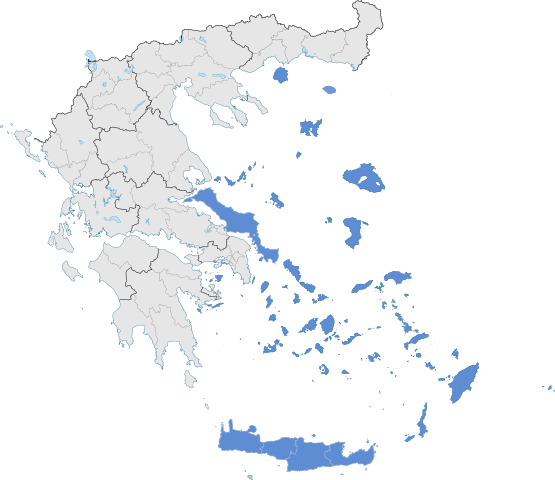
English: The location of Greek Aegean Islands within Greece. |
| Data | |
| Jatorria | Norberak egina |
| Egilea | SilentResident,Philly boy92 |
Lizentzia
Nik, lan honen egileak, argitaratzen dut ondorengo lizentzia pean:
Fitxategi hau Creative Commons Attribution-Share Alike 3.0 Unported lizentziapean dago.
- Askea zara:
- partekatzeko – lana kopiatzeko, banatzeko eta bidaltzeko
- birnahasteko – lana moldatzeko
- Ondorengo baldintzen pean:
- eskuduntza – Egiletza behar bezala aitortu behar duzu, lizentzia ikusteko esteka gehitu, eta ea aldaketak egin diren aipatu. Era egokian egin behar duzu hori guztia, baina inola ere ez egileak zure lana edo zure erabilera babesten duela irudikatuz.
- berdin partekatu – Lan honetan oinarrituta edo aldatuta berria eraikitzen baduzu, emaitza lana hau bezalako lizentzia batekin argitaratu behar duzu.
Fitxategiaren historia
Data/orduan klik egin fitxategiak orduan zuen itxura ikusteko.
| Data/Ordua | Iruditxoa | Neurriak | Erabiltzailea | Iruzkina | |
|---|---|---|---|---|---|
| oraingoa | 08:10, 18 uztaila 2021 | | 8.460 × 7.315 (1,87 MB) | SilentResident | Correcting Euboea and Crete, which for some strange reason I missed marking them as Aegean Islands even though they are. |
| 05:22, 21 abuztua 2018 |  | 8.460 × 7.315 (1,83 MB) | SilentResident | Reverted to version as of 17:09, 17 January 2015 (UTC) The islands are part of geographical Aegean Sea nevertheless. | |
| 13:28, 25 martxoa 2016 |  | 8.460 × 7.315 (1,37 MB) | Nikospag | Thasos and Sporades are not part of Aegean Islands region | |
| 19:09, 17 urtarrila 2015 |  | 8.460 × 7.315 (1,83 MB) | SilentResident | {{Information |Description ={{en|1=The location of Greek Aegean Islands within Greece.}} |Source ={{own}} |Author =SilentResident,Philly boy92 |Date =2014-01-17 |Permission... |
Irudira dakarten loturak
Hurrengo orrialdeek dute fitxategi honetarako lotura:
Fitxategiaren erabilera orokorra
Hurrengo beste wikiek fitxategi hau darabilte:
- ar.wikipedia.org proiektuan duen erabilera
- el.wikipedia.org proiektuan duen erabilera
- en.wikipedia.org proiektuan duen erabilera
- fi.wikipedia.org proiektuan duen erabilera
- fr.wikipedia.org proiektuan duen erabilera
- hyw.wikipedia.org proiektuan duen erabilera
- ml.wikipedia.org proiektuan duen erabilera
- sr.wikipedia.org proiektuan duen erabilera
- ta.wikipedia.org proiektuan duen erabilera
- th.wikipedia.org proiektuan duen erabilera
- www.wikidata.org proiektuan duen erabilera
.svg)