
Fitxategi:Sunda strait map v3.png
Ez dago bereizmen handiagorik.
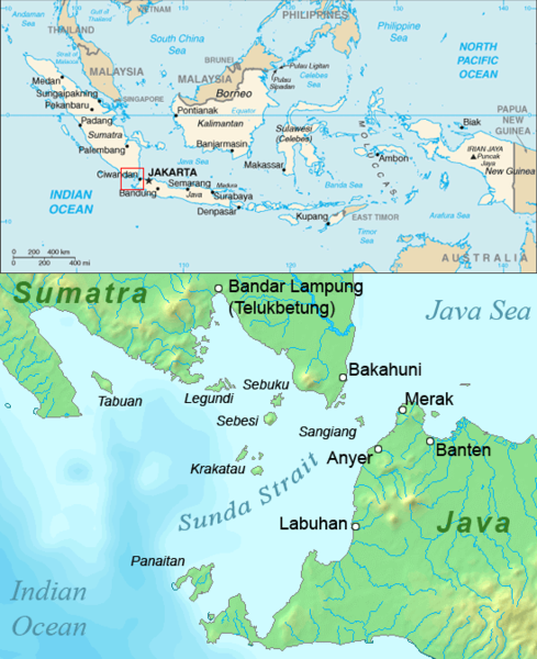
Sunda_strait_map_v3.png ((489 × 600 pixel, fitxategiaren tamaina: 310 KB, MIME mota: image/png))
Fitxategi hau Wikimedia Commonsekoa da. Hango deskribapen orriko informazioa behean duzu. |
Laburpena
| Deskribapena |
English: Map of the Sunda Strait, Indonesia. |
|||||||
| Data | ||||||||
| Jatorria | Combination of CIA World Factbook map and Demis Map Server (http://www2.demis.nl/mapserver/mapper.asp) data with additional annotations and modifications by self. | |||||||
| Egilea | ChrisO | |||||||
| Lizentzia (Fitxategi hau berrerabiltzen) |
|
|||||||
| Beste bertsioak | lower part (demis map) only: File:Sunda strait map v4.png |

Fitxategiaren historia
Data/orduan klik egin fitxategiak orduan zuen itxura ikusteko.
| Data/Ordua | Iruditxoa | Neurriak | Erabiltzailea | Iruzkina | |
|---|---|---|---|---|---|
| oraingoa | 12:39, 2 abendua 2006 | | 489 × 600 (310 KB) | Burgundo | Caricato da en.wiki |
Irudira dakarten loturak
Ez dago fitxategi hau darabilen orririk.
Fitxategiaren erabilera orokorra
Hurrengo beste wikiek fitxategi hau darabilte:
- ar.wikipedia.org proiektuan duen erabilera
- ast.wikipedia.org proiektuan duen erabilera
- ban.wikipedia.org proiektuan duen erabilera
- ba.wikipedia.org proiektuan duen erabilera
- bcl.wikipedia.org proiektuan duen erabilera
- bg.wikipedia.org proiektuan duen erabilera
- br.wikipedia.org proiektuan duen erabilera
- ca.wikipedia.org proiektuan duen erabilera
- cs.wikipedia.org proiektuan duen erabilera
- da.wikipedia.org proiektuan duen erabilera
- el.wikipedia.org proiektuan duen erabilera
- en.wikipedia.org proiektuan duen erabilera
- en.wikinews.org proiektuan duen erabilera
- es.wikipedia.org proiektuan duen erabilera
- fa.wikipedia.org proiektuan duen erabilera
- fr.wikipedia.org proiektuan duen erabilera
- fy.wikipedia.org proiektuan duen erabilera
- gl.wikipedia.org proiektuan duen erabilera
- hak.wikipedia.org proiektuan duen erabilera
- hi.wikipedia.org proiektuan duen erabilera
- hu.wikipedia.org proiektuan duen erabilera
- hy.wikipedia.org proiektuan duen erabilera
- id.wikipedia.org proiektuan duen erabilera
- incubator.wikimedia.org proiektuan duen erabilera
- it.wikipedia.org proiektuan duen erabilera
- ja.wikipedia.org proiektuan duen erabilera
Ikus fitxategi honen erabilpen global gehiago.