
Fitxategi:Belgium location map.svg

SVG fitxategi honen PNG aurreikuspenaren tamaina: 689 × 599 pixel. Bestelako bereizmenak: 276 × 240 pixel | 552 × 480 pixel | 883 × 768 pixel | 1.177 × 1.024 pixel | 2.355 × 2.048 pixel | 1.136 × 988 pixel.
Bereizmen handikoa (SVG fitxategia, nominaldi 1.136 × 988 pixel, fitxategiaren tamaina: 120 KB)
Fitxategi hau Wikimedia Commonsekoa da. Hango deskribapen orriko informazioa behean duzu. |
Laburpena
| Deskribapena |
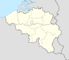
Deutsch: Positionskarte von Belgien
Quadratische Plattkarte, N-S-Streckung 157,218 %. Geographische Begrenzung der Karte:
English: Location map of Belgium
Equirectangular projection, N/S stretching 157.218 %. Geographic limits of the map:
|
||
| Data | |||
| Jatorria | Norberak egina (Original text: own work, using United States National Imagery and Mapping Agency data) | ||
| Egilea | NordNordWest | ||
| Beste bertsioak |
Derivative works of this file: |
||
| SVG genesis | Fitxategi hau (bektore-irudia) hau Adobe Illustrator-ekin sortu da NordNordWest-rako.
|


_location.svg)
_location.svg)
_location.svg)
_location.svg)
Lizentzia
Nik, lan honen egileak, argitaratzen dut ondorengo lizentzia hauen pean:

|
Baimena duzu dokumentu hau kopiatu, banatu edo/eta aldatzeko GNU Free Documentation License baldintzapean, Free Software Foundationek argitaratutako 1.2 edo ondorengo bertsioan; sekzio aldaezinik gabe, azaleko testurik gabe, eta atzeko azaleko testurik gabe. Lizentziaren kopia dago GNU Free Documentation License izenburudun atalean. |
Fitxategi hau Creative Commons Attribution-Share Alike 3.0 Unported lizentziapean dago.
- Askea zara:
- partekatzeko – lana kopiatzeko, banatzeko eta bidaltzeko
- birnahasteko – lana moldatzeko
- Ondorengo baldintzen pean:
- eskuduntza – Egiletza behar bezala aitortu behar duzu, lizentzia ikusteko esteka gehitu, eta ea aldaketak egin diren aipatu. Era egokian egin behar duzu hori guztia, baina inola ere ez egileak zure lana edo zure erabilera babesten duela irudikatuz.
- berdin partekatu – Lan honetan oinarrituta edo aldatuta berria eraikitzen baduzu, emaitza lana hau bezalako lizentzia batekin argitaratu behar duzu.
Nahiago duzun lizentzia erabil dezakezu.
Fitxategiaren historia
Data/orduan klik egin fitxategiak orduan zuen itxura ikusteko.
| Data/Ordua | Iruditxoa | Neurriak | Erabiltzailea | Iruzkina | |
|---|---|---|---|---|---|
| oraingoa | 20:26, 23 iraila 2010 | | 1.136 × 988 (120 KB) | NordNordWest | upd |
| 20:42, 25 abuztua 2008 |  | 1.136 × 945 (159 KB) | NordNordWest | size correction | |
| 21:01, 9 uztaila 2008 |  | 379 × 315 (156 KB) | NordNordWest | {{Information |Description= {{de|Positionskarte von Belgien}} Quadratische Plattkarte, N-S-Streckung 150 %. Geographische Begrenzung der Karte: * N: 51.8° N * S: 49.2° N * W: 2.2° O * O: 6.9° O {{en|Location map of [[:en:Belgium|Belgiu |
Irudira dakarten loturak
Hurrengo orrialdeek dute fitxategi honetarako lotura:
Fitxategiaren erabilera orokorra
Hurrengo beste wikiek fitxategi hau darabilte:
- ar.wikipedia.org proiektuan duen erabilera
- av.wikipedia.org proiektuan duen erabilera
- azb.wikipedia.org proiektuan duen erabilera
- ban.wikipedia.org proiektuan duen erabilera
- be.wikimedia.org proiektuan duen erabilera
- Wiki Loves Monuments/website/Photo tour 28 September 2014/lb
- Wiki Loves Monuments/website/Photo tour 28 September 2014/fr
- Wiki Loves Monuments/website/Photo tour 28 September 2014/de
- Wiki Loves Monuments/website/Photo tour 28 September 2014/nl
- Wiki Loves Monuments/website/Photo tour 28 September 2014
- Uitnodiging voor de fototocht Wiki Takes... Leuven op 28 september 2014
- Invitation to the photo tour Wiki Takes... Leuven on 28 September 2014
- Invitation balade photographique Wiki Takes... Louvain, le 28 Septembre 2014
- bn.wikipedia.org proiektuan duen erabilera
- bs.wikipedia.org proiektuan duen erabilera
- ca.wikipedia.org proiektuan duen erabilera
- ceb.wikipedia.org proiektuan duen erabilera
Ikus fitxategi honen erabilpen global gehiago.