
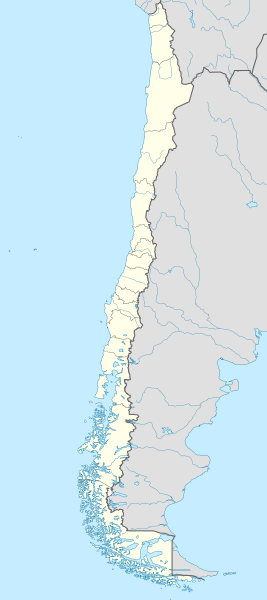
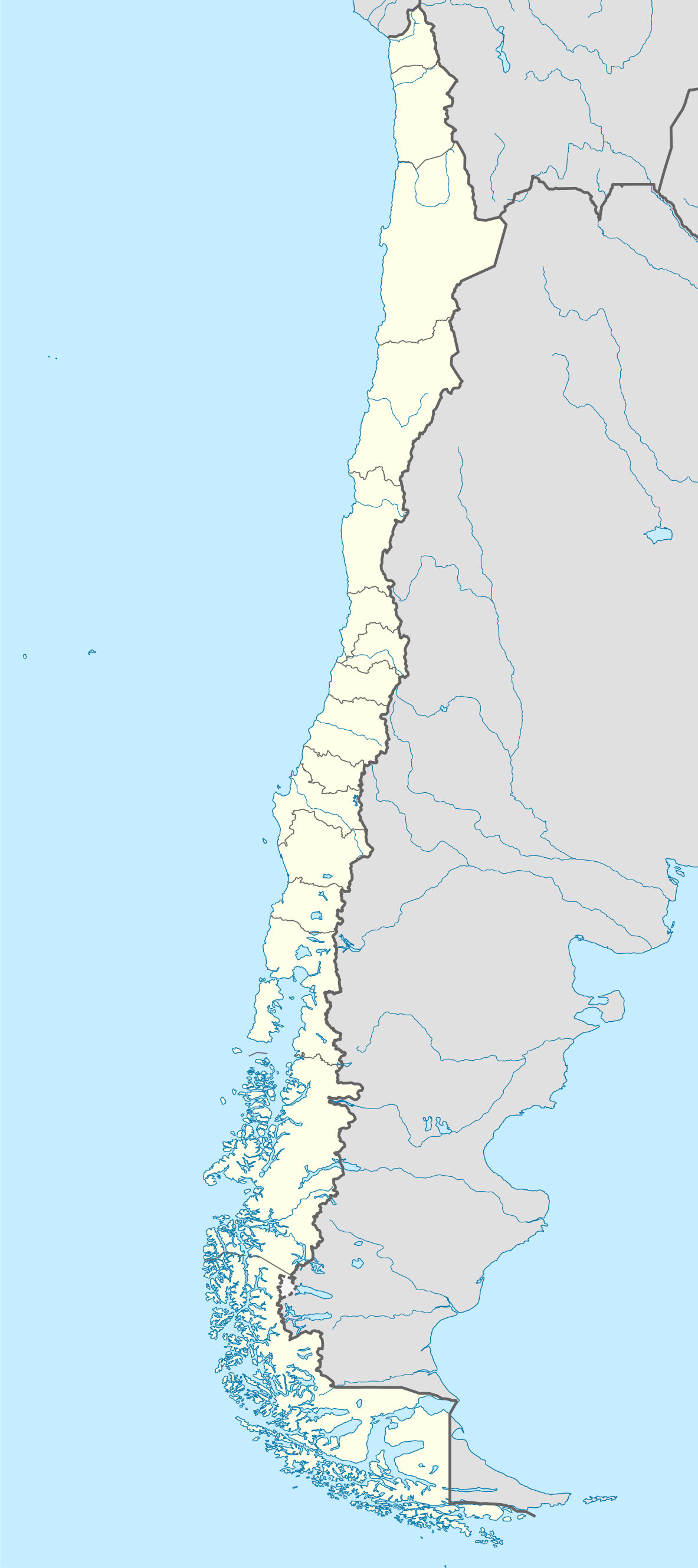
Fitxategi:Chile location map.svg

Bereizmen handikoa (SVG fitxategia, nominaldi 1.183 × 2.658 pixel, fitxategiaren tamaina: 925 KB)
Fitxategi hau Wikimedia Commonsekoa da. Hango deskribapen orriko informazioa behean duzu. |
Laburpena
| Deskribapena |
Deutsch: Positionskarte von Chile
Quadratische Plattkarte, N-S-Streckung 115 %. Geographische Begrenzung der Karte:
English: Location map of Chile
Equirectangular projection, N/S stretching 115 %. Geographic limits of the map:
Español: Mapa de localización de Chile
Proyección Equirectangular, N/S con una extensión de 115 %. Límites geográficos del mapa:
|
| Data | |
| Jatorria |
own work, using
|
| Egilea | NordNordWest |
| Beste bertsioak |
Derivative works of this file:
|
.svg)
.svg)
.svg)
.svg)

|
This map has been made or improved in the German Kartenwerkstatt (Map Lab). You can propose maps to improve as well.
|
Lizentzia

|
Baimena duzu dokumentu hau kopiatu, banatu edo/eta aldatzeko GNU Free Documentation License baldintzapean, Free Software Foundationek argitaratutako 1.2 edo ondorengo bertsioan; sekzio aldaezinik gabe, azaleko testurik gabe, eta atzeko azaleko testurik gabe. Lizentziaren kopia dago GNU Free Documentation License izenburudun atalean. |
- Askea zara:
- partekatzeko – lana kopiatzeko, banatzeko eta bidaltzeko
- birnahasteko – lana moldatzeko
- Ondorengo baldintzen pean:
- eskuduntza – Egiletza behar bezala aitortu behar duzu, lizentzia ikusteko esteka gehitu, eta ea aldaketak egin diren aipatu. Era egokian egin behar duzu hori guztia, baina inola ere ez egileak zure lana edo zure erabilera babesten duela irudikatuz.
- berdin partekatu – Lan honetan oinarrituta edo aldatuta berria eraikitzen baduzu, emaitza lana hau bezalako lizentzia batekin argitaratu behar duzu.
Fitxategiaren historia
Data/orduan klik egin fitxategiak orduan zuen itxura ikusteko.
| Data/Ordua | Iruditxoa | Neurriak | Erabiltzailea | Iruzkina | |
|---|---|---|---|---|---|
| oraingoa | 00:46, 16 abuztua 2023 | | 1.183 × 2.658 (925 KB) | Janitoalevic | Fixed Aysén & Magallanes and Chilean Antarctica Regions border. |
| 00:54, 6 iraila 2018 |  | 1.183 × 2.658 (925 KB) | Janitoalevic | Ñuble Region | |
| 22:30, 3 abendua 2017 |  | 1.183 × 2.658 (921 KB) | Janitoalevic | color error. | |
| 22:28, 3 abendua 2017 |  | 1.183 × 2.658 (921 KB) | Janitoalevic | Fixed Argentina's Lake Nahuel Huapi | |
| 22:25, 3 abendua 2017 |  | 1.183 × 2.658 (920 KB) | Janitoalevic | . | |
| 23:50, 2 abendua 2017 |  | 1.183 × 2.658 (920 KB) | Janitoalevic | Fixed Argentina-Bolivia border | |
| 23:46, 2 abendua 2017 |  | 1.183 × 2.658 (920 KB) | Janitoalevic | . | |
| 02:42, 30 abuztua 2017 |  | 1.183 × 2.658 (919 KB) | Janitoalevic | Fixed size | |
| 01:30, 21 abuztua 2017 |  | 1.262 × 2.835 (910 KB) | Janitoalevic | Removed Ñuble Region (Will be fully implemented in 2018) | |
| 03:00, 20 abuztua 2017 |  | 1.262 × 2.835 (914 KB) | Janitoalevic | Added Ñuble Region & more precise borders |
Irudira dakarten loturak
Hurrengo orrialdeek dute fitxategi honetarako lotura:
- 1962ko Munduko Futbol Txapelketa
- Chiloé uhartedia
- Cochrane aintzira erreserba nazionala
- Conguillío Parke Nazionala
- Corcovado parke nazionala (Txile)
- El Morado natura monumentua
- Islotes de Puñihuil natura monumentua
- Kawésqar parke nazionala
- Laguna San Rafael Parke Nazionala
- Lauca Parke Nazionala
- Los Cipreses ibaiaren erreserba nazionala
- Los Flamencos erreserba nazionala
- Nahuelbuta Parke Nazionala
- Patagonia parke nazionala (Txile)
- Torres del Paine parke nazionala
- Villarrica parke nazionala
- Txantiloi:Kokapen mapa/Txile
Fitxategiaren erabilera orokorra
Hurrengo beste wikiek fitxategi hau darabilte:
- af.wikipedia.org proiektuan duen erabilera
- Antofagasta
- Pichilemu
- FIFA Sokker-Wêreldbekertoernooi in 1962
- Chillán
- Los Ángeles (Chili)
- Talcahuano
- Quinta Normal
- Temuco
- Puerto Montt
- Punta Arenas
- Coyhaique
- Valdivia
- Castro (Chili)
- San Pedro de la Paz
- Villa Alemana
- Sjabloon:Liggingkaart Chili
- Penco
- Hualpén
- Chiguayante
- Hualqui
- Coronel (Chili)
- Lota
- Tomé
- La Serena
- Arica
- Monte Águila (Chili)
- Arturo Merino Benítez Internasionale Lughawe
- als.wikipedia.org proiektuan duen erabilera
- an.wikipedia.org proiektuan duen erabilera
Ikus fitxategi honen erabilpen global gehiago.