
Fitxategi:France departments 1791 (1).jpg

Bereizmen handikoa ((1.635 × 1.303 pixel, fitxategiaren tamaina: 895 KB, MIME mota: image/jpeg))
Fitxategi hau Wikimedia Commonsekoa da. Hango deskribapen orriko informazioa behean duzu. |
.jpg)
| Deskribapena |
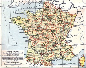
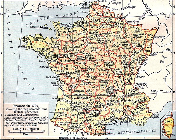
Français : Carte de la France en 1791 (départements et anciennes provinces - en rouge) in The Historical Atlas by William R. Shepherd, 1926
Lëtzebuergesch: Departementer vu Frankräich am Joer 1791. |
| Data | 2006ko martxoaren 11 (Jatorrizko igoera-data) |
| Jatorria | Transferred from fr.wikipedia to Commons by Korrigan using CommonsHelper. |
| Egilea | The original uploader was Tournachon at frantsesa Wikipedia. |
| Beste bertsioak | Derivative works of this file: Départements et provinces de France.png |
Lizentzia
|
Lan hau jabetza publikoan dago bai bere jatorrizko herrialdean, bai egile eskubideak egilea hil eta 70 urtera edo gutxiagora iraungitzen diren gainerako herrialdeetan.
| |
| This file has been identified as being free of known restrictions under copyright law, including all related and neighboring rights. | |
Jatorrizko igoera erregistroa
- 2006-03-11 14:51 Tournachon 741×599×??? (225908 bytes)
Fitxategiaren historia
Data/orduan klik egin fitxategiak orduan zuen itxura ikusteko.
| Data/Ordua | Iruditxoa | Neurriak | Erabiltzailea | Iruzkina | |
|---|---|---|---|---|---|
| oraingoa | 16:31, 22 uztaila 2022 | | 1.635 × 1.303 (895 KB) | Hohum | Clearer version |
| 00:43, 25 urtarrila 2012 |  | 741 × 599 (634 KB) | MarcusBritish | Lower red tint. | |
| 00:41, 25 urtarrila 2012 |  | 741 × 599 (622 KB) | MarcusBritish | Improve tones/colour/contrast. | |
| 10:46, 22 iraila 2008 |  | 741 × 599 (221 KB) | File Upload Bot (Magnus Manske) | {{BotMoveToCommons|fr.wikipedia}} {{Information |Description={{fr|Carte de la France en 1791 (départements et anciennes provinces - en rouge) in The Historical Atlas by William R. Shepherd, 1926 == Licence == [[:fr:Catégorie:Cartes Histoire de Fr |
Irudira dakarten loturak
Hurrengo orrialdeek dute fitxategi honetarako lotura:
Fitxategiaren erabilera orokorra
Hurrengo beste wikiek fitxategi hau darabilte:
- als.wikipedia.org proiektuan duen erabilera
- br.wikipedia.org proiektuan duen erabilera
- de.wikipedia.org proiektuan duen erabilera
- el.wikipedia.org proiektuan duen erabilera
- eo.wikipedia.org proiektuan duen erabilera
- es.wikipedia.org proiektuan duen erabilera
- fi.wikipedia.org proiektuan duen erabilera
- fr.wikipedia.org proiektuan duen erabilera
- hu.wikipedia.org proiektuan duen erabilera
- lb.wikipedia.org proiektuan duen erabilera
- lv.wikipedia.org proiektuan duen erabilera
- mt.wikipedia.org proiektuan duen erabilera
- nn.wikipedia.org proiektuan duen erabilera
- oc.wikipedia.org proiektuan duen erabilera
- pl.wikipedia.org proiektuan duen erabilera
.jpg)