
Fitxategi:Historisch Nordamerika.jpg
Bereizmen handikoa ((2.560 × 2.100 pixel, fitxategiaren tamaina: 6,03 MB, MIME mota: image/jpeg))
Fitxategi hau Wikimedia Commonsekoa da. Hango deskribapen orriko informazioa behean duzu. |
Laburpena
| Deskribapena |
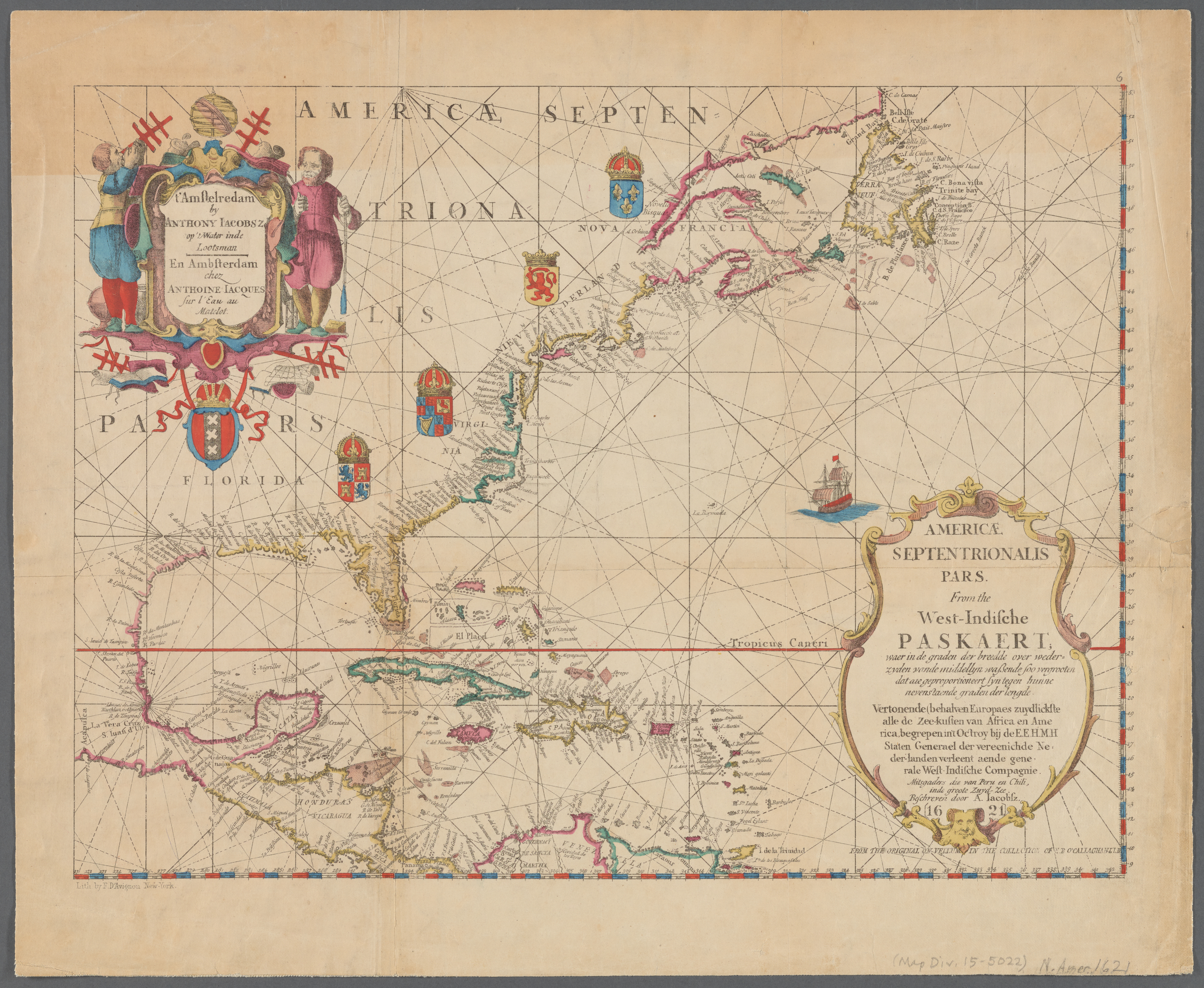
English: Old map of North America, the Caribbean, and northern South America; covers area north from Venezuela to Labrador; includes decorative cartouches and illustrations. This is a facsimile, from the original on vellum in the collection of E.B. O'Callaghan LLD.
|
||
| Data | |||
| Jatorria |
|
||
| Egilea |
Anthoni Jacobsz (1594-1624), cartographer Francis D'Avignon (1813–1875), lithographer E.B. (Edmund Bailey) O'Callaghan (1797–1880), collector |
||
| Beste bertsioak |
|
.jpg)

.jpg)
Lizentzia
|
Lan hau jabetza publikoan dago bai bere jatorrizko herrialdean, bai egile eskubideak egilea hil eta 100 urtera edo gutxiagora iraungitzen diren gainerako herrialdeetan. This work is in the public domain in the United States because it was published (or registered with the U.S. Copyright Office) before January 1, 1929. | |
| This file has been identified as being free of known restrictions under copyright law, including all related and neighboring rights. | |
Fitxategiaren historia
Data/orduan klik egin fitxategiak orduan zuen itxura ikusteko.
| Data/Ordua | Iruditxoa | Neurriak | Erabiltzailea | Iruzkina | |
|---|---|---|---|---|---|
| oraingoa | 01:55, 11 urtarrila 2021 | | 2.560 × 2.100 (6,03 MB) | Vzeebjtf | larger, higher resolution |
| 23:43, 13 iraila 2013 |  | 400 × 314 (83 KB) | Gladiool | Same image, higher quality. | |
| 22:14, 2 urria 2005 |  | 382 × 269 (38 KB) | Newsflash | 16 or 17 century old map |
Irudira dakarten loturak
Ez dago fitxategi hau darabilen orririk.
Fitxategiaren erabilera orokorra
Hurrengo beste wikiek fitxategi hau darabilte:
- bn.wikipedia.org proiektuan duen erabilera
- ka.wikipedia.org proiektuan duen erabilera
- km.wikipedia.org proiektuan duen erabilera