Fitxategi:Serbia Kossovo map.png

Orriaren edukia ez da onartzen beste hizkuntza batzuetan.
Wikipedia, Entziklopedia askea

Serbia_Kossovo_map.png((325 × 349 pixel, fitxategiaren tamaina: 15 KB, MIME mota: image/png))

Fitxategi hau Wikimedia Commonsekoa da. Hango deskribapen orriko informazioa behean duzu.
Commons gordailu bat da, lizentzia askea duten multimedia fitxategiena. Lagun dezakezu.

Fitxategi hau Wikimedia Commonsekoa da

Laburpena

Deskribapena
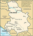
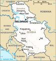
English: Serbia map with Kosovo recolored.
Data
Jatorria
image extraction process
Irudi hori ondorengo honetatik atera da
: 2006 Serbia-CIA WFB Map.png
original file
Egilea Bramfab (talk)
Beste bertsioak

[aldatu]

Lizentzia

Public domain
This image is in the public domain because it contains materials that originally came from the United States Central Intelligence Agency's World Factbook.

Bahasa Indonesia  čeština  Deutsch  eesti  English  español  Esperanto  français  galego  hrvatski  italiano  Nederlands  norsk nynorsk  polski  português  sicilianu  slovenščina  suomi  Türkçe  Zazaki  беларуская (тарашкевіца)  македонски  русский  српски / srpski  українська  ქართული  বাংলা  தமிழ்  മലയാളം  한국어  日本語  中文  中文(简体)  中文(繁體)  العربية  +/−


Jatorrizko igoera erregistroa

This image is a derivative work of the following images:

  • File:2006_Serbia-CIA_WFB_Map.png licensed with PD-USGov-CIA-WF
    • 2009-06-20T09:17:47Z Mike Babic 328x352 (24801 Bytes) {{Information |Description=CIA World Factbook map from 2006. It shows Kosovo as an autonomous province of Serbia. Kosovo declared itself independence on February 17, 2008. This is recognized by the United States and some o
    • 2008-03-25T13:27:11Z Superm401 328x352 (15946 Bytes) {{Information |Description=CIA World Factbook map from 2006. It shows Serbia as an autonomous province of Serbia. Kosovo declared itself independence on February 17, 2008. This is recognized by the United States and some o

Uploaded with derivativeFX

Irudi-oineko testuak

Add a one-line explanation of what this file represents

Fitxategi honetan agertzen diren itemak

honako hau irudikatzen du

1 abendua 2011

media type ingelesa

image/png

Fitxategiaren historia

Data/orduan klik egin fitxategiak orduan zuen itxura ikusteko.

Data/OrduaIruditxoaNeurriakErabiltzaileaIruzkina
oraingoa09:35, 19 otsaila 202209:35, 19 otsaila 2022 bertsioaren iruditxoa325 × 349 (15 KB)LojweCropped 1 % horizontally, 1 % vertically using CropTool with precise mode.
10:50, 1 abendua 201110:50, 1 abendua 2011 bertsioaren iruditxoa328 × 352 (46 KB)Bramfab== {{int:filedesc}} == {{Information |Description=recolor from CIA World Factbook map from 2006. It shows Kosovo . Kosovo declared itself independence on February 17, 2008. This is recognized by the United States and some other nations. The most rece

Hurrengo orrialdeek dute fitxategi honetarako lotura:

Fitxategiaren erabilera orokorra

Hurrengo beste wikiek fitxategi hau darabilte:

Metadatuak