
Fitxategi:Barahona 71.16445W 18.21020N.jpg

Aurreikuspen honen neurria: 449 × 600 pixel. Bestelako bereizmenak: 179 × 240 pixel | 359 × 480 pixel | 958 × 1.280 pixel.
Bereizmen handikoa ((958 × 1.280 pixel, fitxategiaren tamaina: 223 KB, MIME mota: image/jpeg))
Fitxategi hau Wikimedia Commonsekoa da. Hango deskribapen orriko informazioa behean duzu. |
Laburpena
| Deskribapena | |
| Data | 2005ko maiatzaren 15a (Jatorrizko igoera-data) |
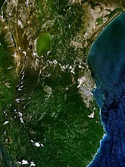
| Jatorria | NASA World Wind screenshot. |
| Egilea | NASA World Wind screenshot. |
| This image is in the public domain because it is a screenshot from NASA’s globe software World Wind using a public domain layer, such as Blue Marble, MODIS, Landsat, SRTM, USGS or GLOBE.
|
 |
Fitxategiaren historia
Data/orduan klik egin fitxategiak orduan zuen itxura ikusteko.
| Data/Ordua | Iruditxoa | Neurriak | Erabiltzailea | Iruzkina | |
|---|---|---|---|---|---|
| oraingoa | 02:01, 22 abuztua 2016 | | 958 × 1.280 (223 KB) | SteinsplitterBot | Bot: Image rotated by 270° |
| 01:14, 16 maiatza 2005 |  | 1.280 × 958 (222 KB) | Rex | NASA World Wind screenshot. {{PD-USGov-NASA}} Category:Maps of the Dominican Republic |
Irudira dakarten loturak
Hurrengo orrialdeek dute fitxategi honetarako lotura:
Fitxategiaren erabilera orokorra
Hurrengo beste wikiek fitxategi hau darabilte:
- ar.wikipedia.org proiektuan duen erabilera
- arz.wikipedia.org proiektuan duen erabilera
- ca.wikipedia.org proiektuan duen erabilera
- ceb.wikipedia.org proiektuan duen erabilera
- de.wikivoyage.org proiektuan duen erabilera
- en.wikipedia.org proiektuan duen erabilera
- en.wikivoyage.org proiektuan duen erabilera
- es.wikipedia.org proiektuan duen erabilera
- fa.wikipedia.org proiektuan duen erabilera
- fr.wikipedia.org proiektuan duen erabilera
- it.wikipedia.org proiektuan duen erabilera
- ko.wikipedia.org proiektuan duen erabilera
- mt.wikipedia.org proiektuan duen erabilera
- pl.wikipedia.org proiektuan duen erabilera
- ru.wikipedia.org proiektuan duen erabilera
- simple.wikipedia.org proiektuan duen erabilera
- sv.wikipedia.org proiektuan duen erabilera
- uk.wikipedia.org proiektuan duen erabilera
- ur.wikipedia.org proiektuan duen erabilera
- www.wikidata.org proiektuan duen erabilera
- zh.wikipedia.org proiektuan duen erabilera