
Fitxategi:Dinaric Alps map-fr.svg

Bereizmen handikoa (SVG fitxategia, nominaldi 1.857 × 1.503 pixel, fitxategiaren tamaina: 3,63 MB)
Fitxategi hau Wikimedia Commonsekoa da. Hango deskribapen orriko informazioa behean duzu. |
Laburpena
| Deskribapena |
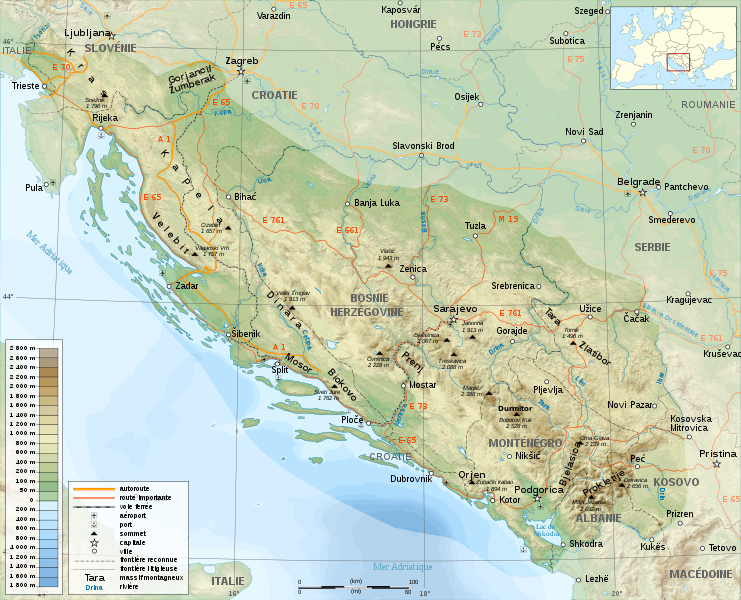
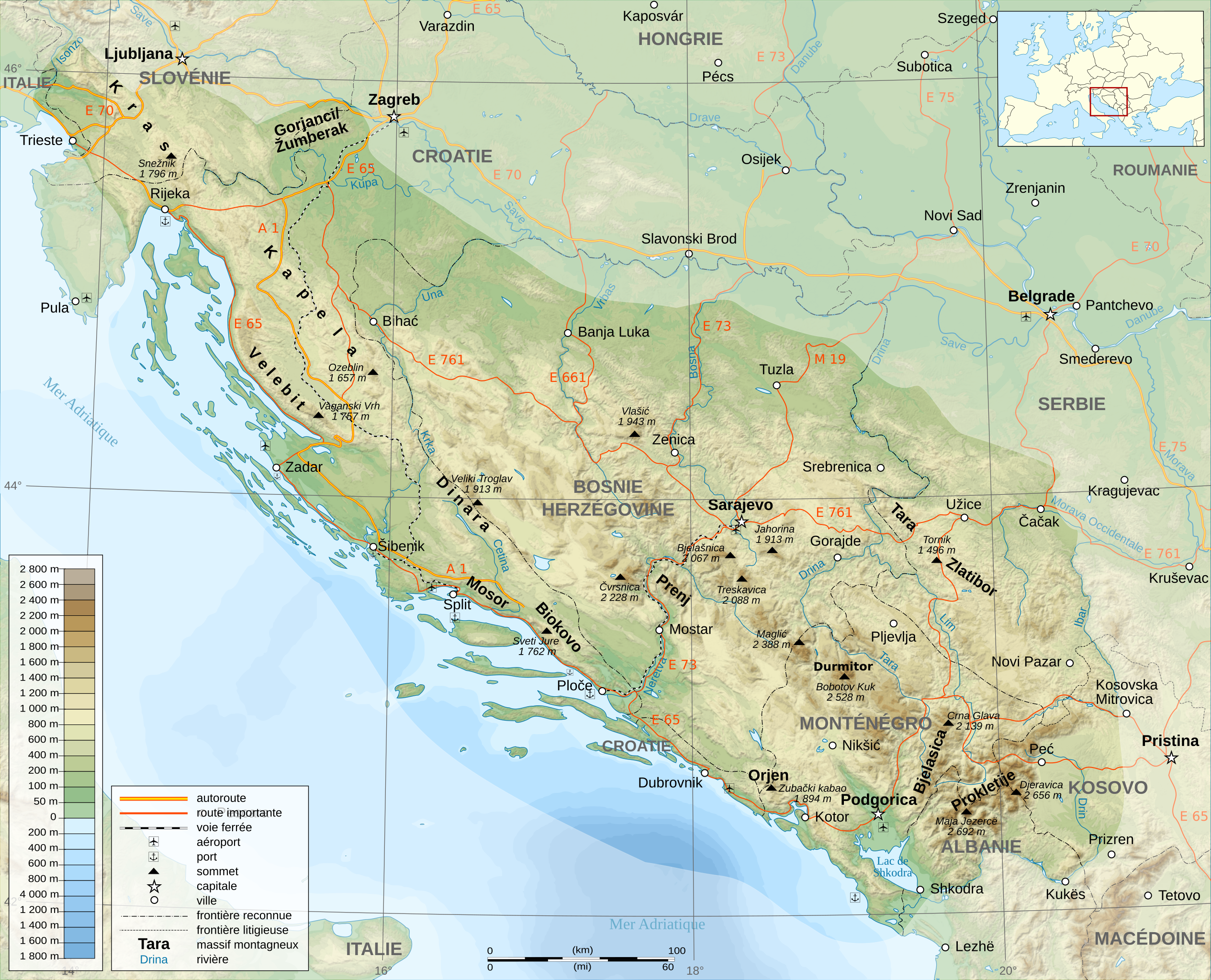
English: A general map of The Dinaric Alps, in French.
Français : Un carte générale de la chaîne des Le Alpes Dinariques. |
||
| Data | |||
| Jatorria |
travail personnel (own work). Sources :
Softwares used:
Others:
|
||
| Egilea | Sémhur | ||
| Beste bertsioak |
Derivative works of this file: | ||
| Aitortu (required by the license) | © Sémhur / Wikimedia Commons / | ||
| SVG | W3C-validity not checked. Fitxategi hau (bektore-irudia) hau Inkscape-ekin sortu da .
.
|
||
| Graphic Lab |

| Kameraren kokapena | | Irudi hau eta gehiago beraien kokapenekin hurrengo lekuetan: OpenStreetMap |
|---|
Lizentzia
| Copyleft: This work of art is free; you can redistribute it and/or modify it according to terms of the Free Art License. You will find a specimen of this license on the Copyleft Attitude site as well as on other sites. |
- Askea zara:
- partekatzeko – lana kopiatzeko, banatzeko eta bidaltzeko
- birnahasteko – lana moldatzeko
- Ondorengo baldintzen pean:
- eskuduntza – Egiletza behar bezala aitortu behar duzu, lizentzia ikusteko esteka gehitu, eta ea aldaketak egin diren aipatu. Era egokian egin behar duzu hori guztia, baina inola ere ez egileak zure lana edo zure erabilera babesten duela irudikatuz.
- berdin partekatu – Lan honetan oinarrituta edo aldatuta berria eraikitzen baduzu, emaitza lana hau bezalako lizentzia batekin argitaratu behar duzu.
Fitxategiaren historia
Data/orduan klik egin fitxategiak orduan zuen itxura ikusteko.
| Data/Ordua | Iruditxoa | Neurriak | Erabiltzailea | Iruzkina | |
|---|---|---|---|---|---|
| oraingoa | 17:38, 23 azaroa 2008 | | 1.857 × 1.503 (3,63 MB) | Sémhur | Correction autoroutes |
| 23:52, 18 azaroa 2008 |  | 1.857 × 1.503 (3,75 MB) | Sémhur | Bonne version... | |
| 21:26, 18 azaroa 2008 |  | 1.857 × 1.503 (3,58 MB) | Sémhur | Correction du nom d'une montagne. | |
| 21:21, 18 azaroa 2008 |  | 1.857 × 1.503 (3,58 MB) | Sémhur | {{Information |Description={{en|1=General map of Dinaric Alps, in French.}} {{fr|1=Carte générale de la chaîne des Alpes Dinariques.}} |Source=travail personnel (own work). Sources : * Background map : [htt |
Irudira dakarten loturak
Ez dago fitxategi hau darabilen orririk.
Fitxategiaren erabilera orokorra
Hurrengo beste wikiek fitxategi hau darabilte:
- ca.wikipedia.org proiektuan duen erabilera
- fr.wikipedia.org proiektuan duen erabilera
- hu.wikipedia.org proiektuan duen erabilera
- it.wikipedia.org proiektuan duen erabilera
- la.wikipedia.org proiektuan duen erabilera
- nn.wikipedia.org proiektuan duen erabilera