
Fitxategi:Enderby Land, Antarctica.jpg

Bereizmen handikoa ((1.750 × 1.300 pixel, fitxategiaren tamaina: 465 KB, MIME mota: image/jpeg))
Fitxategi hau Wikimedia Commonsekoa da. Hango deskribapen orriko informazioa behean duzu. |
Laburpena
| Deskribapena |
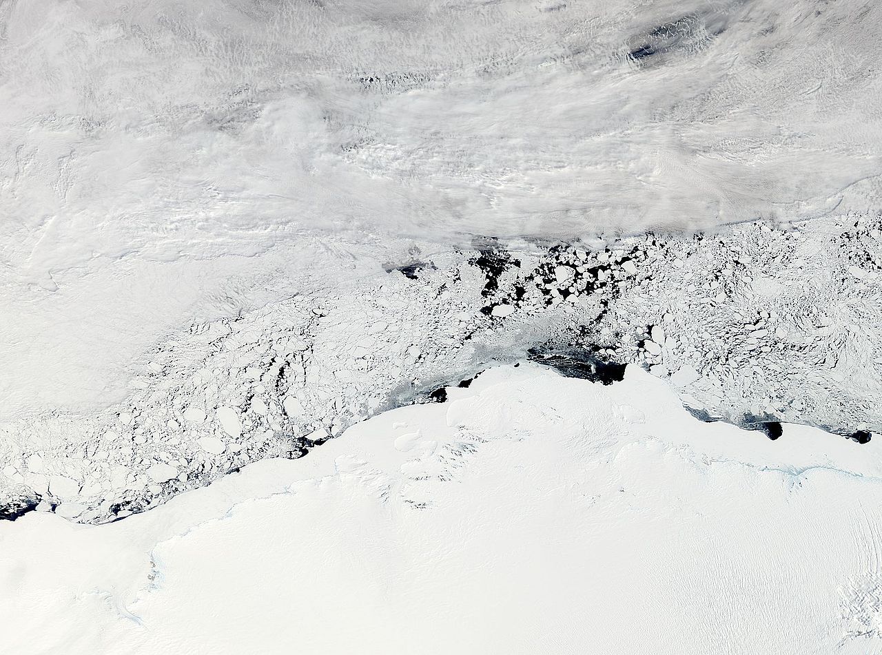
NASA image acquired November 3, 2011 The Moderate Resolution Imaging Spectroradiometer (MODIS) instrument on NASA's Aqua satellite captured this image of Enderby Land, Antarctica on November 3, 2011 at 11:20 UTC (7:20 a.m. EDT). The ice and snow appear bright white at the bottom of the image. Clouds grace the top of the image, and sea ice floats in William Scoresby Bay. Enderby Land is an Antarctic land mass that extends from Shinnan Glacier to William Scoresby Bay. Discovered in 1831, it was named after the Enderby Brothers of London. Operation Ice Bridge is exploring Antarctic ice, and more information can be found at www.nasa.gov/icebridge. Image Credit: NASA Goddard MODIS Rapid Response Team NASA Goddard Space Flight Center enables NASA’s mission through four scientific endeavors: Earth Science, Heliophysics, Solar System Exploration, and Astrophysics. Goddard plays a leading role in NASA’s accomplishments by contributing compelling scientific knowledge to advance the Agency’s mission. |
| Data | |
| Jatorria |
NASA Satellite Sees Enderby Land, Antarctica
|
| Egilea | NASA Goddard Space Flight Center from Greenbelt, MD, USA |
Lizentzia
- Askea zara:
- partekatzeko – lana kopiatzeko, banatzeko eta bidaltzeko
- birnahasteko – lana moldatzeko
- Ondorengo baldintzen pean:
- eskuduntza – Egiletza behar bezala aitortu behar duzu, lizentzia ikusteko esteka gehitu, eta ea aldaketak egin diren aipatu. Era egokian egin behar duzu hori guztia, baina inola ere ez egileak zure lana edo zure erabilera babesten duela irudikatuz.
| This file is in the public domain in the United States because it was solely created by NASA. NASA copyright policy states that "NASA material is not protected by copyright unless noted". (See Template:PD-USGov, NASA copyright policy page or JPL Image Use Policy.) | ||
 |
Warnings:
|
| Irudi hau, berez Flickerren argitaratua, November 8, 2011 egunean File Upload Bot (Magnus Manske) administratzaileak edo gainbegiratzaileak gainbegiratu zuen, eta baieztatu zuen Flickrren lizentzia egokian zegoela aipatutako data horretan. |
Fitxategiaren historia
Data/orduan klik egin fitxategiak orduan zuen itxura ikusteko.
| Data/Ordua | Iruditxoa | Neurriak | Erabiltzailea | Iruzkina | |
|---|---|---|---|---|---|
| oraingoa | 05:34, 8 azaroa 2011 | | 1.750 × 1.300 (465 KB) | File Upload Bot (Magnus Manske) | {{Information |Description=NASA image acquired November 3, 2011 The Moderate Resolution Imaging Spectroradiometer (MODIS) instrument on NASA's Aqua satellite captured this image of Enderby Land, Antarctica on November 3, 2011 at 11:20 UTC (7:20 a.m. EDT) |
Irudira dakarten loturak
Hurrengo orrialdeek dute fitxategi honetarako lotura:
Fitxategiaren erabilera orokorra
Hurrengo beste wikiek fitxategi hau darabilte:
- ar.wikipedia.org proiektuan duen erabilera
- arz.wikipedia.org proiektuan duen erabilera
- bg.wikipedia.org proiektuan duen erabilera
- ca.wikipedia.org proiektuan duen erabilera
- ceb.wikipedia.org proiektuan duen erabilera
- ce.wikipedia.org proiektuan duen erabilera
- de.wikipedia.org proiektuan duen erabilera
- en.wikipedia.org proiektuan duen erabilera
- eo.wikipedia.org proiektuan duen erabilera
- he.wikipedia.org proiektuan duen erabilera
- ארץ אנדרבי
- הרי טולה
- תבנית:הרי טולה
- הרי נייפייר
- תבנית:הרי נייפייר
- הר אלקינס
- הר דנהאם (אנטארקטיקה)
- הר המפסון
- הר קייזר
- הר ריידר
- הר קינג (אנטארקטיקה, הרי טולה)
- הר סוקק
- רכס פיקוק (אנטארקטיקה)
- הר הארדי (אנטארקטיקה)
- הר אולדפילד (אנטארקטיקה)
- פסגת פיתגורס
- הר סטורר
- הר ריסר-לארסן
- הר פורטאוס
- הר ברטלט (אנטארקטיקה, ארץ אנדרבי)
- הר הארווי (אנטארקטיקה)
- נונאטאקי יאנג
- הר מילר (ארץ אנדרבי)
- הר מוריסון (ארץ אנדרבי)
- הר בסט
- נונאטאקי הארווי
- הר דאנג'י
- הר דגרפלדט
- הר רודס (אנטארקטיקה)
- הר בונד (אנטארקטיקה)
- hi.wikipedia.org proiektuan duen erabilera
- hy.wikipedia.org proiektuan duen erabilera
- it.wikipedia.org proiektuan duen erabilera
- ja.wikipedia.org proiektuan duen erabilera
- mk.wikipedia.org proiektuan duen erabilera
- nl.wikipedia.org proiektuan duen erabilera
- nn.wikipedia.org proiektuan duen erabilera
- pl.wikipedia.org proiektuan duen erabilera
Ikus fitxategi honen erabilpen global gehiago.