
Fitxategi:Hail Blount House, San Augustine, Texas.jpg
Bereizmen handikoa ((1.024 × 732 pixel, fitxategiaren tamaina: 182 KB, MIME mota: image/jpeg))
Fitxategi hau Wikimedia Commonsekoa da. Hango deskribapen orriko informazioa behean duzu. |
Laburpena
| Deskribapena |
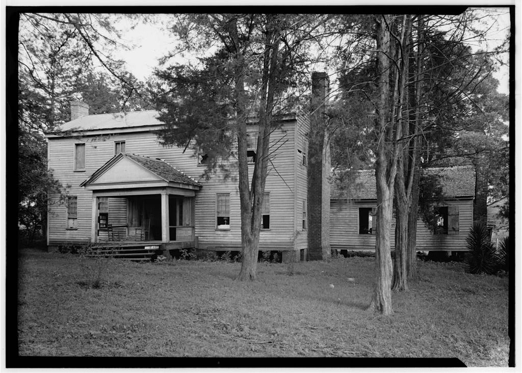
English: Hail / Captain Thomas William Blount House, San Augustine, Texas.
|
|||||
| Data | ||||||
| Jatorria |
|
|||||
| Egilea | Harry L. Starnes |

| Objektuaren kokapena | | Irudi hau eta gehiago beraien kokapenekin hurrengo lekuetan: OpenStreetMap |
|---|
|
This is an image of a place or building that is listed on the National Register of Historic Places in the United States of America. Its reference number is 73001974. |
Lizentzia
Lan hau Ameriketako Estatu Batuetako jabetza publikoan dago, lanaren iturria Estatu Batuetako gobernu federala delako eta Ameriketako Estatu Batuetako Kodeko 17. titulu, 1. kapitulu, 105. atal-aren arabera. Ikus Copyright.
Oharra: Estatutu hau gobernu federalaren lanetan aplikatzen da bakarrik eta ez AEBetako estatu, lurralde, konderri, azpibanaketa edo udalerriren lanetan.
|
 | |
| This file has been identified as being free of known restrictions under copyright law, including all related and neighboring rights. | ||
Fitxategiaren historia
Data/orduan klik egin fitxategiak orduan zuen itxura ikusteko.
| Data/Ordua | Iruditxoa | Neurriak | Erabiltzailea | Iruzkina | |
|---|---|---|---|---|---|
| oraingoa | 13:18, 1 apirila 2012 | | 1.024 × 732 (182 KB) | 25or6to4 |
Irudira dakarten loturak
Hurrengo orrialdeek dute fitxategi honetarako lotura:
Fitxategiaren erabilera orokorra
Hurrengo beste wikiek fitxategi hau darabilte:
- ar.wikipedia.org proiektuan duen erabilera
- arz.wikipedia.org proiektuan duen erabilera
- azb.wikipedia.org proiektuan duen erabilera
- be.wikipedia.org proiektuan duen erabilera
- ceb.wikipedia.org proiektuan duen erabilera
- ce.wikipedia.org proiektuan duen erabilera
- cy.wikipedia.org proiektuan duen erabilera
- en.wikipedia.org proiektuan duen erabilera
- en.wikivoyage.org proiektuan duen erabilera
- es.wikipedia.org proiektuan duen erabilera
- fa.wikipedia.org proiektuan duen erabilera
- fr.wikipedia.org proiektuan duen erabilera
- ga.wikipedia.org proiektuan duen erabilera
- ht.wikipedia.org proiektuan duen erabilera
- hu.wikipedia.org proiektuan duen erabilera
- it.wikipedia.org proiektuan duen erabilera
- lld.wikipedia.org proiektuan duen erabilera
- pl.wikipedia.org proiektuan duen erabilera
- pt.wikipedia.org proiektuan duen erabilera
- ru.wikipedia.org proiektuan duen erabilera
- sr.wikipedia.org proiektuan duen erabilera
- tt.wikipedia.org proiektuan duen erabilera
- uk.wikipedia.org proiektuan duen erabilera
- www.wikidata.org proiektuan duen erabilera
- zh-min-nan.wikipedia.org proiektuan duen erabilera
- zh.wikipedia.org proiektuan duen erabilera