
Fitxategi:Intracoastal Waterway at Bayou Barataria.jpg
Aurreikuspen honen neurria: 800 × 533 pixel. Bestelako bereizmenak: 320 × 213 pixel | 640 × 427 pixel | 1.024 × 683 pixel | 1.500 × 1.000 pixel.
Bereizmen handikoa ((1.500 × 1.000 pixel, fitxategiaren tamaina: 396 KB, MIME mota: image/jpeg))
Fitxategi hau Wikimedia Commonsekoa da. Hango deskribapen orriko informazioa behean duzu. |
| Deskribapena |
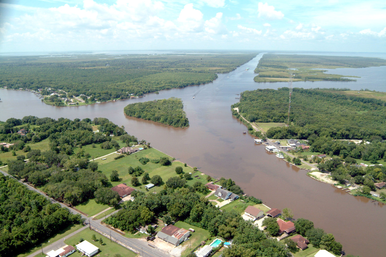
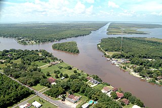
English: Aerial view of a northern section of Jean Lafitte, Louisiana at the Gulf Intracoastal Waterway (GIWW). The waterway stretches off to the southwest at the top of the picture and also turns right into the Bayou Villars and Lake Salvador at the right. Bayou Barataria runs off to the left. |
|||
| Data | ||||
| Jatorria |
U.S. Army Corps of Engineers Digital Visual Library Image page Image description page Digital Visual Library home page |
|||
| Egilea | Lane Lefort, U.S. Army Corps of Engineers | |||
| Lizentzia (Fitxategi hau berrerabiltzen) |
|
|||
| Location | Jefferson Parish, Louisiana |
| Kameraren kokapena | | Irudi hau eta gehiago beraien kokapenekin hurrengo lekuetan: OpenStreetMap |
|---|
Fitxategiaren historia
Data/orduan klik egin fitxategiak orduan zuen itxura ikusteko.
| Data/Ordua | Iruditxoa | Neurriak | Erabiltzailea | Iruzkina | |
|---|---|---|---|---|---|
| oraingoa | 01:23, 8 apirila 2007 | | 1.500 × 1.000 (396 KB) | DanMS | {{Information | Description = {{en|Aerial view of a northern section of Jean Lafitte, Louisiana at the Gulf Intracoastal Waterway (GIWW). The waterway stretches off to the southwest at the top of the picture and also turns right into the Bayou Villars |
Irudira dakarten loturak
Hurrengo orrialdeek dute fitxategi honetarako lotura:
Fitxategiaren erabilera orokorra
Hurrengo beste wikiek fitxategi hau darabilte:
- ar.wikipedia.org proiektuan duen erabilera
- arz.wikipedia.org proiektuan duen erabilera
- azb.wikipedia.org proiektuan duen erabilera
- ca.wikipedia.org proiektuan duen erabilera
- ceb.wikipedia.org proiektuan duen erabilera
- ce.wikipedia.org proiektuan duen erabilera
- cy.wikipedia.org proiektuan duen erabilera
- en.wikipedia.org proiektuan duen erabilera
- en.wikivoyage.org proiektuan duen erabilera
- es.wikipedia.org proiektuan duen erabilera
- fa.wikipedia.org proiektuan duen erabilera
- fr.wikipedia.org proiektuan duen erabilera
- ht.wikipedia.org proiektuan duen erabilera
- it.wikipedia.org proiektuan duen erabilera
- lld.wikipedia.org proiektuan duen erabilera
- nl.wikipedia.org proiektuan duen erabilera
- pl.wikipedia.org proiektuan duen erabilera
- pt.wikipedia.org proiektuan duen erabilera
- sh.wikipedia.org proiektuan duen erabilera
- sr.wikipedia.org proiektuan duen erabilera
- tt.wikipedia.org proiektuan duen erabilera
- uk.wikipedia.org proiektuan duen erabilera
- www.wikidata.org proiektuan duen erabilera
- zh-min-nan.wikipedia.org proiektuan duen erabilera