
Fitxategi:Keyesport Illinois with Carlyle Lake filling.jpg
Aurreikuspen honen neurria: 800 × 533 pixel. Bestelako bereizmenak: 320 × 213 pixel | 640 × 427 pixel | 1.024 × 683 pixel | 1.500 × 1.000 pixel.
Bereizmen handikoa ((1.500 × 1.000 pixel, fitxategiaren tamaina: 287 KB, MIME mota: image/jpeg))
Fitxategi hau Wikimedia Commonsekoa da. Hango deskribapen orriko informazioa behean duzu. |
| Deskribapena |
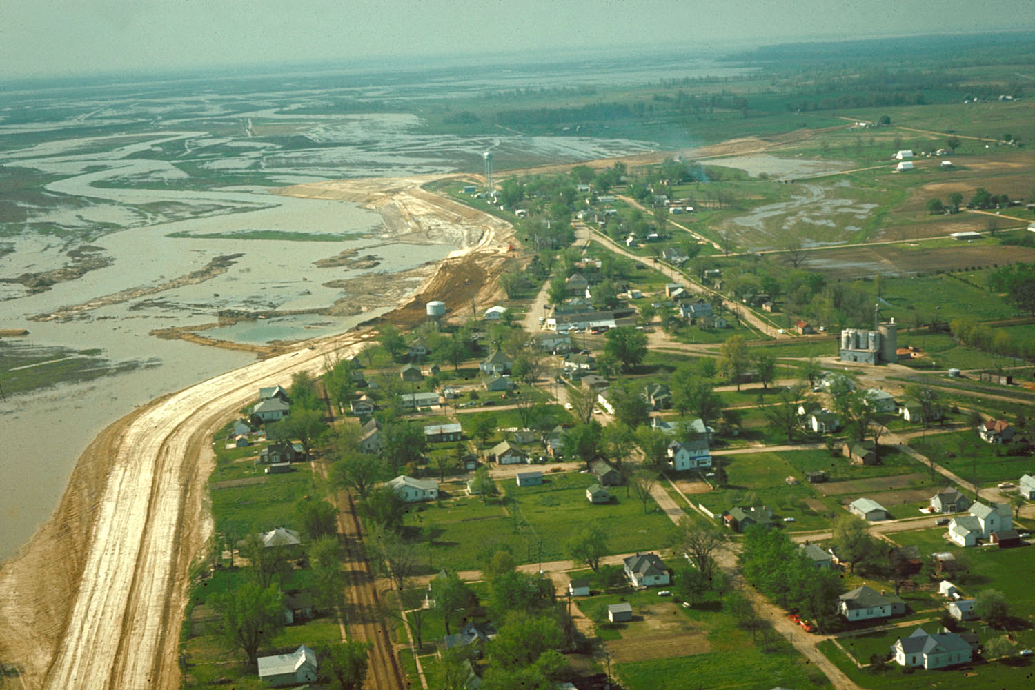
English: Aerial view of Keyesport, Illinois, USA. The photograph was taken in 1967 or 1968 after the Carlyle Lake Dam had been completed and Carlyle Lake was filling. The town now lies directly on the lakeshore. |
|||
| Data | circa 1968 | |||
| Jatorria |
U.S. Army Corps of Engineers Digital Visual Library Image page Image description page Digital Visual Library home page |
|||
| Egilea | U.S. Army Corps of Engineers, photographer not specified or unknown | |||
| Lizentzia (Fitxategi hau berrerabiltzen) |
|
|||
| Location | Keyesport, Illinois, USA |
| Kameraren kokapena | | Irudi hau eta gehiago beraien kokapenekin hurrengo lekuetan: OpenStreetMap |
|---|
Fitxategiaren historia
Data/orduan klik egin fitxategiak orduan zuen itxura ikusteko.
| Data/Ordua | Iruditxoa | Neurriak | Erabiltzailea | Iruzkina | |
|---|---|---|---|---|---|
| oraingoa | 23:01, 7 apirila 2007 | | 1.500 × 1.000 (287 KB) | DanMS | {{Information | Description = {{en|Aerial view of Keyesport, Illinois, USA. The photograph was taken in 1967 or 1968 after the Carlyle Lake Dam had been completed and Carlyle Lake was filling. The town now lies directly on the lakeshore.}} | So |
Irudira dakarten loturak
Hurrengo orrialdeek dute fitxategi honetarako lotura:
Fitxategiaren erabilera orokorra
Hurrengo beste wikiek fitxategi hau darabilte:
- ar.wikipedia.org proiektuan duen erabilera
- ca.wikipedia.org proiektuan duen erabilera
- ceb.wikipedia.org proiektuan duen erabilera
- cy.wikipedia.org proiektuan duen erabilera
- en.wikipedia.org proiektuan duen erabilera
- es.wikipedia.org proiektuan duen erabilera
- fr.wikipedia.org proiektuan duen erabilera
- ht.wikipedia.org proiektuan duen erabilera
- it.wikipedia.org proiektuan duen erabilera
- lld.wikipedia.org proiektuan duen erabilera
- pl.wikipedia.org proiektuan duen erabilera
- pt.wikipedia.org proiektuan duen erabilera
- sr.wikipedia.org proiektuan duen erabilera
- uk.wikipedia.org proiektuan duen erabilera
- vi.wikipedia.org proiektuan duen erabilera
- www.wikidata.org proiektuan duen erabilera
- zh-min-nan.wikipedia.org proiektuan duen erabilera
- zh.wikipedia.org proiektuan duen erabilera