
Fitxategi:Kissimmee River canal section.jpg
Aurreikuspen honen neurria: 800 × 470 pixel. Bestelako bereizmenak: 320 × 188 pixel | 640 × 376 pixel | 1.024 × 601 pixel | 1.500 × 881 pixel.
Bereizmen handikoa ((1.500 × 881 pixel, fitxategiaren tamaina: 165 KB, MIME mota: image/jpeg))
Fitxategi hau Wikimedia Commonsekoa da. Hango deskribapen orriko informazioa behean duzu. |
| Deskribapena |
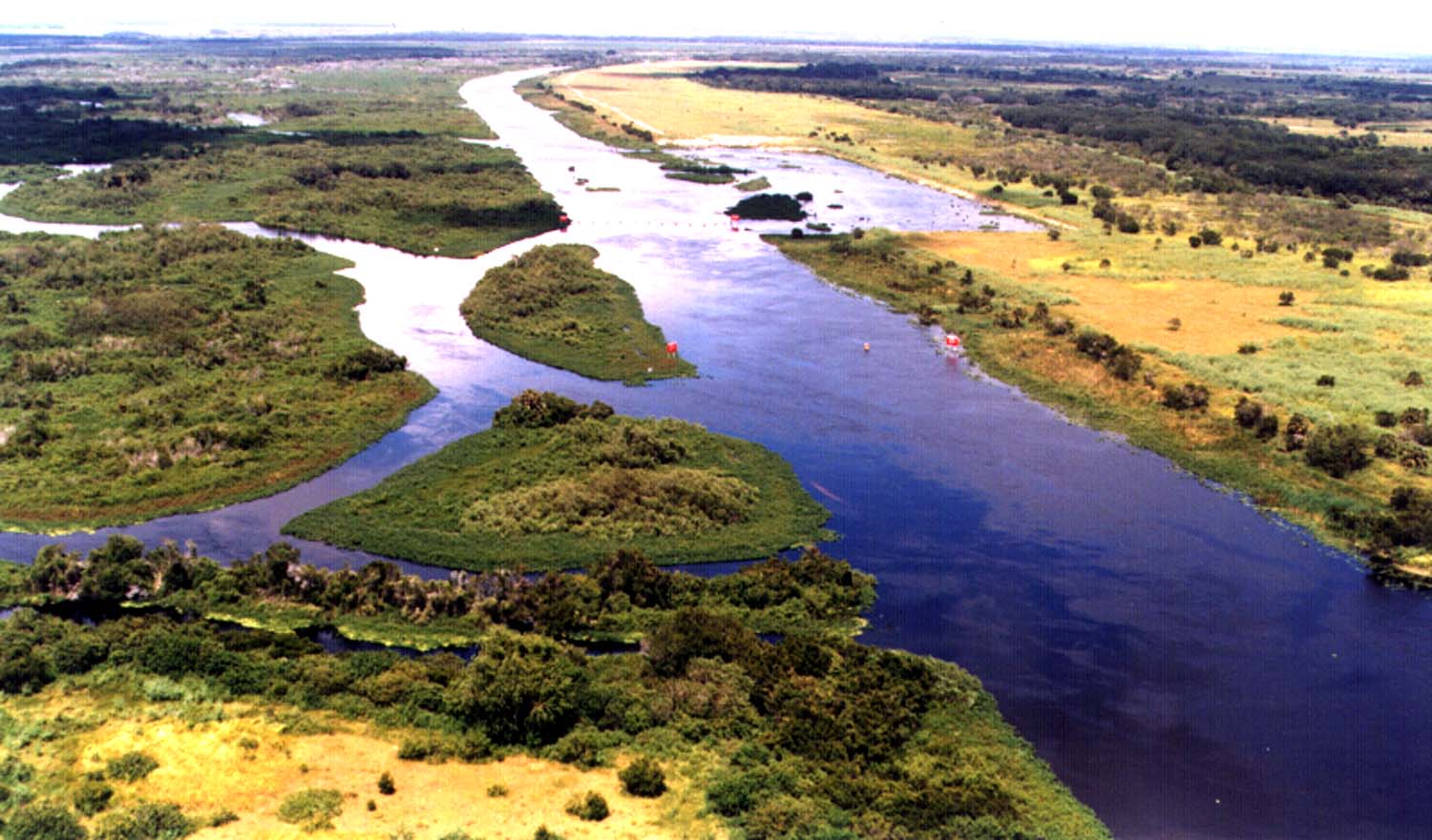
English: A stretch of the Kissimmee River in central Florida, USA. The original meandering river path was widened, straightened, and excavated by the U.S. Army Corps of Engineers between 1962 and 1971 for flood control in central Florida. As of 2007, the Kissimmee River Restoration Project is underway to restore parts of the river to its original condition. |
|||
| Location | Central Florida, USA | |||
| Data | (Caveat: Dates provided by U.S. Army Corps of Engineers Digital Visual Library are not reliable and are often wrong.) | |||
| Jatorria |
U.S. Army Corps of Engineers Digital Visual Library Image page Image description page Digital Visual Library home page |
|||
| Egilea | Tony Santana, U.S. Army Corps of Engineers | |||
| Lizentzia (Fitxategi hau berrerabiltzen) |
|
Fitxategiaren historia
Data/orduan klik egin fitxategiak orduan zuen itxura ikusteko.
| Data/Ordua | Iruditxoa | Neurriak | Erabiltzailea | Iruzkina | |
|---|---|---|---|---|---|
| oraingoa | 03:06, 28 apirila 2007 | | 1.500 × 881 (165 KB) | DanMS | {{Information | Description = {{en|A stretch of the Kissimmee River in central Florida, USA. The original meandering river path was widened, straightened, and excavated by the U.S. Army Corps of Engineers between 1962 and 1971 for flood control in cent |
Irudira dakarten loturak
Hurrengo orrialdeek dute fitxategi honetarako lotura:
Fitxategiaren erabilera orokorra
Hurrengo beste wikiek fitxategi hau darabilte:
- ar.wikipedia.org proiektuan duen erabilera
- arz.wikipedia.org proiektuan duen erabilera
- ca.wikipedia.org proiektuan duen erabilera
- ce.wikipedia.org proiektuan duen erabilera
- da.wikipedia.org proiektuan duen erabilera
- de.wikivoyage.org proiektuan duen erabilera
- en.wikipedia.org proiektuan duen erabilera
- en.wikivoyage.org proiektuan duen erabilera
- fr.wikipedia.org proiektuan duen erabilera
- he.wikivoyage.org proiektuan duen erabilera
- ht.wikipedia.org proiektuan duen erabilera
- hu.wikipedia.org proiektuan duen erabilera
- hy.wikipedia.org proiektuan duen erabilera
- ia.wikipedia.org proiektuan duen erabilera
- it.wikipedia.org proiektuan duen erabilera
- it.wikivoyage.org proiektuan duen erabilera
- ja.wikipedia.org proiektuan duen erabilera
- lld.wikipedia.org proiektuan duen erabilera
- no.wikipedia.org proiektuan duen erabilera
- pt.wikipedia.org proiektuan duen erabilera
- ro.wikipedia.org proiektuan duen erabilera
- ru.wikipedia.org proiektuan duen erabilera
- sv.wikipedia.org proiektuan duen erabilera
- tt.wikipedia.org proiektuan duen erabilera
- vo.wikipedia.org proiektuan duen erabilera
- www.wikidata.org proiektuan duen erabilera
- zh-min-nan.wikipedia.org proiektuan duen erabilera