
Fitxategi:Muddus national park topographic map-fr.svg

SVG fitxategi honen PNG aurreikuspenaren tamaina: 489 × 599 pixel. Bestelako bereizmenak: 196 × 240 pixel | 392 × 480 pixel | 627 × 768 pixel | 836 × 1.024 pixel | 1.672 × 2.048 pixel | 2.000 × 2.450 pixel.
Bereizmen handikoa (SVG fitxategia, nominaldi 2.000 × 2.450 pixel, fitxategiaren tamaina: 1,51 MB)
Fitxategi hau Wikimedia Commonsekoa da. Hango deskribapen orriko informazioa behean duzu. |
Laburpena
| Deskribapena |
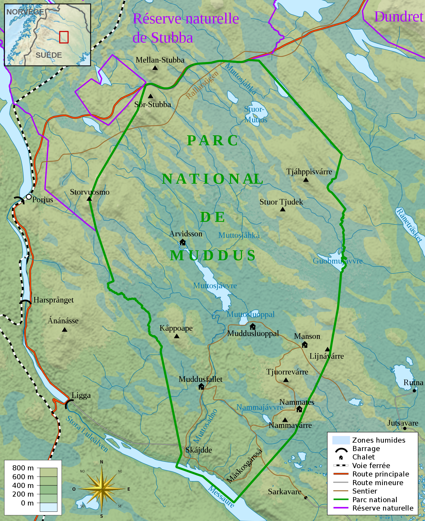
Français : Carte topographique du parc national de Muddus, en Laponie suédoise.
English: Topographic map in French language of Muddus national park, Swedish Lappland
|
| Data | |
| Jatorria |
Création personnelle ;
|
| Egilea | Mickaël Delcey (Silverkey) |
_(-mini_map).svg)
Lizentzia
Nik, lan honen egileak, argitaratzen dut ondorengo lizentzia pean:
Fitxategi hau Creative Commons Attribution-Share Alike 3.0 Unported lizentziapean dago.
- Askea zara:
- partekatzeko – lana kopiatzeko, banatzeko eta bidaltzeko
- birnahasteko – lana moldatzeko
- Ondorengo baldintzen pean:
- eskuduntza – Egiletza behar bezala aitortu behar duzu, lizentzia ikusteko esteka gehitu, eta ea aldaketak egin diren aipatu. Era egokian egin behar duzu hori guztia, baina inola ere ez egileak zure lana edo zure erabilera babesten duela irudikatuz.
- berdin partekatu – Lan honetan oinarrituta edo aldatuta berria eraikitzen baduzu, emaitza lana hau bezalako lizentzia batekin argitaratu behar duzu.
Fitxategiaren historia
Data/orduan klik egin fitxategiak orduan zuen itxura ikusteko.
| Data/Ordua | Iruditxoa | Neurriak | Erabiltzailea | Iruzkina | |
|---|---|---|---|---|---|
| oraingoa | 02:43, 1 urtarrila 2017 | | 2.000 × 2.450 (1,51 MB) | Silverkey | Change river name (it changes name along its course) + few details |
| 21:03, 26 abendua 2016 |  | 2.000 × 2.450 (1,5 MB) | Silverkey | A few forgotten details (sorry) | |
| 20:54, 26 abendua 2016 |  | 2.000 × 2.450 (1,5 MB) | Silverkey | Use Sami spellings instead of Swedish ones (as is now standard). A few minor corrections. | |
| 13:25, 27 apirila 2013 |  | 2.000 × 2.450 (1,5 MB) | Silverkey | User created page with UploadWizard |
Irudira dakarten loturak
Hurrengo orrialdeek dute fitxategi honetarako lotura:
Fitxategiaren erabilera orokorra
Hurrengo beste wikiek fitxategi hau darabilte:
- cs.wikipedia.org proiektuan duen erabilera
- es.wikipedia.org proiektuan duen erabilera
- fr.wikipedia.org proiektuan duen erabilera
- gl.wikipedia.org proiektuan duen erabilera
- it.wikipedia.org proiektuan duen erabilera