
Fitxategi:Ohio Portage Kent.png

Aurreikuspen honen neurria: 800 × 468 pixel. Bestelako bereizmenak: 320 × 187 pixel | 640 × 374 pixel | 1.025 × 599 pixel.
Bereizmen handikoa ((1.025 × 599 pixel, fitxategiaren tamaina: 141 KB, MIME mota: image/png))
Fitxategi hau Wikimedia Commonsekoa da. Hango deskribapen orriko informazioa behean duzu. |
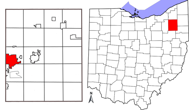
| Deskribapena | Combination map showing location of Kent, Ohio within Portage County and Portage County's location within the state of Ohio. Original map of Ohio by David Benbennick; map of Portage County with Kent highlighted made by Jon Ridinger. |
| Data | (UTC) |
| Jatorria | |
| Egilea |
| This is a retouched picture, which means that it has been digitally altered from its original version. Modifications: added two maps together; removed distance chart from Portage County map; moved compass. The original can be viewed here: Portage County Kent.png:
|
Fitxategi hau Creative Commons Attribution-Share Alike 3.0 Unported lizentziapean dago.
- Askea zara:
- partekatzeko – lana kopiatzeko, banatzeko eta bidaltzeko
- birnahasteko – lana moldatzeko
- Ondorengo baldintzen pean:
- eskuduntza – Egiletza behar bezala aitortu behar duzu, lizentzia ikusteko esteka gehitu, eta ea aldaketak egin diren aipatu. Era egokian egin behar duzu hori guztia, baina inola ere ez egileak zure lana edo zure erabilera babesten duela irudikatuz.
- berdin partekatu – Lan honetan oinarrituta edo aldatuta berria eraikitzen baduzu, emaitza lana hau bezalako lizentzia batekin argitaratu behar duzu.
Jatorrizko igoera erregistroa
This image is a derivative work of the following images:
- File:Map_of_Ohio_highlighting_Portage_County.svg licensed with PD-self
- 2006-02-12T16:10:28Z David Benbennick 3675x3995 (59503 Bytes) {{subst:User:Dbenbenn/clm|county=Portage County|state=Ohio|type=county}}
- File:Portage_County_Kent.png licensed with Cc-by-3.0
- 2010-05-01T03:26:12Z JonRidinger 425x577 (81460 Bytes) Minor correction
- 2010-05-01T03:22:22Z JonRidinger 425x577 (76288 Bytes) Straightened map, cropped, removed extra white areas
- 2008-05-16T02:27:08Z JonRidinger 489x615 (44136 Bytes) {{Information |Description= Map of Portage County, Ohio with the city of Kent highlighted. |Source=self-made |Date= 15 May 2008 |Author= [[User:JonRidinger|JonRidinger]] |Permission= Public domain |other_versions= }} [[Categ
Uploaded with derivativeFX
Fitxategiaren historia
Data/orduan klik egin fitxategiak orduan zuen itxura ikusteko.
| Data/Ordua | Iruditxoa | Neurriak | Erabiltzailea | Iruzkina | |
|---|---|---|---|---|---|
| oraingoa | 14:12, 7 maiatza 2010 | | 1.025 × 599 (141 KB) | JonRidinger | {{Information |Description=Combination map showing location of Kent, Ohio within Portage County and Portage County's location within the state of Ohio. Original map of Ohio by [[User:Dbenbenn|David B |
Irudira dakarten loturak
Hurrengo orrialdeek dute fitxategi honetarako lotura:
Fitxategiaren erabilera orokorra
Hurrengo beste wikiek fitxategi hau darabilte:
- ar.wikipedia.org proiektuan duen erabilera
- arz.wikipedia.org proiektuan duen erabilera
- azb.wikipedia.org proiektuan duen erabilera
- bn.wikipedia.org proiektuan duen erabilera
- ca.wikipedia.org proiektuan duen erabilera
- ceb.wikipedia.org proiektuan duen erabilera
- cy.wikipedia.org proiektuan duen erabilera
- en.wikipedia.org proiektuan duen erabilera
- fa.wikipedia.org proiektuan duen erabilera
- fi.wikipedia.org proiektuan duen erabilera
- fr.wikipedia.org proiektuan duen erabilera
- ht.wikipedia.org proiektuan duen erabilera
- id.wikipedia.org proiektuan duen erabilera
- it.wikipedia.org proiektuan duen erabilera
- no.wikipedia.org proiektuan duen erabilera
- sh.wikipedia.org proiektuan duen erabilera
- sr.wikipedia.org proiektuan duen erabilera
- sv.wikipedia.org proiektuan duen erabilera
- tr.wikipedia.org proiektuan duen erabilera
- tt.wikipedia.org proiektuan duen erabilera
- ur.wikipedia.org proiektuan duen erabilera
- vo.wikipedia.org proiektuan duen erabilera
- www.wikidata.org proiektuan duen erabilera
- zh-min-nan.wikipedia.org proiektuan duen erabilera
- zh.wikipedia.org proiektuan duen erabilera