
Fitxategi:Ophelia 13 sept 2005 1830Z.jpg
Bereizmen handikoa ((4.400 × 5.600 pixel, fitxategiaren tamaina: 4,4 MB, MIME mota: image/jpeg))
Fitxategi hau Wikimedia Commonsekoa da. Hango deskribapen orriko informazioa behean duzu. |
Laburpena
| Deskribapena |
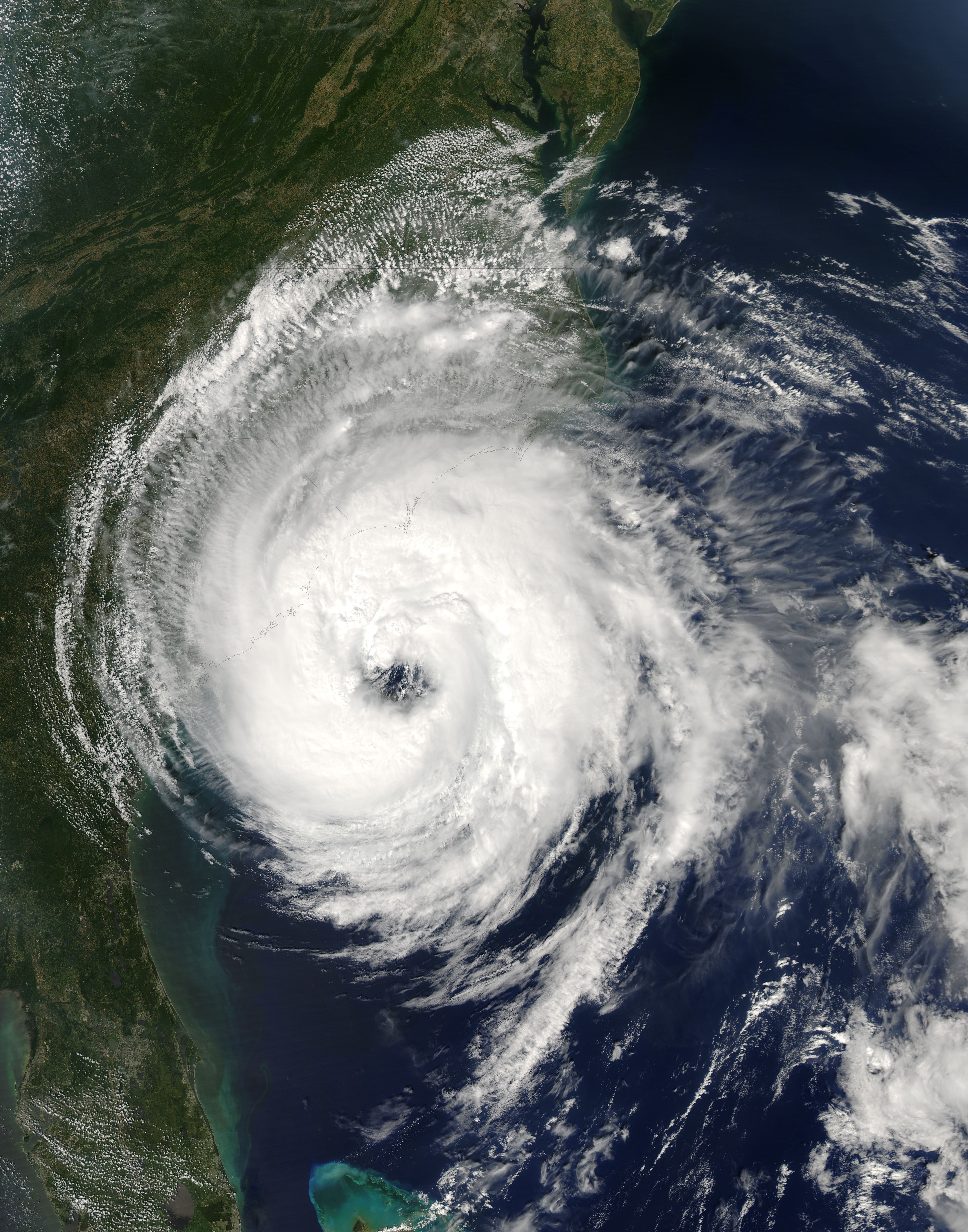
Hurricane Ophelia lived up to its name as it wound haphazardly north along the U.S. Eastern Seaboard during the second week of September 2005. The storm was a still two days away from making landfall when the Moderate Resolution Imaging Spectroradiometer (MODIS) on NASA’s Aqua satellite captured this image at 2:30 p.m. Eastern time on September 13, 2005. At the time, Ophelia had winds of 110 kilometers per hour (70 miles per hour) with stronger gusts. The slow-moving storm is forecast to dump heavy rain on the Outer Banks of North Carolina before turning out to sea on its northeastward course. The large image provided above has a resolution of 250 meters per pixel. The image is available in additional resolutions from the MODIS Rapid Response Team. |
|||||
| Data | ||||||
| Jatorria | http://earthobservatory.nasa.gov/NaturalHazards/natural_hazards_v2.php3?img_id=13129 | |||||
| Egilea | NASA image courtesy Jeff Schmaltz, MODIS Land Rapid Response Team at NASA GSFC | |||||
| Lizentzia (Fitxategi hau berrerabiltzen) |
|

Fitxategiaren historia
Data/orduan klik egin fitxategiak orduan zuen itxura ikusteko.
| Data/Ordua | Iruditxoa | Neurriak | Erabiltzailea | Iruzkina | |
|---|---|---|---|---|---|
| oraingoa | 22:49, 6 azaroa 2006 | | 4.400 × 5.600 (4,4 MB) | Good kitty | == Summary == {{Information |Description=Hurricane Ophelia lived up to its name as it wound haphazardly north along the U.S. Eastern Seaboard during the second week of September 2005. The storm was a still two days away from making landfall when the Moder |
Irudira dakarten loturak
Ez dago fitxategi hau darabilen orririk.
Fitxategiaren erabilera orokorra
Hurrengo beste wikiek fitxategi hau darabilte:
- eo.wikipedia.org proiektuan duen erabilera
- es.wikipedia.org proiektuan duen erabilera
- nl.wikipedia.org proiektuan duen erabilera
- simple.wikipedia.org proiektuan duen erabilera