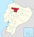
Fitxategi:Pichincha in Ecuador (+Galapagos).svg
Itxura

SVG fitxategi honen PNG aurreikuspenaren tamaina: 512 × 551 pixel. Bestelako bereizmenak: 223 × 240 pixel | 446 × 480 pixel | 714 × 768 pixel | 951 × 1.024 pixel | 1.903 × 2.048 pixel.
Bereizmen handikoa (SVG fitxategia, nominaldi 512 × 551 pixel, fitxategiaren tamaina: 259 KB)
Fitxategiaren historia
Data/orduan klik egin fitxategiak orduan zuen itxura ikusteko.
| Data/Ordua | Iruditxoa | Neurriak | Erabiltzailea | Iruzkina | |
|---|---|---|---|---|---|
| oraingoa | 04:34, 26 iraila 2017 |  | 512 × 551 (259 KB) | Berposen | .. |
| 02:28, 24 iraila 2017 |  | 512 × 551 (274 KB) | Berposen | The limits of the province of Santo Domingo were out of place. | |
| 17:49, 14 ekaina 2012 |  | 1.535 × 1.654 (704 KB) | TUBS | see your disk | |
| 22:46, 13 ekaina 2012 |  | 1.536 × 1.654 (409 KB) | Joffrenomuere | Nuevos limites Sto. Domingo | |
| 10:13, 16 azaroa 2011 |  | 1.535 × 1.654 (704 KB) | TUBS |
Irudira dakarten loturak
Hurrengo orrialdeek dute fitxategi honetarako lotura:
Fitxategiaren erabilera orokorra
Hurrengo beste wikiek fitxategi hau darabilte:
- ar.wikipedia.org proiektuan duen erabilera
- be-tarask.wikipedia.org proiektuan duen erabilera
- be.wikipedia.org proiektuan duen erabilera
- bg.wikipedia.org proiektuan duen erabilera
- ca.wikipedia.org proiektuan duen erabilera
- de.wikipedia.org proiektuan duen erabilera
- en.wikipedia.org proiektuan duen erabilera
- eo.wikipedia.org proiektuan duen erabilera
- es.wikipedia.org proiektuan duen erabilera
- fa.wikipedia.org proiektuan duen erabilera
- fi.wikipedia.org proiektuan duen erabilera
- frr.wikipedia.org proiektuan duen erabilera
- gl.wikipedia.org proiektuan duen erabilera
- guc.wikipedia.org proiektuan duen erabilera
- hy.wikipedia.org proiektuan duen erabilera
- ia.wikipedia.org proiektuan duen erabilera
- id.wikipedia.org proiektuan duen erabilera
- incubator.wikimedia.org proiektuan duen erabilera
- it.wikipedia.org proiektuan duen erabilera
- ja.wikipedia.org proiektuan duen erabilera
- ko.wikipedia.org proiektuan duen erabilera
- lad.wikipedia.org proiektuan duen erabilera
- lv.wikipedia.org proiektuan duen erabilera
- nl.wikipedia.org proiektuan duen erabilera
- no.wikipedia.org proiektuan duen erabilera
- os.wikipedia.org proiektuan duen erabilera
- pl.wikipedia.org proiektuan duen erabilera
- pt.wikipedia.org proiektuan duen erabilera
- qu.wikipedia.org proiektuan duen erabilera
Ikus fitxategi honen erabilpen global gehiago.


