
Fitxategi:Reed Covered Bridge site.jpg

Aurreikuspen honen neurria: 800 × 600 pixel. Bestelako bereizmenak: 320 × 240 pixel | 640 × 480 pixel | 1.024 × 768 pixel | 1.280 × 960 pixel | 2.560 × 1.920 pixel | 2.816 × 2.112 pixel.
Bereizmen handikoa ((2.816 × 2.112 pixel, fitxategiaren tamaina: 4,39 MB, MIME mota: image/jpeg))
Fitxategi hau Wikimedia Commonsekoa da. Hango deskribapen orriko informazioa behean duzu. |
|
This is an image of a place or building that is listed on the National Register of Historic Places in the United States of America. Its reference number is 75001547. |
| Kameraren kokapena | | Irudi hau eta gehiago beraien kokapenekin hurrengo lekuetan: OpenStreetMap |
|---|
| Deskribapena |
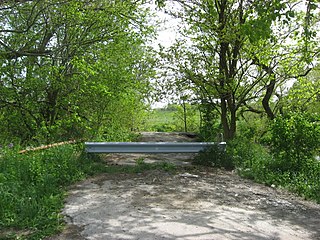
English: Barrier at the site of the northern portal of the Reed Covered Bridge, which once carried State Route 38 over Darby Creek south of Marysville in Darby Township, Union County, Ohio, United States. The bridge was listed on the National Register of Historic Places in 1975; it remains on the Register despite having collapsed in August of 1993. |
||
| Data | Taken on 2010ko maiatzaren 10a | ||
| Jatorria | Norberak egina | ||
| Egilea | Nyttend | ||
| Lizentzia (Fitxategi hau berrerabiltzen) |
|
Fitxategiaren historia
Data/orduan klik egin fitxategiak orduan zuen itxura ikusteko.
| Data/Ordua | Iruditxoa | Neurriak | Erabiltzailea | Iruzkina | |
|---|---|---|---|---|---|
| oraingoa | 04:27, 11 maiatza 2010 | | 2.816 × 2.112 (4,39 MB) | Nyttend | {{Location|40|8|59|N|83|22|50|W}} {{Information |Description={{en|Barrier at the site of the northern portal of the {{w|Reed Covered Bridge}}, which once carried {{w|Ohio State Route 38|State Route 38}} over Darby Creek south of {{w|Marysville, Ohio|Marys |
Irudira dakarten loturak
Hurrengo orrialdeek dute fitxategi honetarako lotura:
Fitxategiaren erabilera orokorra
Hurrengo beste wikiek fitxategi hau darabilte:
- en.wikipedia.org proiektuan duen erabilera
- fa.wikipedia.org proiektuan duen erabilera
- pt.wikipedia.org proiektuan duen erabilera
- vi.wikipedia.org proiektuan duen erabilera
- www.wikidata.org proiektuan duen erabilera
- zh.wikipedia.org proiektuan duen erabilera